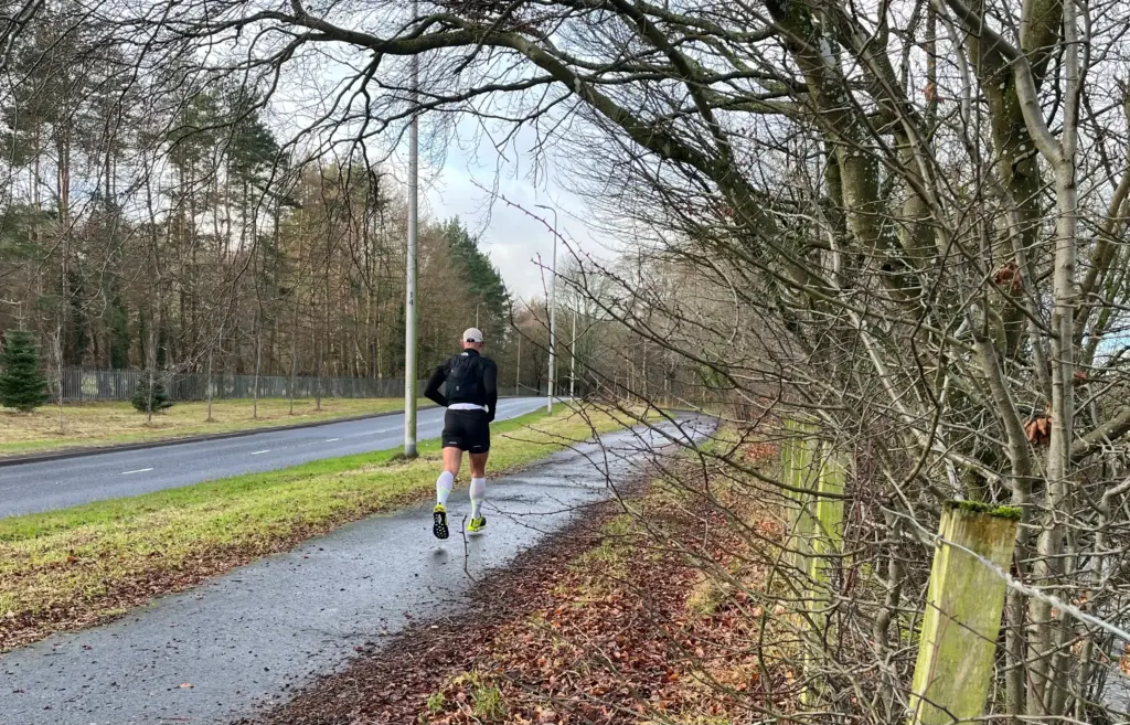
Most of the running I have done since the new year has been on the treadmill. The pavements have been far too icy and the roads north of Dundee have been fairly treacherous making access to trails difficult or inadvisable. That said, I have generated some decent mileage indoors, inclusive of some stair training and weights, so little has been lost.
After a slightly warmer but very wet day yesterday, today promised to be dry with some sun and a balmy six or seven degrees. That is T-shirt weather for a proportion of the Dundee populace. So, I decided to stay local and to get out for a long run, even if most of it would be on hard surface. After batting a few ideas about, I settled on a full circuit of the Green Circular.
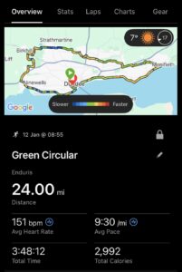
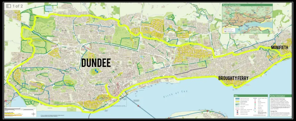
The Green Circular is a walking and cycling route that circumnavigates the city of Dundee with as much of the route as possible away from main roads and thoroughfares. Most of it is pavement or surfaced path with some short sections on woodland trail. I believe it is called the Green Circular as the route passes through many of the green spaces in and around the city. I have done the full circuit once previously and abbreviated versions on numerous occasions. I’ll include a map below for reference.
There is no defined starting point, so I just head down from my house to the riverside and begin from there.
I left the house just before 0900 and set off down to Dock Street, heading east along the main road before cutting into the docks.
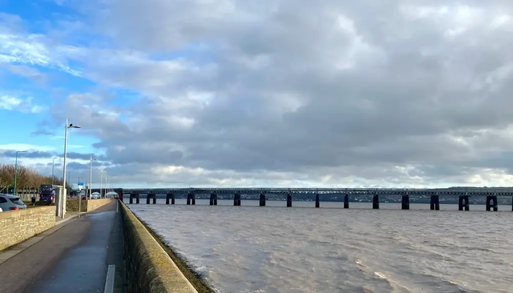
The road through the docks is wide and quiet, eventually narrowing onto the new fenced path which takes you all the way along to Stannergate.
Leaving the docks, the view opens up once more and the sun was out. There was a chilly south westerly wind being funnelled up the Tay but it was a following wind which provided some extra propulsion all the way to Monifieth as it turned out.
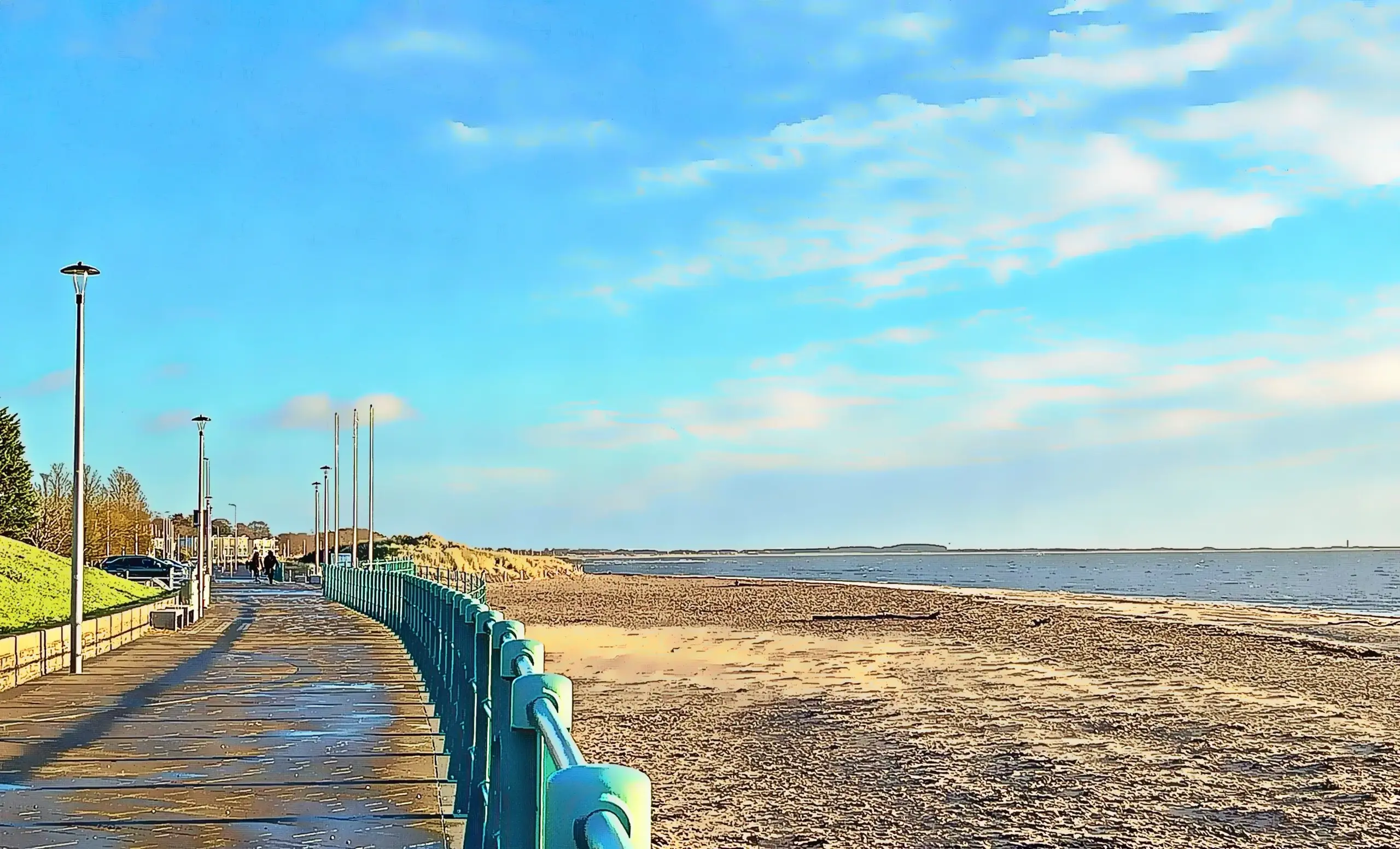
The route continues alongside the Tay estuary, along the public footpath known locally as the Grassy Beach.
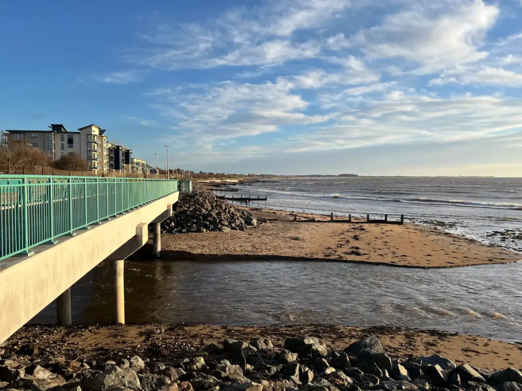
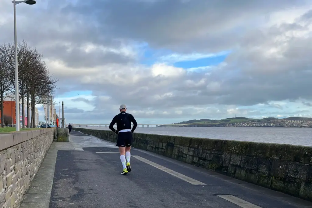
The path is mostly level and continues past the yacht club until Broughty Ferry is reached.
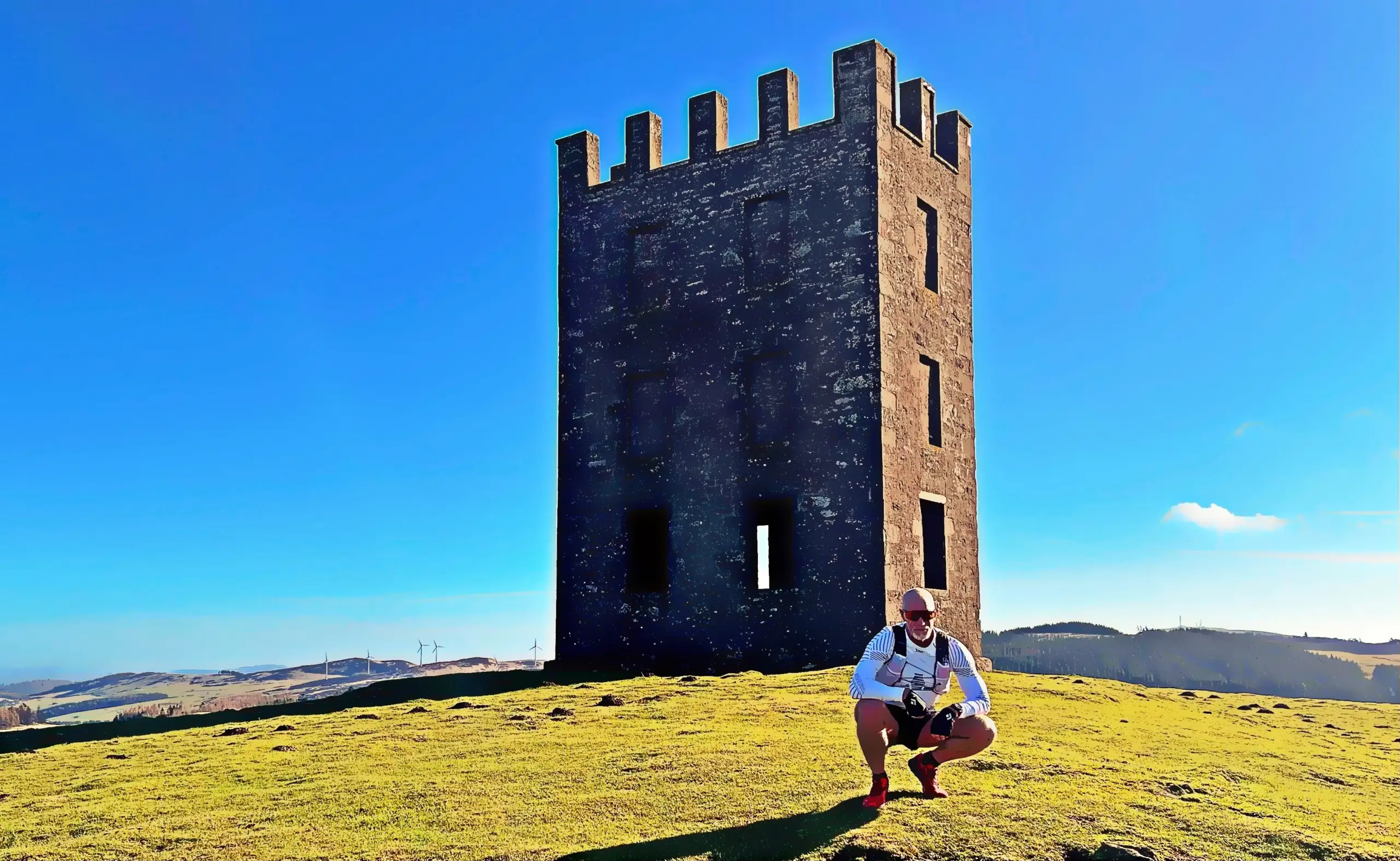
A lot of work has been done there on the promenade in recent years so it is a pleasant run, past the Lifeboat station until the castle is reached.
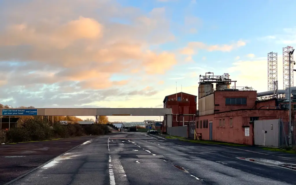
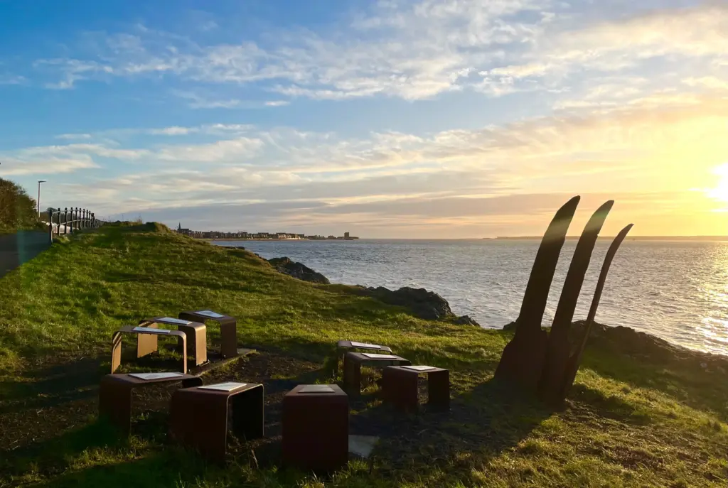
It is five miles on the dot to the castle and I was pacing myself well, trying to maintain a pace between 8.45- and 9.00-minute miles. I stopped in some shelter to take in some calories before pressing on towards Monifieth. Again, much work has been done on this section of the route with a new path and some sculptures along the way.
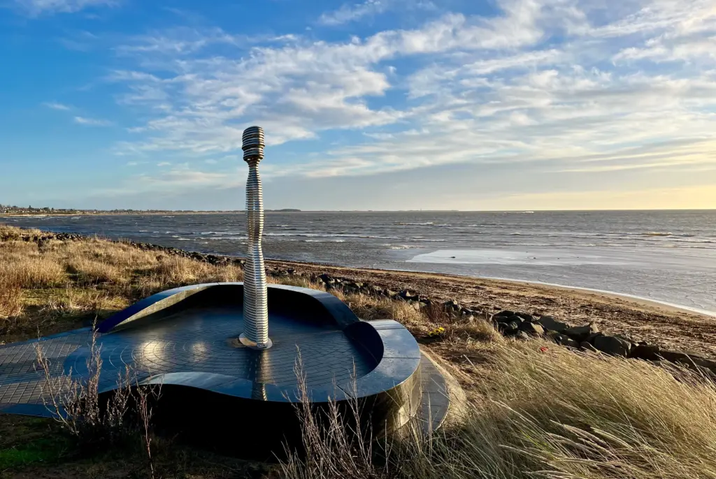
The new work includes the new foot bridge over the outfall of the Dighty Burn.
The Dighty Burn is about 20 miles long, rising near Lundie in the Sidlaw Hills before running along the north of Dundee to eventually reach the sea at Monifieth. Large portions of the Green Circular run alongside the Dighty Burn so it is a big feature of this run. Water from the burn used to power large numbers of the Dundee mills, back in the day.
About a mile further on, the small footbridge over the railway line marks the most easterly point of the route. The main road is crossed and after a couple of streets are negotiated, a path leads down into the green space that surrounds, yes you’ve guessed it, the Dighty Burn.
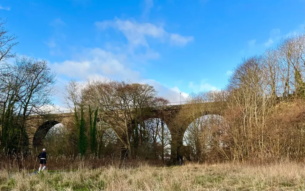
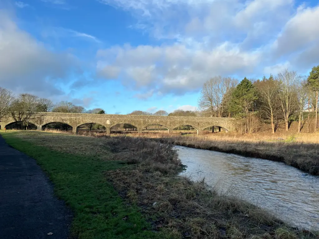
The path winds around, passing under the Seven Arches Viaduct which used to carry the Dundee to Forfar railway.
After another mile or so around the houses of Panmurefield, I then popped out onto Balgillo Road which is a gradual uphill slog before turning right onto the main Arbroath road. I was still running well but I could feel my hamstrings starting to tighten. Not great as the halfway point was still some way away!
Sainsbury’s arrives, bang on 10 miles. I was happy I had enough calories with me but there are no reliable water sources, so I usually nip into the shop to buy water to top up my flasks. I was only carrying 300ml flasks, but I knew there was an Asda later on so I would not run dry at any point.
After Sainsbury’s, the road is crossed and a left turn then takes you onto a footpath alongside our old friend, the Dighty Burn. The burn was high, I assume from a combination of rain and snowmelt. Good though as the higher water was effectively covering the shopping trolleys, buggies, bikes and other urban crap that is unfortunately dumped into the burn.
The path continues, mostly level, for the next few miles and once in Finlathen Park, the Finlathen Aqueduct is reached.
Shortly thereafter, the A90 Aberdeen road is crossed and the route continues on some pleasant and quiet path until Trottick Ponds. The path down past the ponds was closed for maintenance so I had to plod along Claverhouse Road before turning down Old Glamis Road to rejoin the proper route on Harestane Road.
By this point, my legs were starting to toil, and the stiffness was really setting in. However, Harestane Road marks the start of the climb to the high point of the route so once the gradient changed, I settled into a power walk. This continued, with intermittent running, all the way up Laird Street and onto the road to Clatto reservoir.
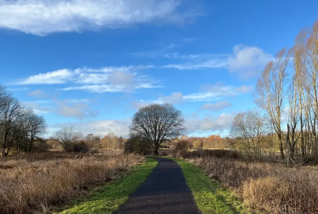
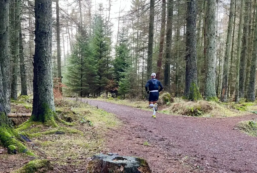
I reached the high point of the route as I entered Templeton Woods which is the nicest section of the whole run.
My legs started to loosen a bit as the downhill began and I made good running, across the main road into Camperdown Park.
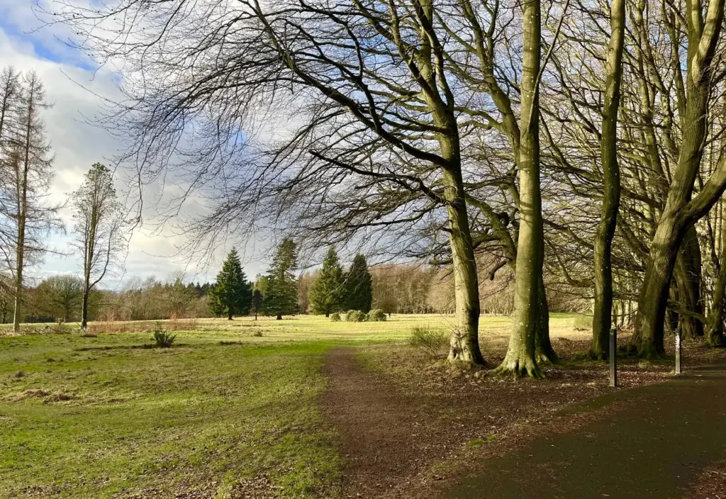
I continued down through Camperdown, via the south drive, before popping out onto Liff Road which I followed until the turn down to Asda.
I bought water and a couple of bananas in Asda and took time to ensure I had consumed some decent calories to fortify myself for the final push which I knew was going to be a hard slog given the way my legs were feeling.
I made good time down the path alongside the A90, but things then level off again once Riverside Avenue is reached. By this time, I had resolved that the final stretch along the riverside would be a walk/run.
Long distance, sustained tarmac running is my Achilles heel and today was going to be no exception. The other problem I have is that I find a very slow running pace (for me anything slower than about 9.15-minute mile pace) to be very uncomfortable on a hard, smooth surface. In fact, the slower I go, the more painful my legs become. Pace management can be problematic as a consequence.
I kept topping up my calories and fluids to give myself the best chance of making good progress and in fact I didn’t really walk that much. Just enough here and there to mitigate the burn in my legs before running again. When I was running, I was actually going at a half decent pace, so the distance was disappearing quickly.
Eventually, I found myself on the home stretch, under the rail bridge and running well towards the finish line.
I completed the loop alongside the RSS Discovery with the V&A Museum just behind. Not a bad spot to end a long run, I think.
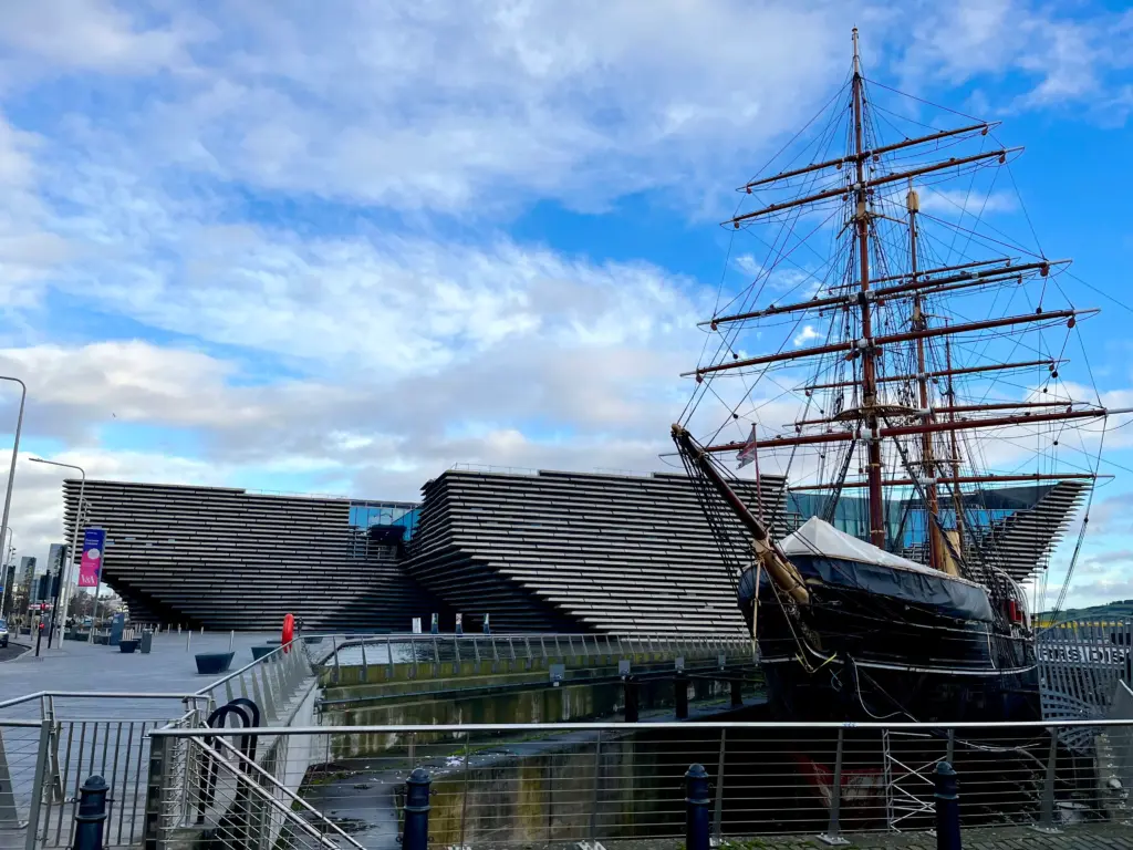
I walked and jogged back up the hill to my house, and I was very happy to get back. The full loop is about 24 miles so a very respectable distance for a long run, especially as most of it is actual running. Good then to exploit a decent weather day before it all turns to shit once more.
It is only about 4 weeks now until the Glentress Trail Marathon. I don’t have any specific training plan in mind other than to increase my climbing and hill intervals wherever possible. So much depends on the weather though. In any event, I see the event as a training milestone rather than a goal race so no drama.
Now, time for some more Spine Race dot-watching……