Since returning from Andorra, I have mostly been running locally on tarmac. I say mostly but I haven’t been out that many times, something of a hiatus before the next significant training block. Overall, I am building up towards November but I have eight weeks and I could easily succumb to over-training if not careful. Thus, I tend to ‘pulse’ my training a bit rather than consistently ramping it up, possibly too soon.
I am watching the weather, but my intention is to head north in a week or so for some more hill and trail training. I am not sure where yet, but I have a route near Aviemore that I really want to do. I will also look further north-west, possibly towards Ullapool. Wherever it turns out to be, it will provide plenty of opportunity for further hills and climbing.
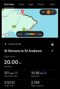
So, back to today. I wanted to do a long run, around 20 miles, but without too much tarmac. As I just said, no need to head to the hills as I will hopefully have that covered soon anyway. The weather seemed to be reliable so I decided once again to head across the Tay into the Kingdom. More specifically to cover a long section of the Fife Coastal Path in the East Neuk.
The East Neuk of Fife is a fairly small area in the east of the Fife peninsula. It is largely coastal but includes a number of old fishing villages that are both picturesque and steeped in the fishing history and culture of this corner of Scotland. The Fife Coastal Path is a long-distance path but in my humble opinion, it only really comes into its own from around Leven and beyond. The section I would do today is a favourite, ending at St Andrews. I have normally started at Anstruther in the past but decided to add a few miles by kicking off at St Monan’s which would bring the mileage up to around the 20-mile mark.
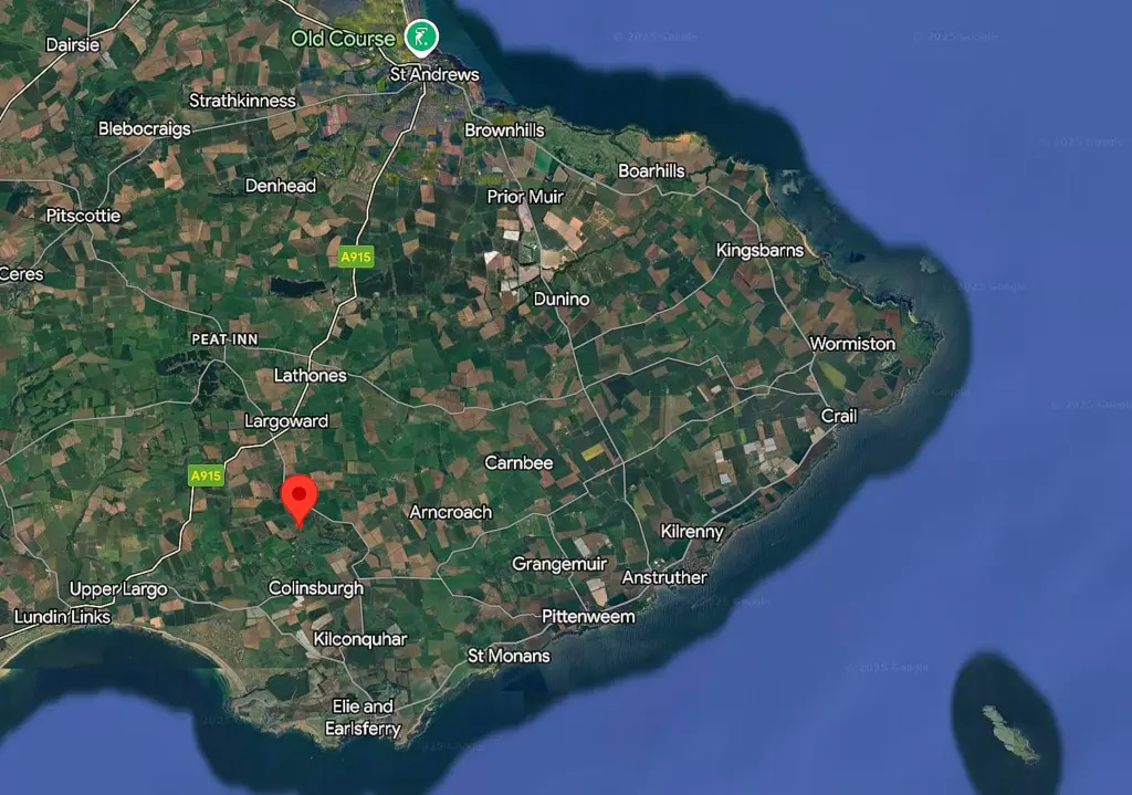
I’ll throw in a map below which includes most of the place-names I will mention, should you be unfamiliar with the area.
It is a bit of a bus-hopping affair to get to St. Monan’s, nearly an hour and a half including a wait at St. Andrews. Nonetheless, I alighted from the bus around 1100 and headed down the hill to the harbour at St. Monans.
The sun was out, and it would be warm enough once I started moving which I did without delay, heading along the harbour then out of the village along the scenic path which in only about two miles, arrives at Pittenweem.
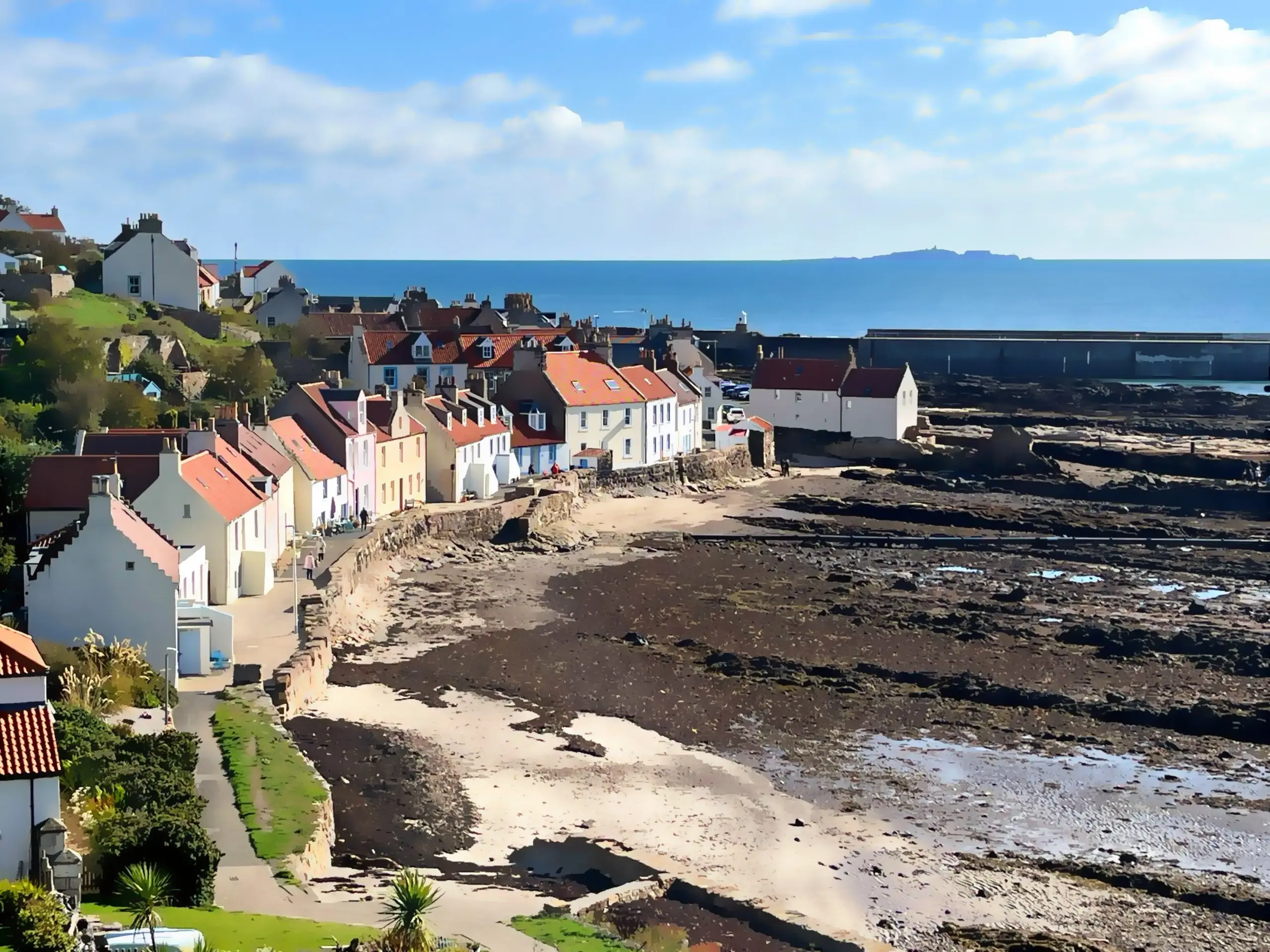
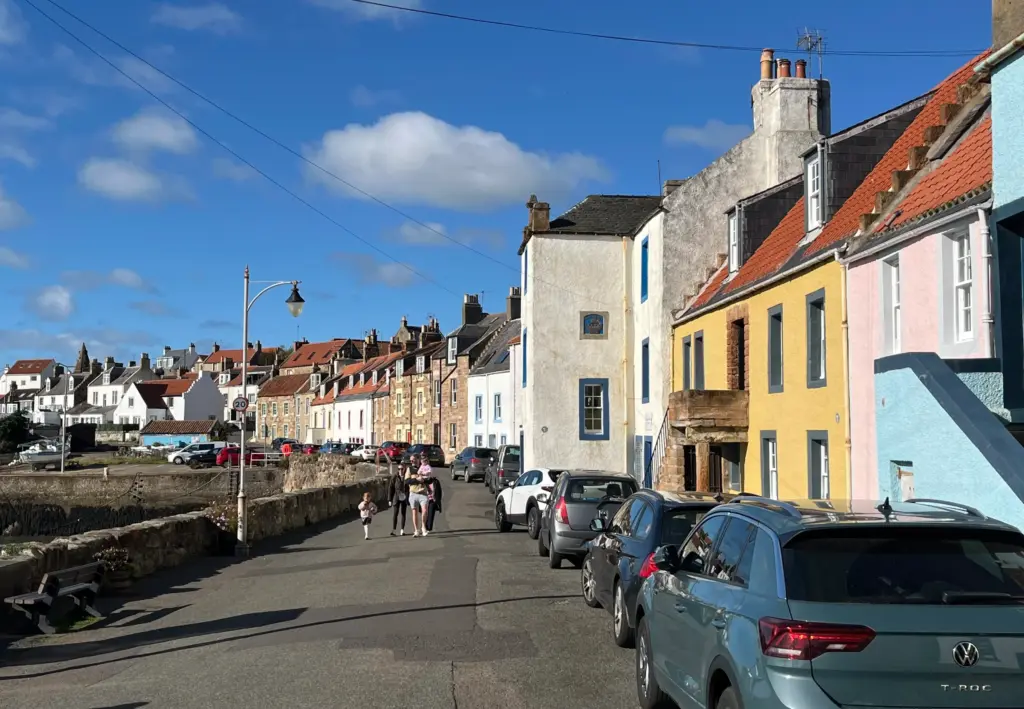
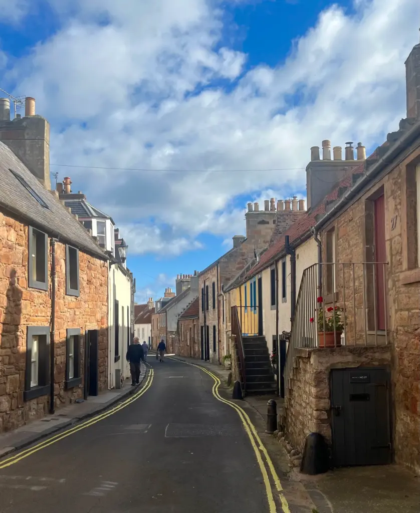
The trail passes the little, colourful houses crowding the harbour-front (the header image is also of Pittenweem) already lively with cyclists and dog-walkers.
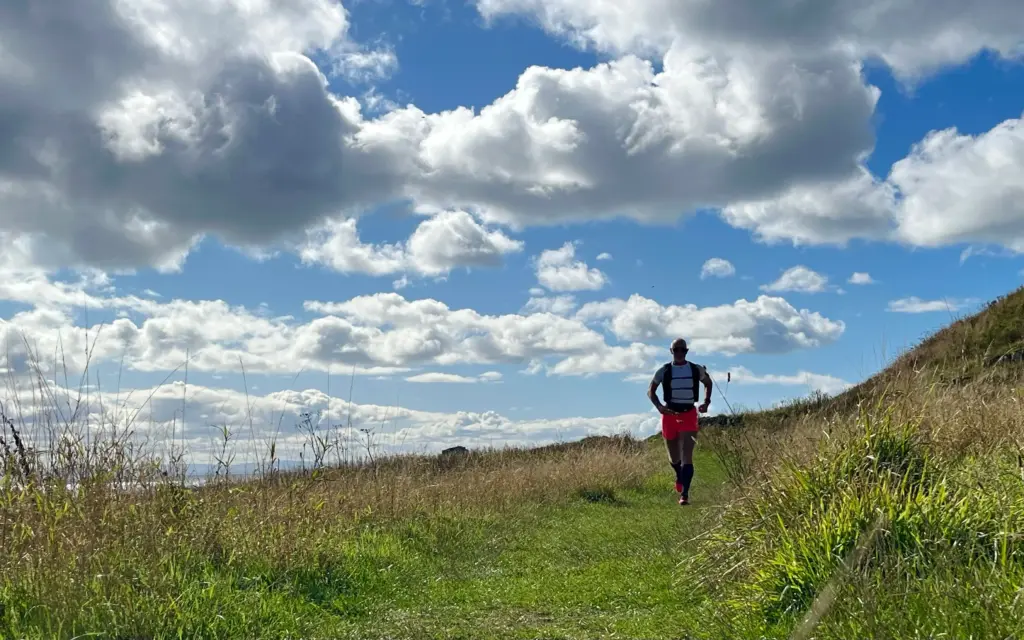
There is a short hill out of the village then you are on the coastal path again, heading for Anstruther. This is good running on either hard-packed trail or grass, and I had to check myself constantly for going too fast or I would pay for it later.
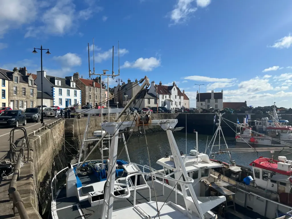
There is a nice little beach just west of Anstruther and before long, I was heading into the narrow streets of the town down to the harbour. Anstruther is a reasonable size and it was already busy with visitors out enjoying the town and the pavement cafes. Anstruther is also home to some of the best fish and chips in Scotland but that would have to wait for another day.
Adjoining Anstruther is Cellardykes, an older and quainter fishing village. It was great to run down the narrow, quiet streets with the old fishing dwellings in various shapes and colours either side of the street.
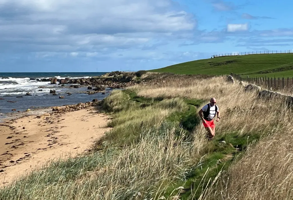
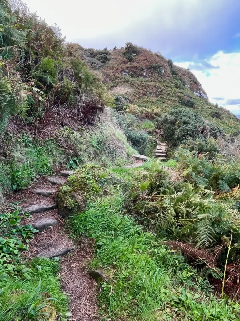
Leaving Cellardykes, a fairly sizeable caravan park needs to be negotiated before the trail opened up again. Although very level, the path along this whole section is very rocky. The rocks are half-buried in the grass and care is required to avoid tripping.
I really tried to moderate my pace as my legs were already starting to stiffen. My hamstrings were tight and my hips were complaining. Basically, sensations that I would only expect to afflict me after a lot more mileage than I had done. Anyway, a long way to go so I just carried on, enjoying the sunshine and the views.
Eventually the path climbs a little and on rounding the headland, the famous village of Crail hove into view.
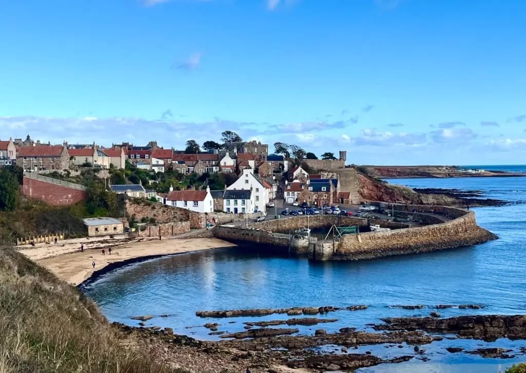
Crail merits an hour or two of wandering about but that wasn’t my agenda today so I made a beeline for the small CooP where a bottle of water, a banana and a slab of tablet boosted supplies. A mouthful of tablet and banana is quite a tasty combo. Just saying…
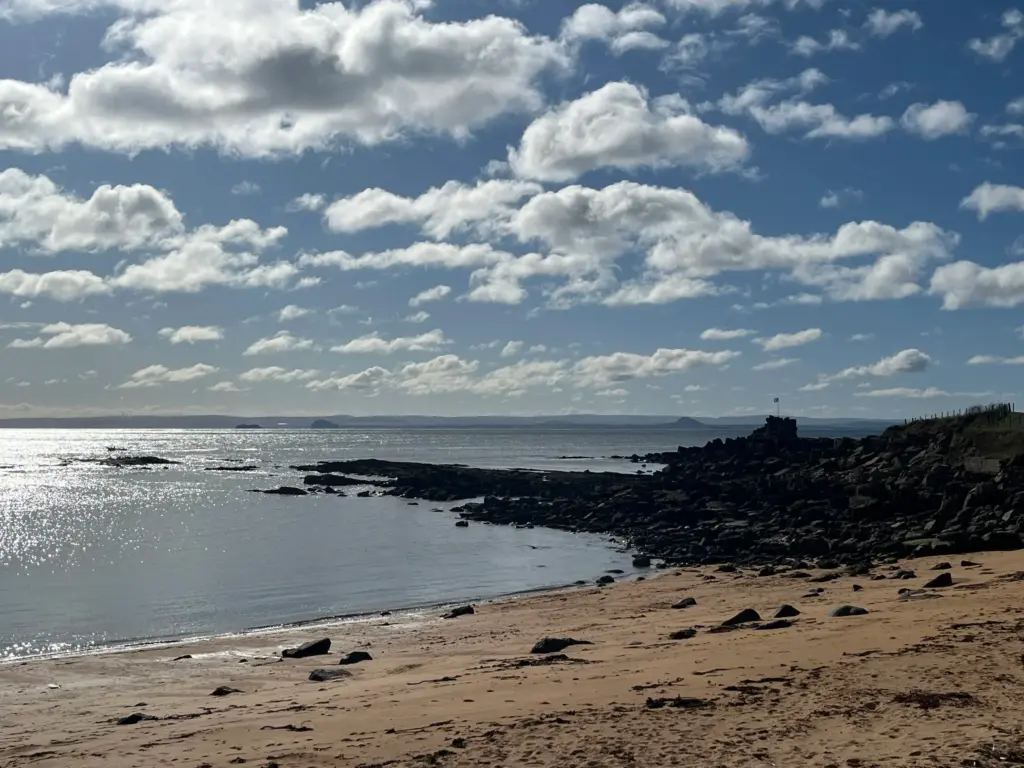
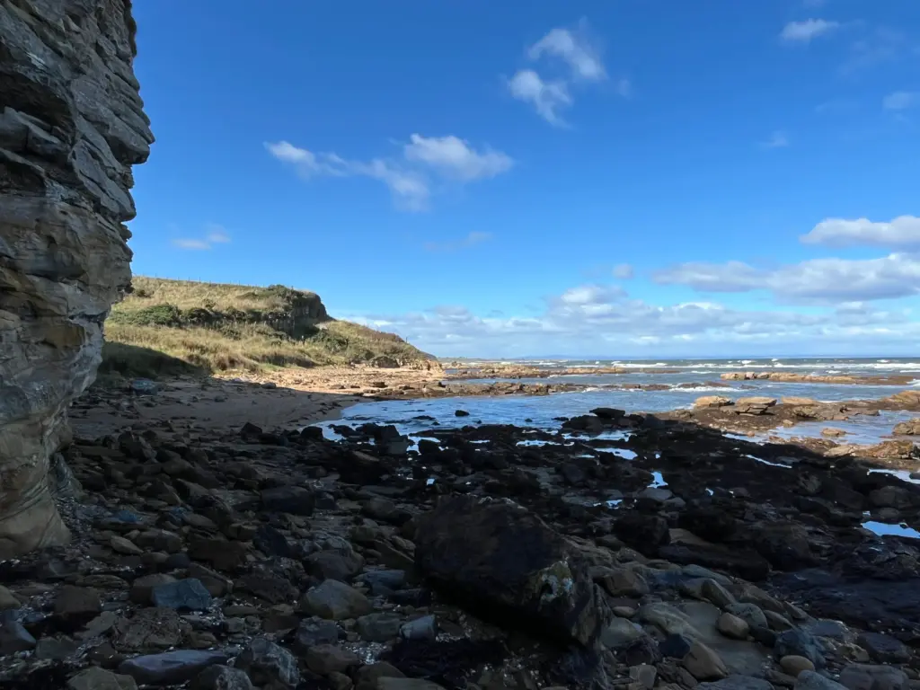
Once out of Crail I was once again in the land of static caravans and holiday chalets. This holiday park seems to go on forever but eventually I was out the other side and readying myself for what I knew to be a short but gnarly section to the lighthouse. This slowed the pace considerably with all the rock hopping and dodging but I eventually arrived at Fife Ness with its somewhat underwhelming lighthouse.
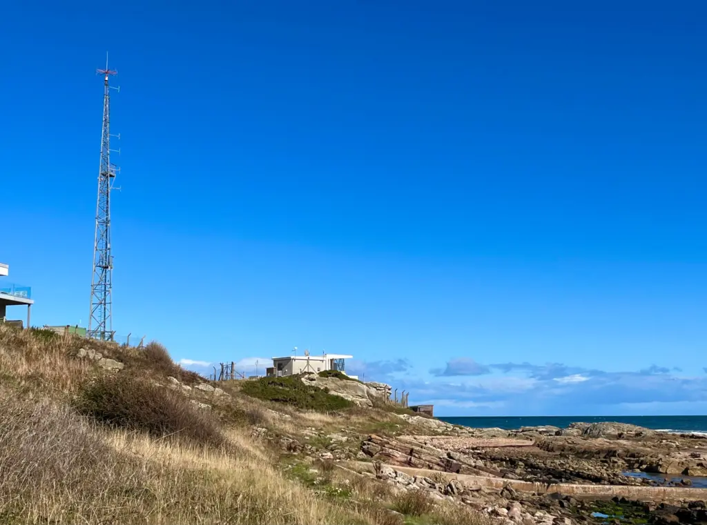
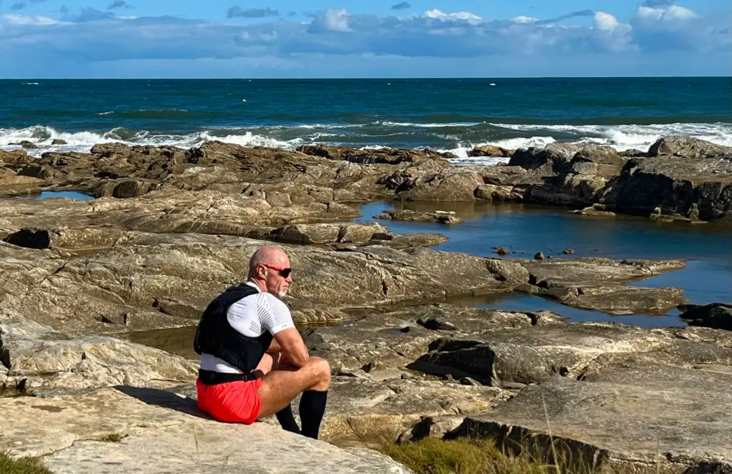
This is where the trail turns northwest. I took a short break, eating a few calories and watching the waves.
Moving again, there is a kinder section which skirts the edge of Crail Golf Course. Nice running on soft grass initially but this eventually changes to hidden path through long grass on the narrow dunes backing the beach. There are a lot of hidden hazards here, so it really does take time.
Not long after this, there is a section which requires crossing a section of beach. These small sections do recur later on and they are tidal so unless you have researched in advance ( I didn’t) you could get caught out. More of that to come!
Eventually, Kingsbarns Golf Course is reached, and the trail uses the gravel tracks through the course before moving onto sandy paths through the dune system to the beach carpark. The path continues beyond and this is a long section on very varied path.
By now, my legs were like blocks of granite and running consistently was requiring a level of commitment which I don’t normally have to resort to until about 25-30 miles.
This coastal section is quite long and I was glad of the change in scenery once I arrived at Boarhills. This is the only section of the trail that leaves the coast and moves briefly inland for a few miles. This is all to eventually cross a river and return to the coast as there is no bridge or crossing where the river meets the sea. The path goes gradually uphill through woods and following the river until a small bridge is reached. After a short section of road and farm track, a grassy path leads once again back to the coast.
The section from here to St. Andrews is the most difficult and slow of the entire day’s route. Thankfully, the trail was dry. I have done it when it was wet and muddy and that adds a whole different level of challenge!
The path goes up and down continually with a lot of smooth stones as steps. These are very slippery if wet.
As if to punish me further, a squall passed over and it was suddenly cold and raining intermittently. Not enough for a jacket but I was certainly wishing the sun back again.
Now, I mentioned the beach sections earlier. There is one on this part, about two miles shy of St. Andrews. It is worth pointing out that here in particular, there is no alternative path up above and the warning signs indicate that if the tide is high, you just need to wait it out. There was just one critical section where the cliff comes right down to the shore and there was no clear way past. I have no idea if the tide was coming in or out, but I had no intention of waiting what could have been a couple of hours. I also had no intention of making a significant backtrack then finding a way up to the road.
Fortune favours the bold they say, so I decided to put that to the test. The waves were regular and when they broke amongst the rocks where I needed to cross, the water was about waist deep. However, when the water receded there was a small window in shallower water to dash through, avoiding the rocks, then grabbing on to the rocks on the other side to climb free of the water before the next set of waves. This was my cunning plan and it worked….kind of. I misjudged the speed with which the water would surge back in and there was a sketchy moment where I was waist deep and nearly swimming before I managed to get a good handhold and foothold on the rocks to get clear.
Although I was soaked below the waist, not all was bad as the cold water had numbed my legs to the point where much of the pain left them for a while and I got a new lease of life. Who says trail running is boring.
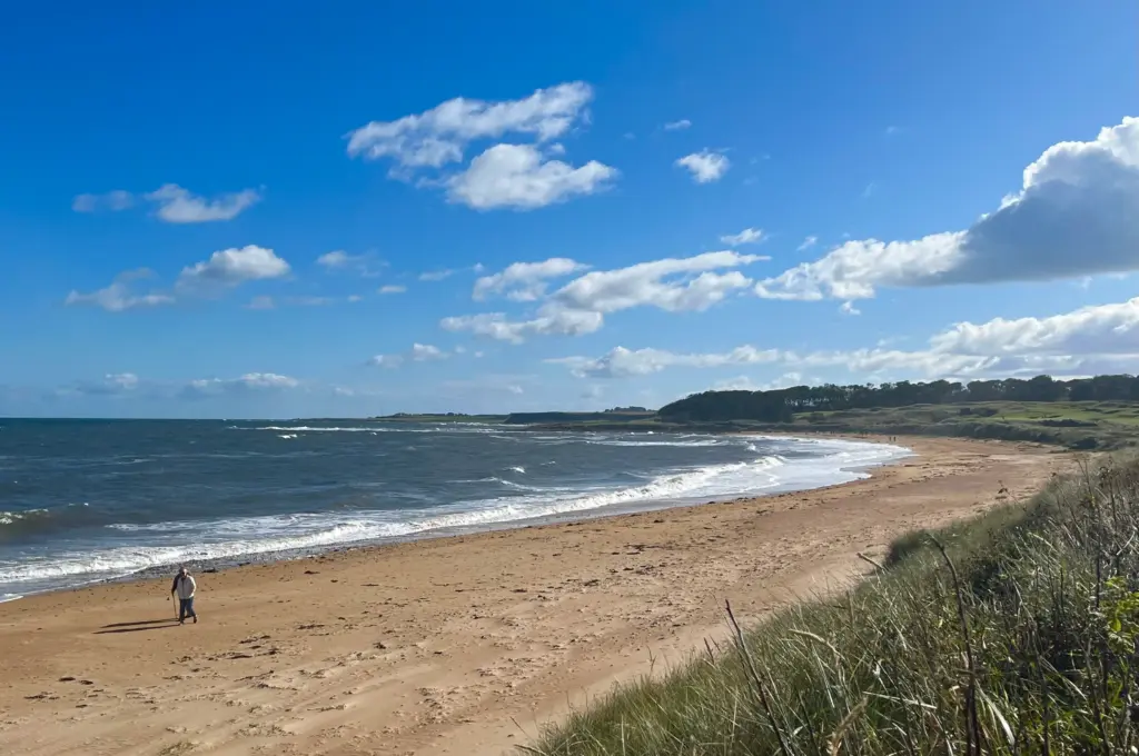
I ground out the last couple of miles, running wherever possible and after the last climb I covered the last section alongside the golf course before the path started to descend, past the holiday park towards the East Beach at St. Andrews.
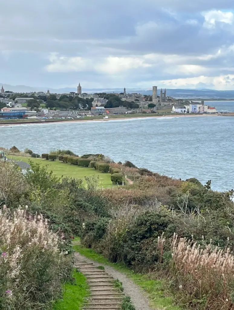
I was delighted to be there and as I reached the end of the promenade, I stopped my watch on exactly 20 miles. Very tidy and route planning at its very finest.
I forced myself to speed march up and through the town, paying no real heed to the shops, cafes or the throngs of Sunday visitors. No sightseeing today. I stepped straight onto a Dundee bus as soon as I arrived at the bus station and the rest is history, as they say.
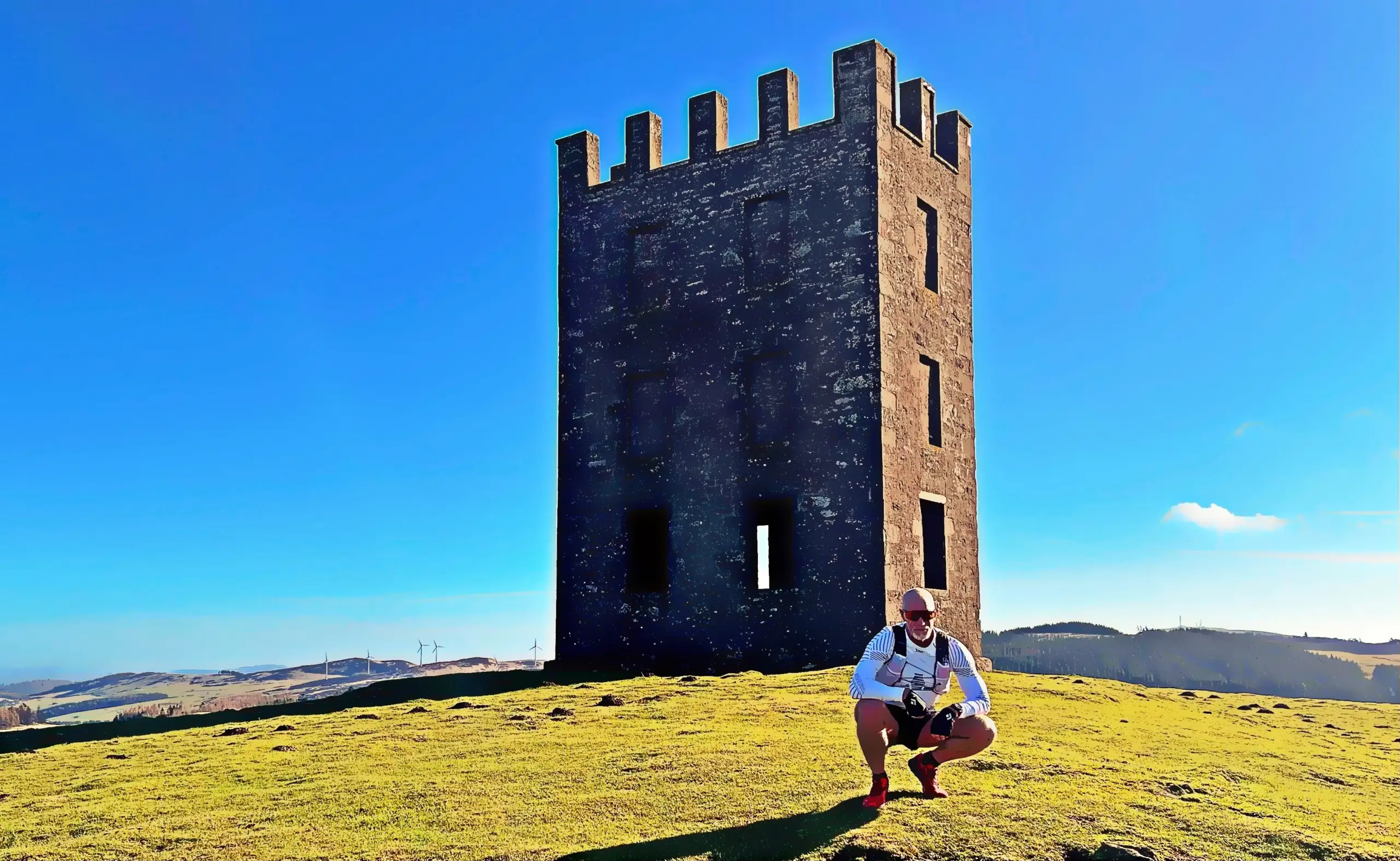
The photos should give a flavour of what a scenic trail this really is, particularly if the weather is kind which it mostly was. Obviously I wanted to enjoy it but in the end I just didn’t after the first ten miles. My legs were like lead today and that really detracted from my overall enjoyment but, these shit days happen, and I still managed a hugely beneficial long run which is what I set out to do.