Last August, I documented my attempt to complete a continuous, overnight journey from Alyth in Perthshire to Aviemore. By and large, that was a success although I decided on the day to stop about six miles short of Aviemore. In any event, about 56 miles on that occasion, but in very favourable summer weather.
For some time now, I have had a similar route sitting in my GPX file collection and despite the weather recently having been at best mixed, at worst complete shit, I felt compelled to dust off the GPX file and give the route a go as a winter effort.
This time, Alyth to Aboyne in Aberdeenshire.
Yes, I know it is more place names beginning with A but it does make sense even if it seems a little contrived. As with the previous trip, Alyth is the perfect jumping off point being a short distance from Dundee on the last night bus. After the first four or five miles, the route is entirely different on this trip.
After the first few miles leaving Alyth, I would head over the Cateran Trail from Kilry to Kirkton of Glenisla. From there I would head up Glen Markie, cutting over the hill to Glenhead, then following the track around before climbing the hill, descending on the other side into Glen Prosen.
Heading down the road a mile or so to Glen Prosen village, I would then take the Minister’s Path over the hill to Glen Clova with the halfway point being the Glen Clova Hotel which would almost certainly be closed when I pass by.
I would then climb to the high point of the route above Loch Brandy before a couple of miles of pathless descent leading to the track that goes up over the hill before the steep descent to Inchgrundle at Loch Lee. I would head along the lochside to Invermark, then turning up the track towards Glen Mark and Mount Keen.
I would not summit Mount Keen but would contour around the hill on the through path which then descends into Glen Tanar. The remainder of the route is then the gradual descent down Glen Tanar until finally arriving at Aboyne. About 55 miles in total.
From Aboyne, bus to Aberdeen then train back to Dundee. Simple. What could possibly go wrong?
Joking aside, it is a reasonable undertaking. There would be a 12 to 18 hour window of better weather for it, but it is still winter and the first half would be done in the dark. However, it is not a complex route by way of navigation. I would only find out what snow cover there was at higher ground once I crossed over into Glen Prosen. Overall though, I was not confident that everything would align in order to make it the full distance in winter, but Glen Prosen and Glen Clova offer viable escape routes should I decide to bail.
That was the plan. Here’s how it went, although the title is a bit of a spoiler I grant you.
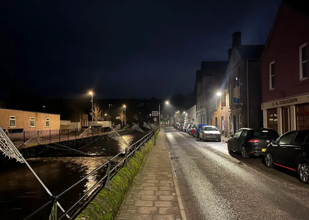
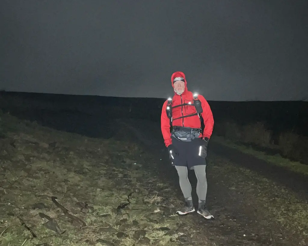
I finalised all my gear in the evening and whiled away time waiting for departure time, then headed across the road for the last bus at 2225 and settled in for the journey to Alyth. We arrived as per the schedule, and I was moving up through the town by 2315.
I selected a nice easy gear for the first big hill climb up the Hill of Alyth. The water erosion on the track and the running water hinted strongly at the extremely wet conditions that were to come and they started just as soon as I hit the descent. Rivers of water down the path and slurry-like mud everywhere forcing me to slow right down and pick my way along the rougher verges. Already I was congratulating myself for my decision to wear waterproof socks!
Eventually I reached the road and forced myself into a nice easy walk/run over the few undulating miles to Kilry. At least I was off the mud for a while.
At Kilry, I turned right onto the Cateran Trail and climbed the hill up past the farm buildings. The Coffin Road veers off to the left, but I remained on the main trail, making good time on some of the downhill and level sections. The muddy conditions continued but not enough to break my rhythm and I made fairly short work of the few miles towards Kirkton of Glenisla.
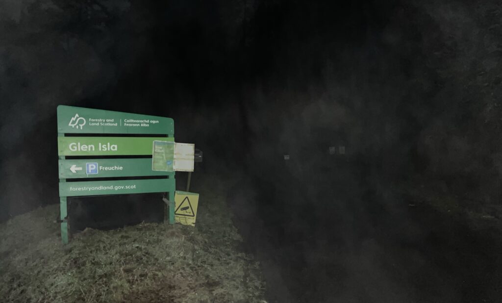
Instead of following the Cateran Trail up and over the hill to approach Kirkton from the east, I hung a right down the farm track to the bridge over the River Isla and to the main road thereafter. From the road junction, it is only about a mile along to the Freuchies turnoff and by taking this shortcut, I maybe shaved between one and two miles off the route.
I then arrived at the Freuchies car park, jumping off point for so many of my other runs in this area. The air was thick with chilly mist but still no rain up to that point.
There is a fair bit of power walking over the next couple of miles as it is mostly uphill. As I approached the short downhill towards the bridge to Glen Markie, the heavens opened and let loose a deluge of sleet which started to soak me in no time. However, I was only a few hundred metres from the path that turns up through the forest so I decided that I could take shelter there in the trees to let it pass over.
No such luck! As I approached, I could see that the entire hillside has been felled since my last visit (quite a while now I think about it), so not a scrap of shelter. I was forced to trudge uphill and accept the soaking but no sooner had I reached the crest of the hill, it stopped. This was just in time I think as my jacket was starting to wet through in places.
I moved quickly down the grassy slope, crossed the footbridge then headed for Glenhead. The track remained a quagmire but the verges were firm enough to run on so I made reasonable time and I was soon past the houses and heading around the hill. Body heat had nearly dried my jacket, shorts and tights so I was more comfortable again.
Eventually, I turned off onto the track that heads up to the top of the hill between this glen and Glen Prosen beyond.
About halfway up, I hit snow. Initially, patches on the ground and the track.
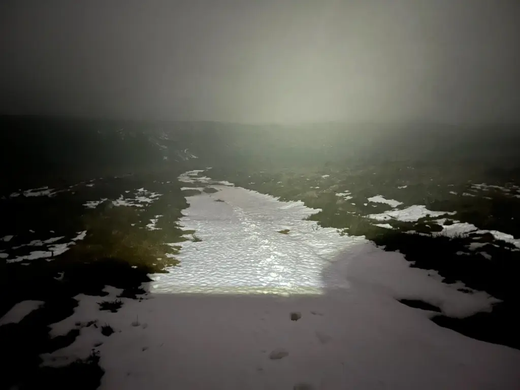
However, the snow soon became deeper, especially where it had gathered on the track between the verges. It was wet snow and I was sinking through, sometimes a few inches, sometimes up to my knees. The verges were no better, so I was gradually reduced to a slow plod as the climb continued.
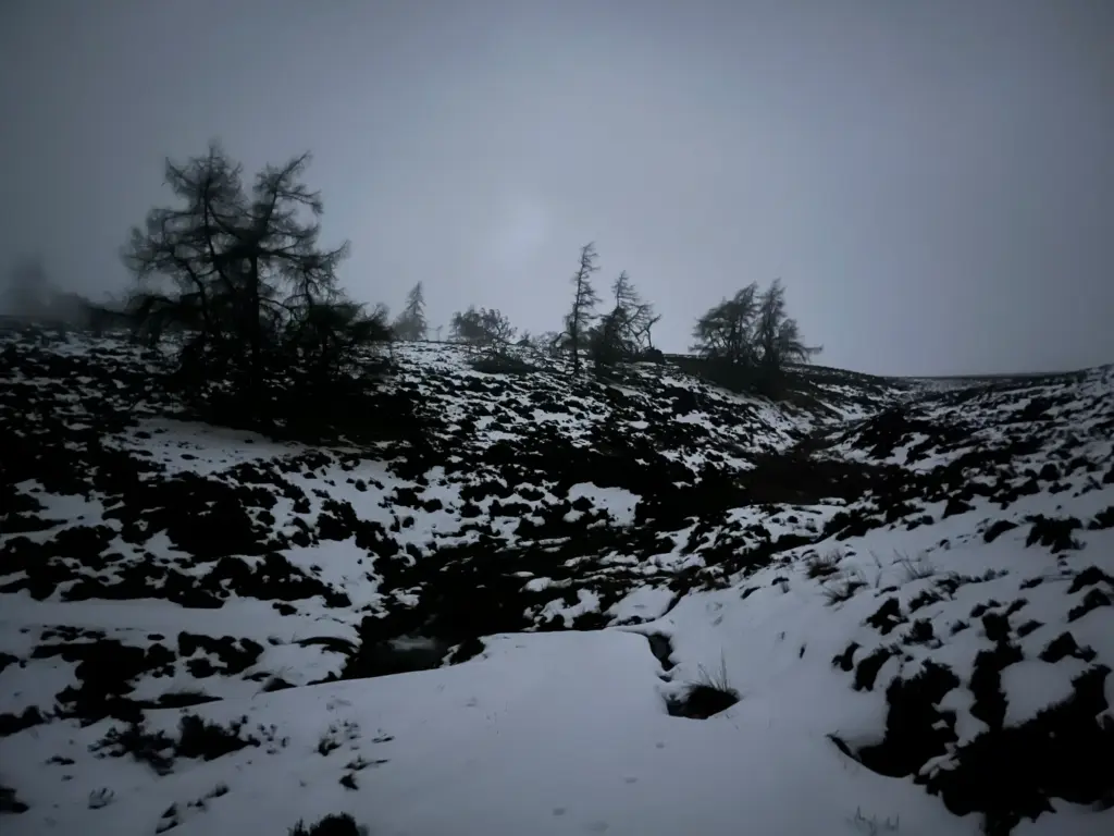
It was much colder now too, and a couple of brief but squally snow showers accompanied my climb, reducing overall visibility. I reached the gate at the first top, then negotiated the brief downhill and stream crossing before the final grind up the snow-covered track to the highest point.
The snow here varied between six and 12 inches inches deep and this continued for around the first half mile of the long descent.
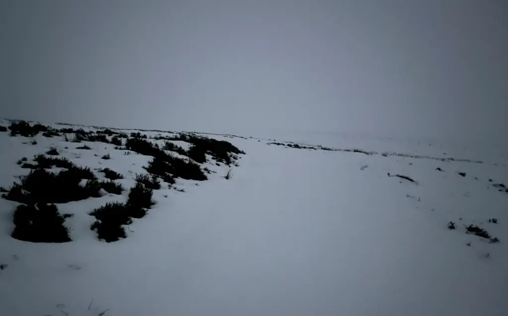
Eventually, I dropped below the snow line again and made good running on the remainder of the rough downhill track down to the Glen Prosen road at Balnaboth.
The climb through the snow had provided the information I needed to ponder my options as I made the descent. I had managed my calories so had enough to continue. My legs weren’t great as I hadn’t fully recovered from the weights session a few days before.
The main issue was the snow.
I suspected that the Minister’s Path to Glen Clova would be snow free, but I had cause to assess that the snow conditions up to and above Loch Brandy would be as bad if not worse than I had already experienced. From the high point at Green Hill, there are two miles of difficult pathless ground down a river valley. This would be extremely challenging, if not hazardous, under significant snow cover. I decided that to continue with the main route plan was inadvisable.
I could however continue over to Glen Clova and halt at that point. The problem with that would be the time of day (about 0500) and therefore no shelter. There are no public transport options and the run out to civilisation from there is significant.
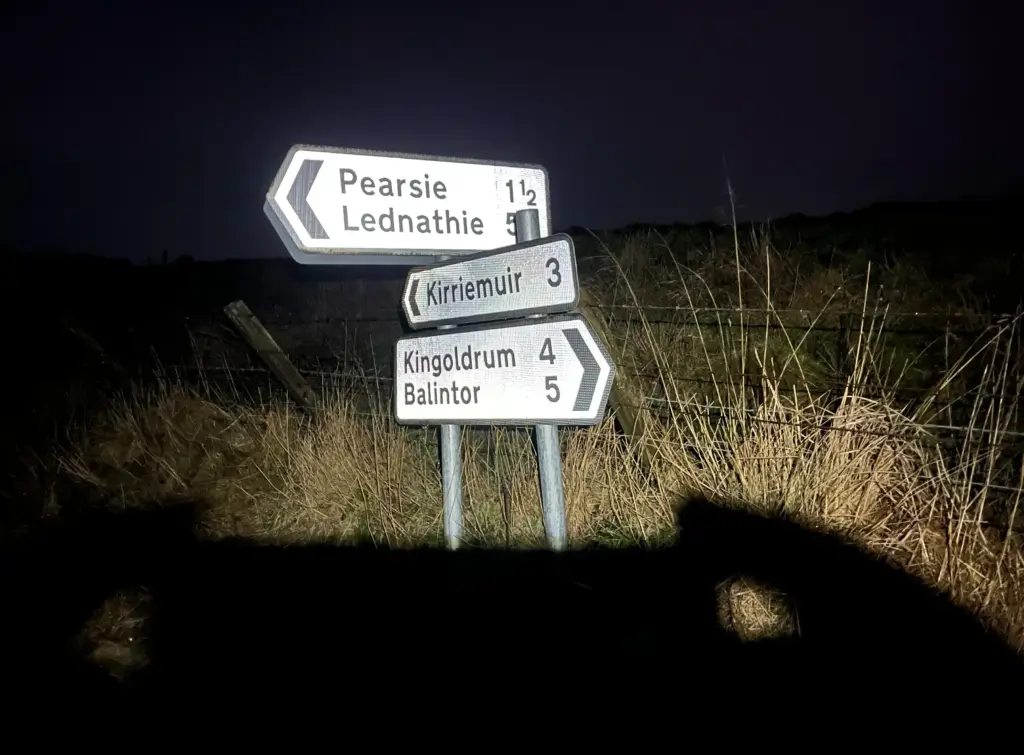
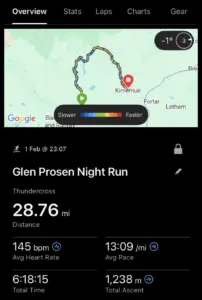
There are also no shelter or public transport options in Glen Prosen, but it is about ten miles on minor B roads to Kirriemuir. I had reached 20 miles by reaching Glen Prosen so another ten or so would put me close to 30 miles which would make for a significant outing in any event. I calculated that early buses might be running by the time I reached Kirriemuir as it was already 0400. Decision made.
I paused to get some calories inside me then headed off down the road. I had run some of the next few miles before, so I knew that wasn’t going to be an easy ten mile run as the roads undulate considerably. Thus, it was going to be a determined walk/run and I would try and hold an average pace around 12 minute/mile to get me to Kirriemuir in around two hours.
The miles passed slowly but surely, through Easter Lednathie before I reached the halfway point around Pearsie. I forced my legs to perform on the climbs and set a good running pace on the flats and downhills to keep up the average pace. By forcing calories in at regular intervals, I was able to keep up this energy. Soon, it was only three miles to go.
The good news is that it had remained dry but my thermal top below my jacket just wouldn’t dry in the damp cold and with the jacket over it. I had a spare layer in my pack though if I needed it once I stopped.
Passing Caddam Woods, I was nearly there and before long I could see some streetlights ahead. I hit the quiet residential streets on the outskirts of the town and settled into a determined run down into the town centre.
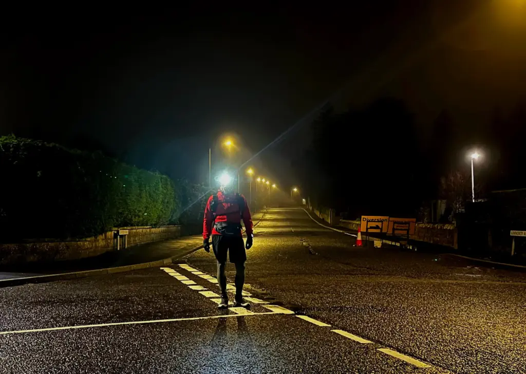
I arrived just after 0600 and a quick check of my phone advised me that the first bus to Dundee would leave about 15 minutes later. Great timing and I congratulated myself that I hadn’t dawdled on the final road section.
The bus went via Forfar but actually took less time than I had anticipated and I was in a hot shower at home before 0730.
So, what do I make of it all in retrospect?
The long route was very ambitious and the weather variables, especially snow cover, were always going to be influencing factors. I am glad that I pulled the plug when and where I did. I concluded a very long and challenging route under my own steam; in an OK time I think given the conditions. Just shy of 29 miles and over 1,200 metres of elevation.
I will re-visit the long route to Aboyne again. I still think it is a great route, but I will leave it for generous summer weather when the nights are shorter and I can focus on my performance rather than battling the conditions.
My knee starting playing up again last night and I feel twinges in it as I sit typing this later in the day. I will need to monitor this closely.
In other news, less than two weeks now until the Glentress Trail Marathon so I’ll taper and recover in the next fortnight. I am looking forward to the event but will be watching the weather forecast with close interest!
Keep an eye on the blog as I will soon announce some details of a new fastpacking trip to take place within the next two months.