I took nearly a whole week off after the Sidlaw Ultra and I think I needed it. I ventured out the following weekend and clocked up nearly 12 miles, all on tarmac. My legs still felt a little stiff and heavy but no real cause for any concern.
I did a tempo five miles midway through the current week with a view to a long run at the weekend. I am trying not to run too many total days at the moment, simply to give myself a bit of a break for four weeks or so, and to let all of the bothersome calf niggles settle down.
Thus, I needed a plan for the weekend and despite a rough weather forecast, I felt the need to head out onto some decent trail. Sunday was the calmer day after some strong wind on the Saturday so that was my day. I just needed some inspiration for a route. No point going to altitude, particularly in bad weather, but I had about 20 miles in mind.
After much deliberation I decided that if I was going to get wet, then I might as well go somewhere where just about everything would be wet, and very muddy!
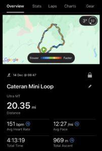
I had done the Cateran Mini Trail several years ago but in fairly decent summer weather as I recollect. It only goes up to about 650 metres at its highest point and it is a gradual climb to that point and total elevation gain over the 20 miles is just under 1,000 metres.
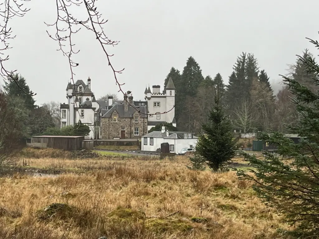
The entire Cateran Trail is a 55-mile loop and there is an ultra on the route. The very first ultra I ever did, as it happens. The Mini Trail starts and concludes in the village of Kirkmichael. The loop follows the Cateran Trail for about the first 14 miles then turns off to cross back over the hill to Kirkmichael.
The main challenge which I expected would be the underfoot conditions, particularly in the second two thirds of the route. It was likely to be heavily waterlogged, very muddy and the final section is virtually pathless for a couple of miles over some challenging terrain.
I sorted all of my kit on the Saturday evening so I could get an early start the following morning. I wanted to reach Kirkmichael by 0900 to make the most of the daylight as I surmised that the route would take around four hours.
And so it transpired the following day. Driving before 0800 and in the carpark at Kirkmichael for about 0845.
I headed off out of the village, a nice slow start and thankful that it was not raining. The farm track soon gives way to a winding single-track. Difficult to believe now but this used to be through quite dense forest, but the entire plantation was flattened by Storm Arwen back in 2021.
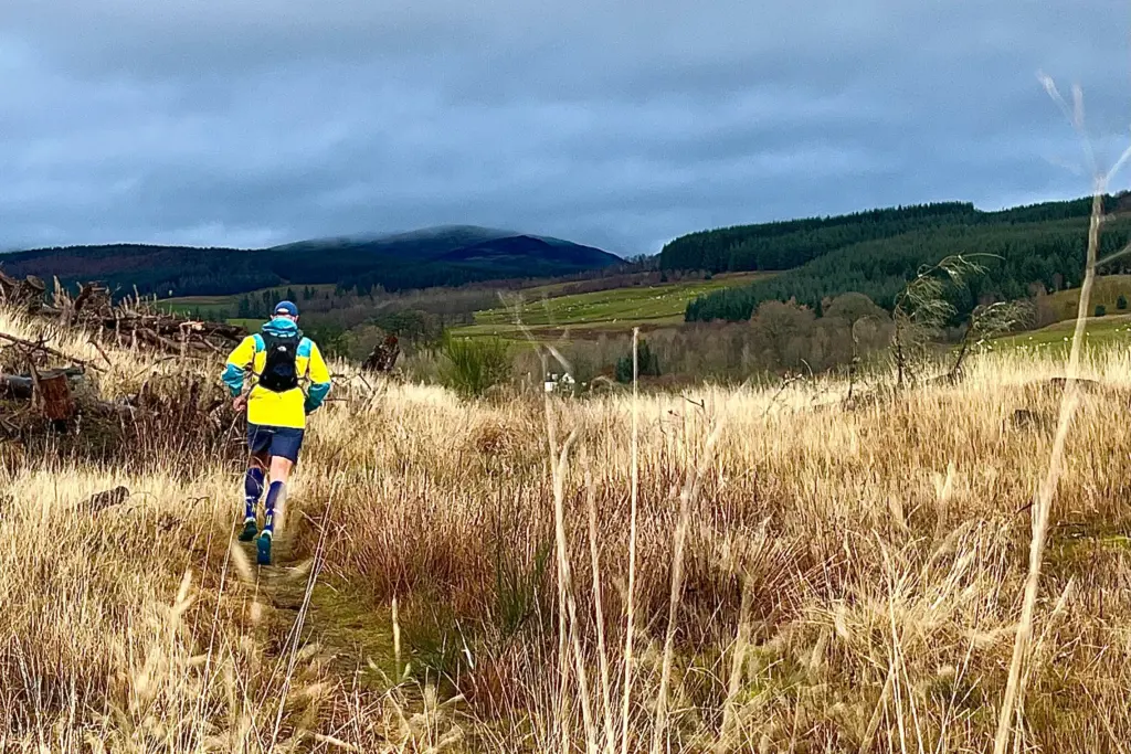
After some fields and a bridge crossing over the river, the small hamlet of Enochdhu is reached. The road is crossed and this is the start of the gradual climb up onto the hill proper.
The track is good gravel vehicle track and the distance passed quickly. The track climbs through the forest and I sent several small groups of deer scampering for the treeline on my approach.
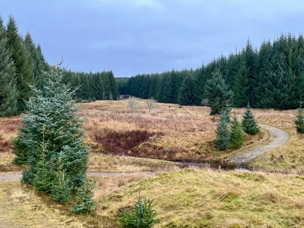
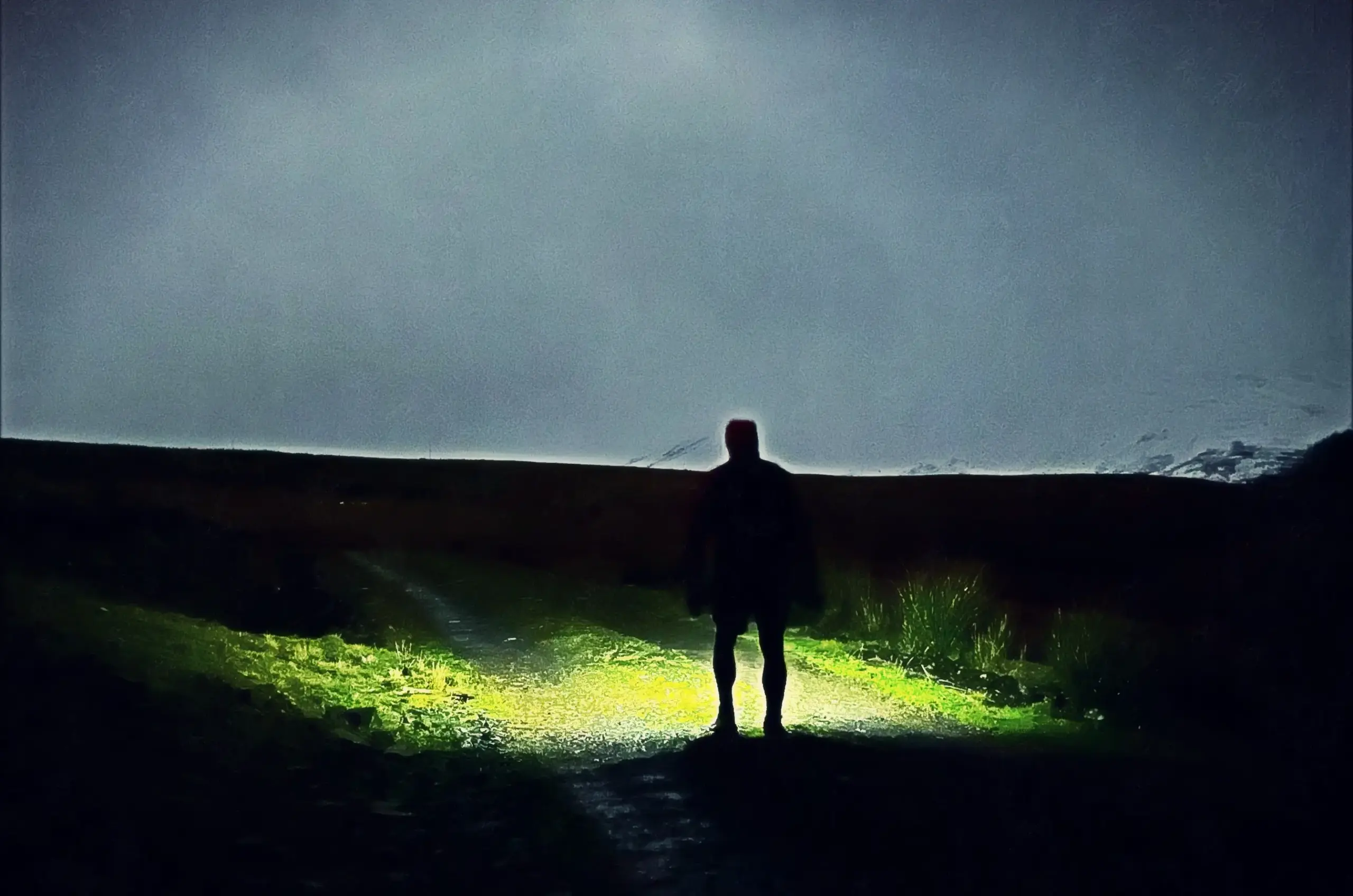
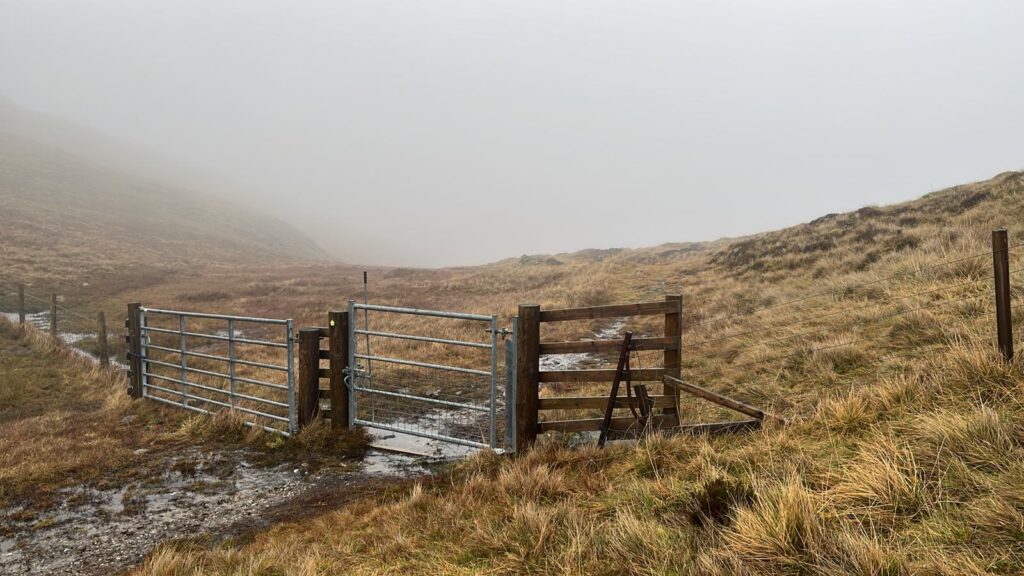
The Green Gate (no longer green!) marks the transition from the forest to the open hillside, and the path becomes a rougher ATV track which undulates across the hill. There was still no rain although a lot of ominous cloud and it was clear that the pass at the high point of the day was in cloud.
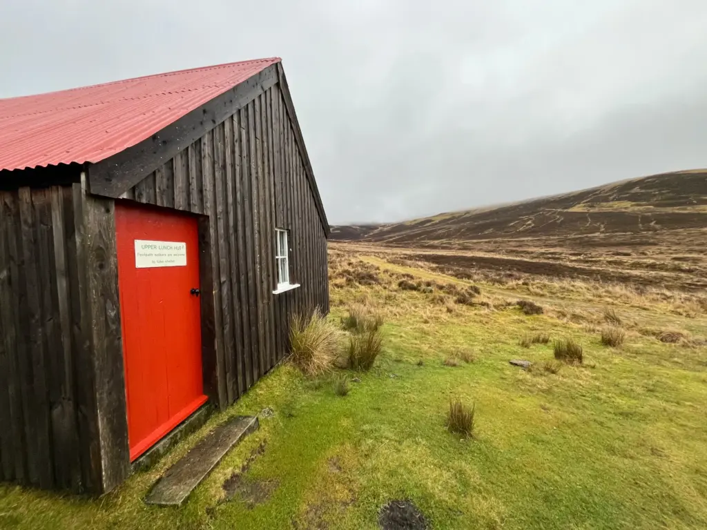
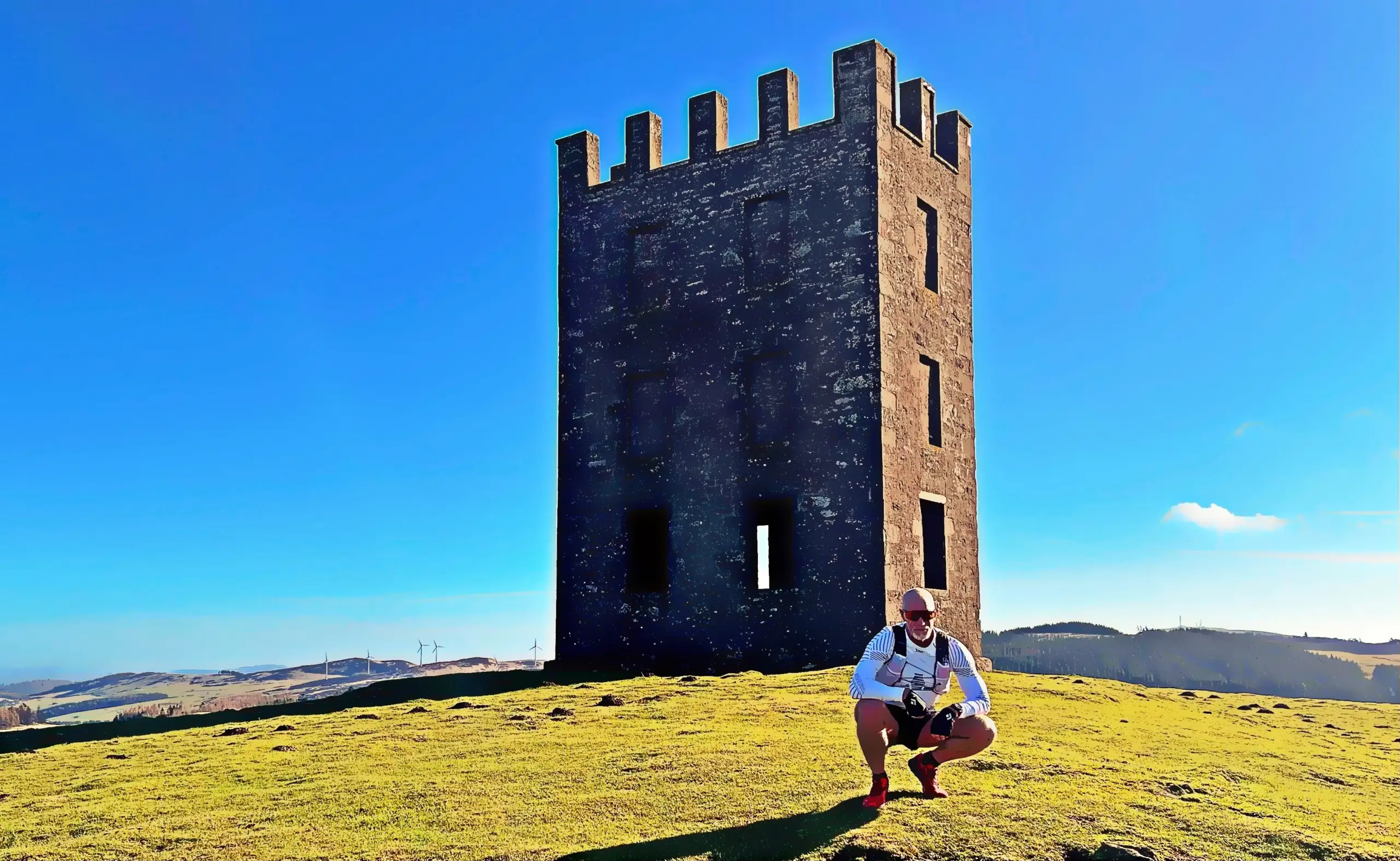
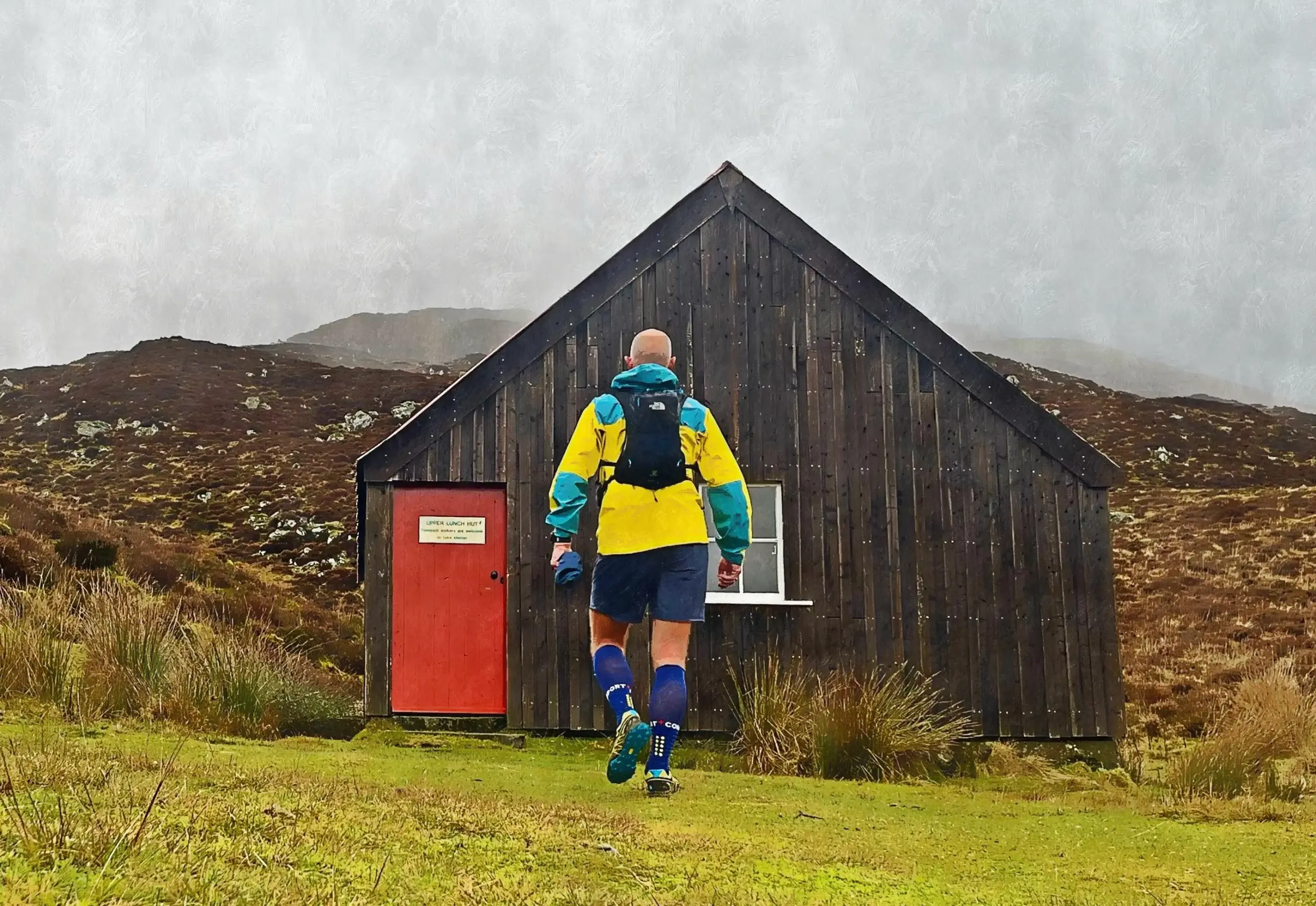
Eventually, the Lunch Hut is reached. Originally intended as a shelter for shooting parties, it is basically a bothy which is open to the public. There are no bunks and I think it is mainly used as a shelter during the day. I have slept in it overnight on a previous fastpacking trip and would quite happily do so again some time. The last entry in the visitors’ book was back in November, an indication that this trail does not see much action at this time of year.
Imagine my surprise then when I met a couple coming the other way as I climbed up to the lairig. They had used the new Ember bus service between Dundee and Braemar to alight at Spittal of Glenshee and were walking to Kirkmichael. They were the only people I saw on the trail the whole day.
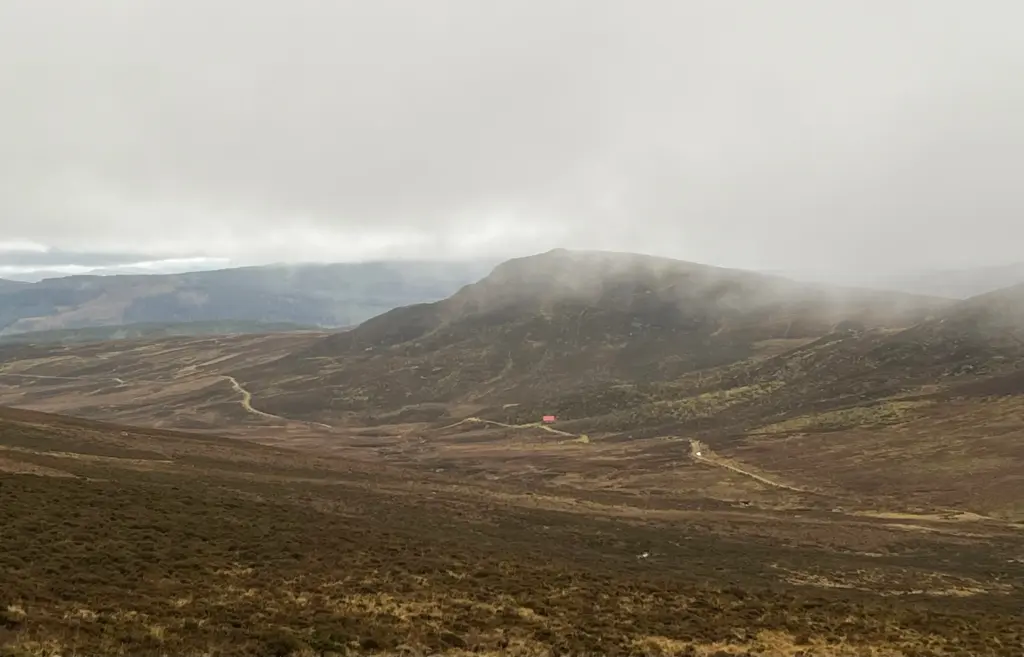
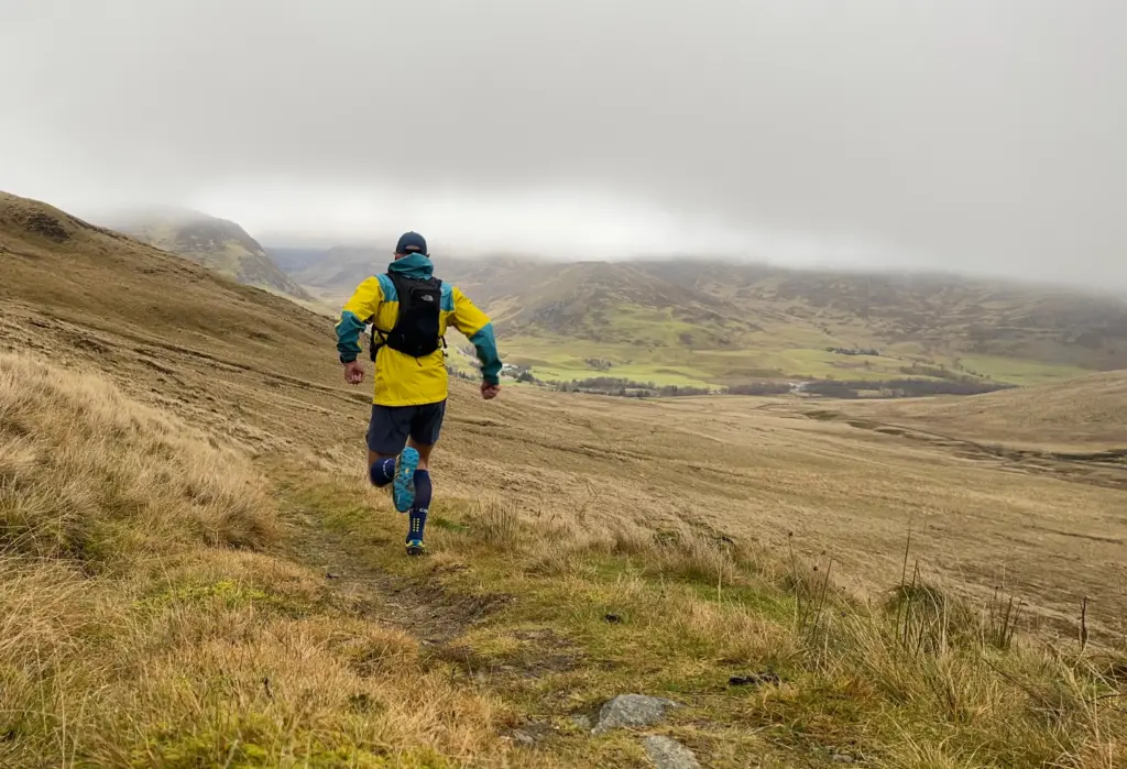
Up into the cloud then and I could feel some moisture in the air now. The temperature had dropped too but I was warm enough in my rain jacket. Eventually I reached the Lairig Gate which is the high point of the whole Cateran Trail.
What goes up must come down and I was more than happy to do just that. The downhill from the pass down to Spittal of Glenshee is longer than it looks and I do believe it is one of the best trail running descents I know. It is only slightly technical and not too steep, and you really can fly down from top to bottom at whatever speed you choose. I held back somewhat, conscious of the miles still ahead but I did enjoy it immensely, nonetheless.
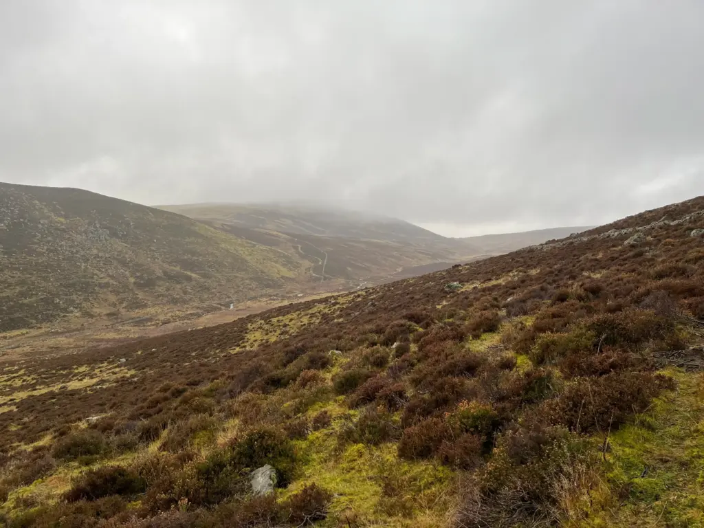
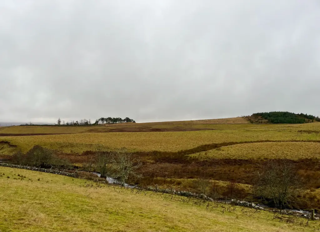
The arrival at Spittal of Glenshee and the crossing of the A93 marks the conclusion of the first of what I consider to be three distinct sections of the mini loop. Although the next seven miles to Lair are generally quite level, it is a really wet and muddy trail which can be a bit of a grind. That is exactly what it was today.
I won’t dwell on much detail as there is not too much scenic value to this section, particularly as it had started to rain and visibility was limited. There are lots of gates too and this makes a slow section flow even less.
The mud was actually worse than I had expected. The section around the Compass Christian Centre was very sloppy and it only got worse thereafter. The final mile or so before Dalnaglar was completely waterlogged in places. I am talking knee-deep in places.
Finally, the harder track arrived and this levels off along the back of Dalnaglar Castle before reaching the minor public road.
At the road junction, the Cateran Trail heads left towards Forter and into Angus. The mini loop turns right and heads downhill for about a mile before a sharp rise to the second crossing of the A93. This road crossing marks the beginning of the third section which although only five miles, is possibly the most challenging of the entire 20 miles.
By now it was raining quite heavily but I was warm enough when moving and my jacket was doing a good job. All my other kit was in a drybag inside my backpack, so I had no concerns there either.
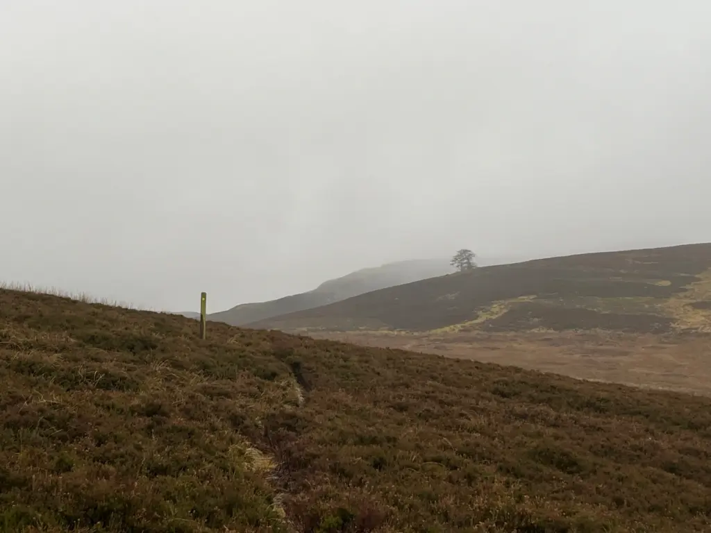
The faint path climbs up away from the road and in only a short distance seems quite desolate, particularly in the poorer weather. There are trail posts for the first couple of miles, and these do help as the direction of the track is never intuitive and it does periodically disappear.
The ground here was totally waterlogged, and it was either mud or paddling or sometimes both.
The posts are great but eventually they stop for whatever reason. I knew that I had to drop down and cross the glen floor before climbing on the other side to skirt round the hillside opposite. The GPX track on my watch was precious little use as I think the GPX for this section is only an approximation of general direction.
Predictably (as happened last time), I lost any semblance of a path and there was nothing for it but to forge my own way through the heather and mud. I roughly followed the GPX track although I knew which direction I had to go. The pathless route was sapping my energy, and it was pissing down quite heavily at this point, but I tried to remain upbeat.
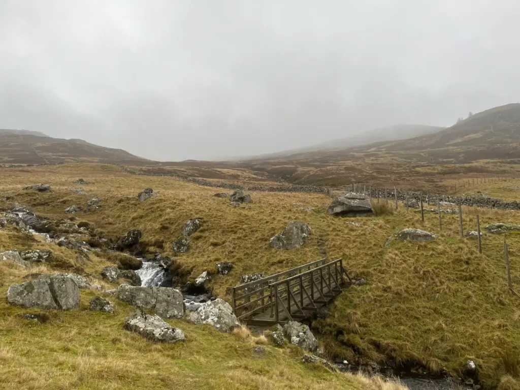
I contoured around the opposite hillside, and I knew where I had to drop down to, a gate followed by a footbridge over the river. I also knew that it was better track thereafter and in fact the ATV track could be seen climbing the hill beyond the bridge.
I climbed the track which then joined a proper 4×4 road, dropping slowly towards Ashintully Castle. Once again, I tried to follow the GPX track as I had gone adrift several times on this section the first time I was here. If only this time was different.
For some reason, nothing on the ground resonated with my memory and only the new gates provided a real clue as to which way to go. Once again, the GPX just didn’t seem to match what was on the ground.
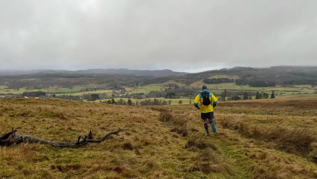
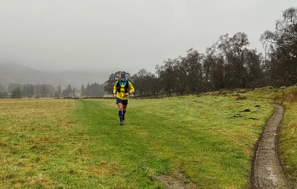
Eventually I could see the tops of the houses in Kirkmichael down below although I have to admit that I was completely winging it in the last mile, running randomly across fields and climbing gates and walls until I finally reached the road and the end of the run.
In the end, a shade over four hours so my projection had been fairly accurate. The last five miles in particular were very slow, especially on tired legs. This is not an easy route and the challenge is only magnified by poorer weather and very difficult underfoot conditions over many of the miles. When I arrived back in Kirkmichael, my body and mind felt like they had done nearer 30 miles, not just 20.
All that said, no cause for complaint and I did enjoy the outing overall. When you set out knowing the trail and weather are both going to be shitty, it can’t really come as a surprise and today I was up for it. You can’t run hills and trails and only be a fair weather runner.
I think I will taper off the longer distance over the next two weeks and then start to build up slowly once the new year comes around.