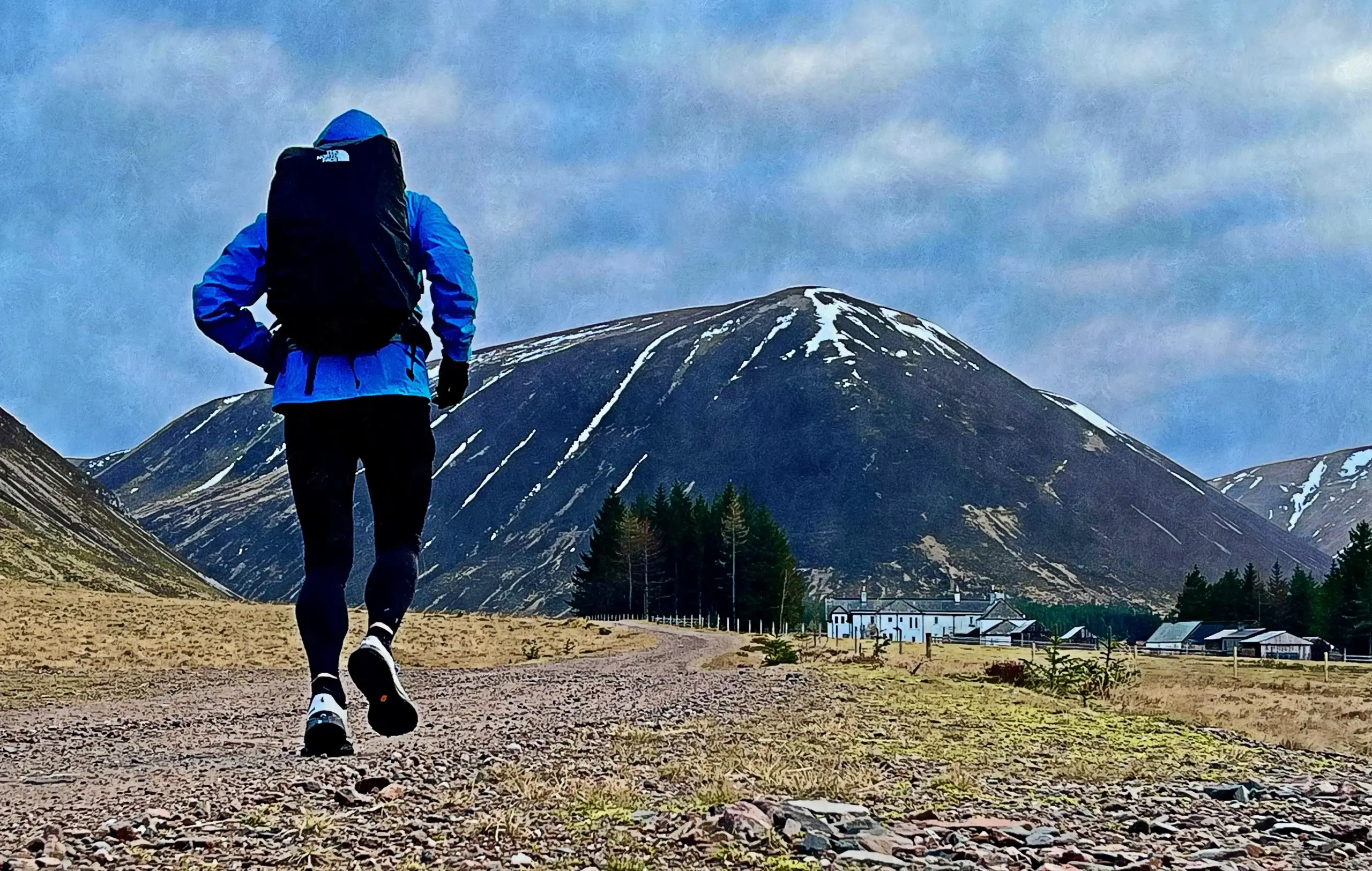
I know it is still only August, but the hours of darkness are now inexorably lengthening. It is important then to make the most of the longer days and summer temperatures that remain in addition to maximising opportunities for heavier pack-carrying before Andorra in just a few weeks. So, fastpacking time once again.
I identified Tuesday into Wednesday as the best weather window, then cast my mind to a potential route. On this occasion, I first made a decision as to where I wanted to bivy overnight. I aborted a fastpack to this particular location a number of years ago due to fatigue and poorer weather, opting for a lower more sheltered overnight spot instead on that occasion. It has always been on my mind since and although the area can be midgey, I will risk it.
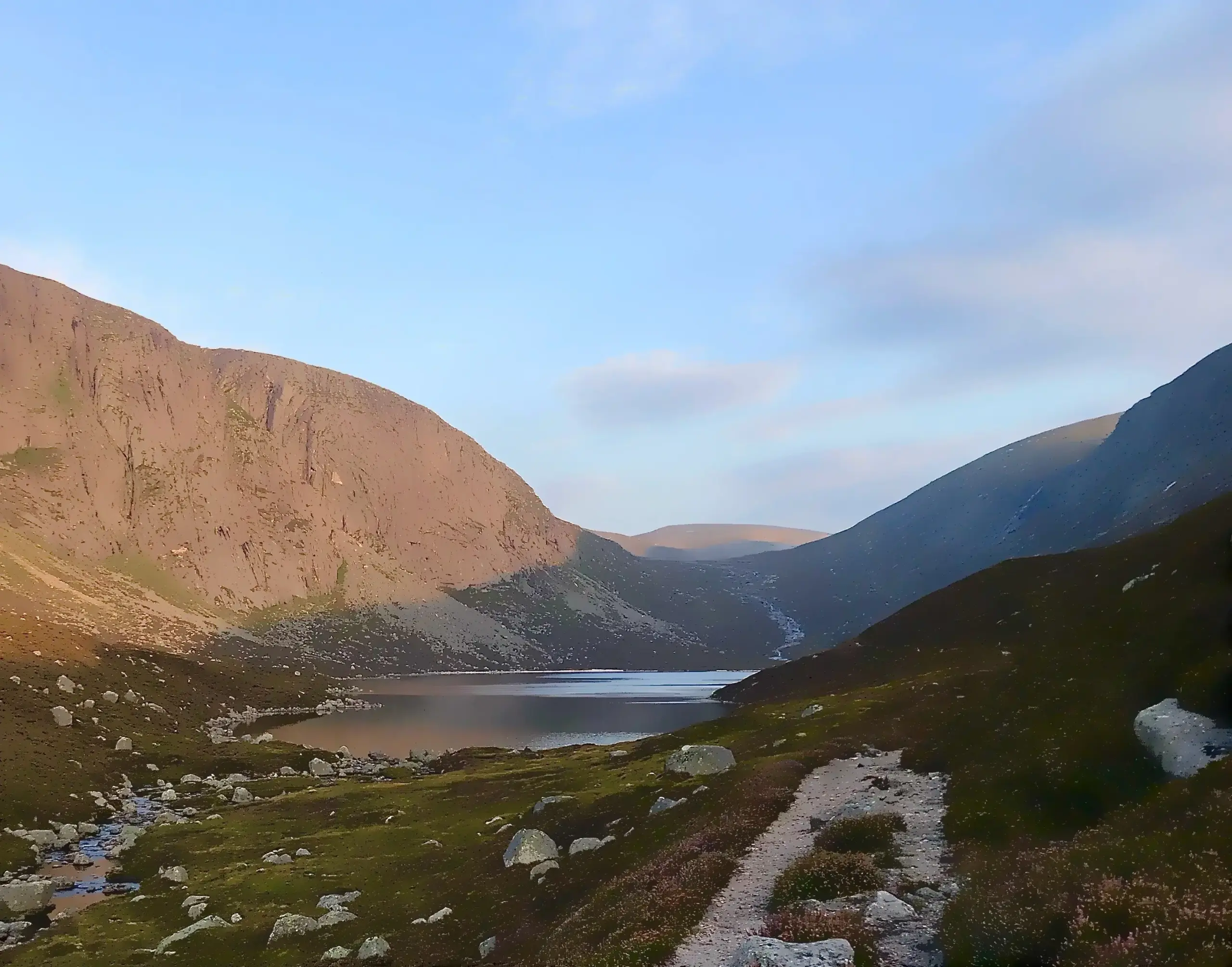
Dubh Loch (Dark or Black Loch) is a small loch which sits in a secluded valley above Loch Muick in the heart of the White Mounth plateau. Surrounded by steep slopes and crags on each side, it is a loch which does not lie directly on most regular walking routes and so requires a deliberate effort to reach. At the east end of the loch are some small sections of sandy beach and a few grassy areas for a small tent or bivy.
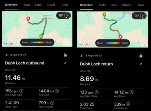
I wanted to make this trip more about the destination so I would not bother with any peaks in the area, instead identifying slightly longer and varied outward and return routes to avoid a simple out and back on the most direct route. I would depart from and return to the carpark at Glen Doll, at the head of Glen Clova. There would still be plenty of ascent and descent as well as some good level running as well.
Day One
My plan was to arrive at my bivy location sometime after 1900 so there was no rush to leave Dundee and it was later in the afternoon when I headed off, first to Kirriemuir then up Glen Clova to the carpark at Glen Doll. This is a paid carpark, now £3 a day. Although the ticket technically expired at midnight, the rangers are relaxed about extending parking overnight once the fee has been paid.
It was very warm and I was glad I was starting later in the day. The first mile and a bit was on fairly easy gravel road which allowed me to warm up. Soon enough, the signs for the Capel Mounth path appeared, pointing off track towards the trees. The first part of the path through the trees was badly affected by fallen trees during one of the big storms a few years ago. Could have been Arwen but not sure. Anyway, best to continue a little farther along the track then turn off on a faint quad track.
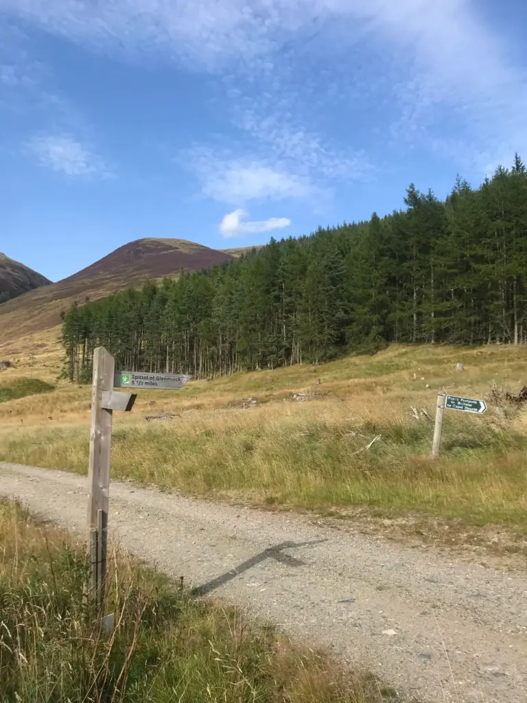
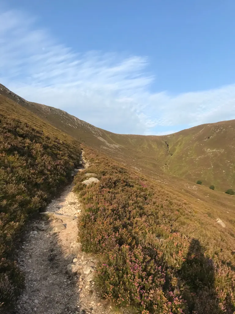
This track eventually meets the footpath and the long uphill climb begins. The path is good and switchbacks assist on the steeper sections. I was careful not to push the pace too much so early on and paused a couple of times to take in the view and progress so far.
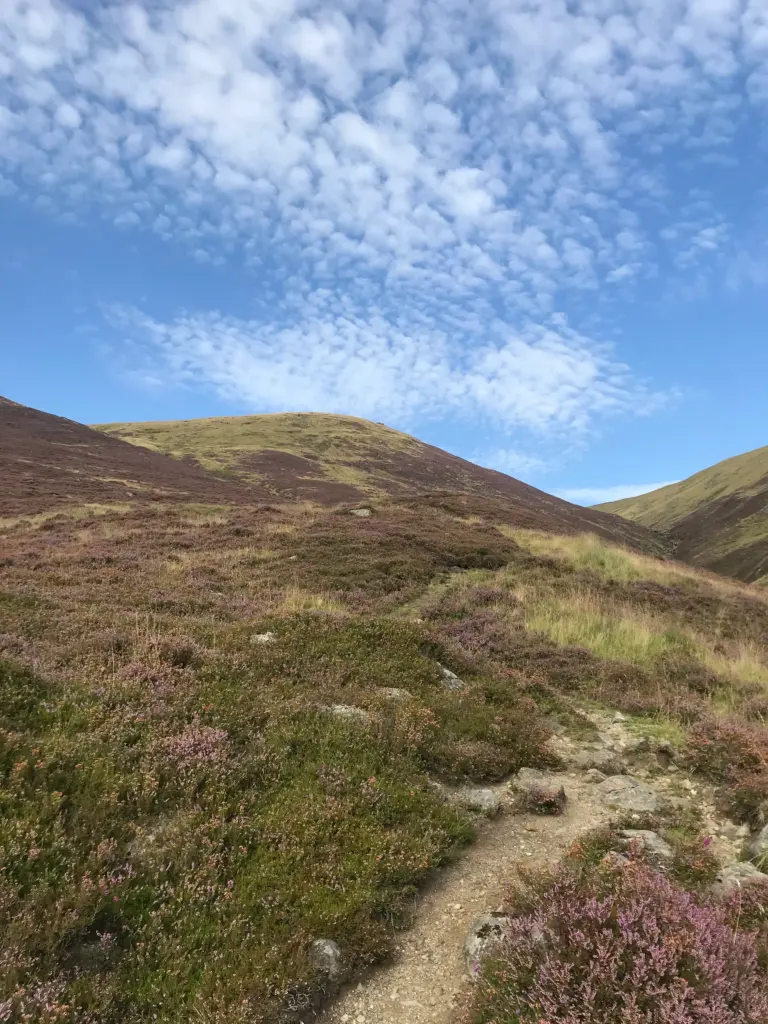
Eventually, I reached the top and the path levels off as the plateau is reached. There was a welcome cool breeze to take the edge off the afternoon sun and there was a fine view across to Lochnagar to be enjoyed as well.
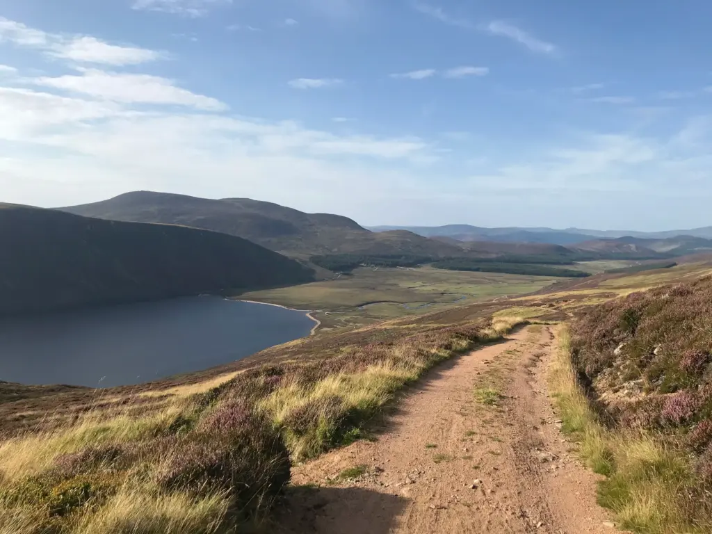
The next few miles undulate across the plateau but all on a good, sandy vehicle track that permitted speedier and risk-free running.
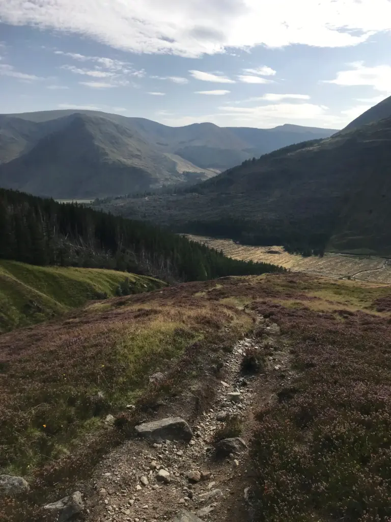
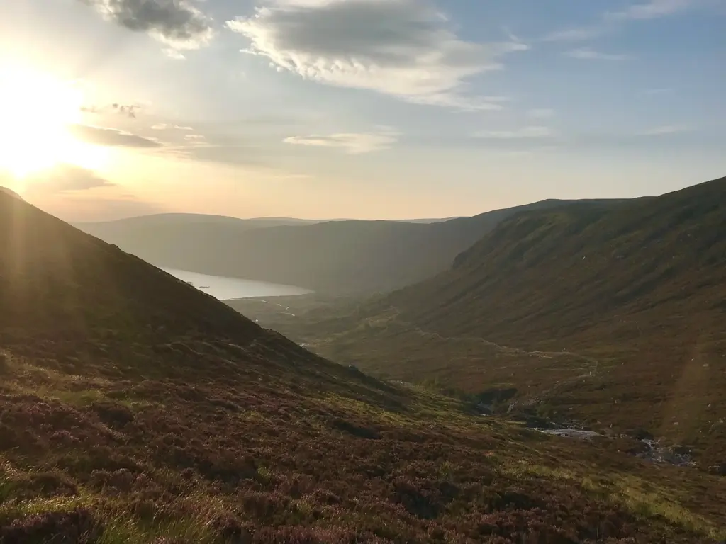
Eventually the track arrives at the beginning of the descent to the east end of Loch Muick. It is a sudden and very attractive change of scenery as the Loch comes into view below.
On reaching the path junction, it is a sharp left turn followed about a half mile later by a right turn down towards the loch shore and the foot bridge across the River Muick outfall. This was a good place for a short stop and a complete water refill.
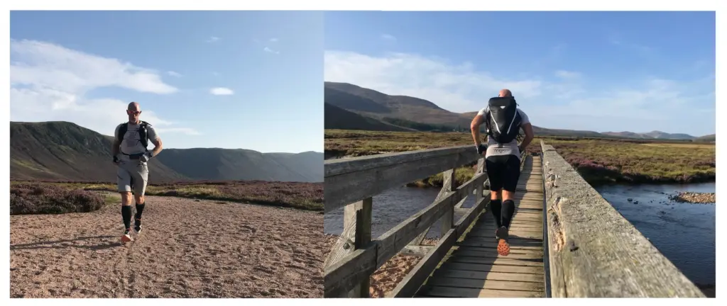
The path then turns onto the north shore of the Loch, by now in shade which was a bonus. I fell into a progressive walk/run for the next couple of miles before the trees signalled my arrival at Glas-Allt-Shiel.
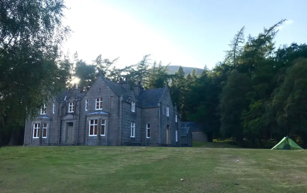
This lodge was built by Queen Victoria following the death of Prince Albert as a secluded and private retreat on the far edge of the Balmoral Estate. Although now in disuse, there is a bothy in a rear section of the building which remains very popular. On this occasion, there were about five tents pitched around the lodge and evidence of activity in the bothy as well.
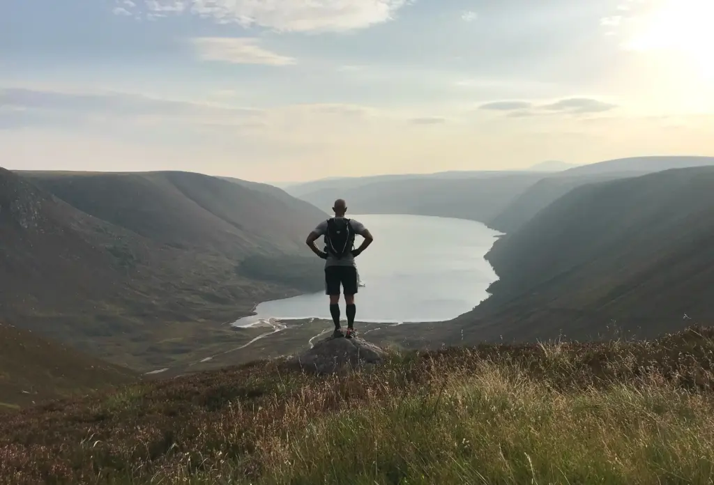
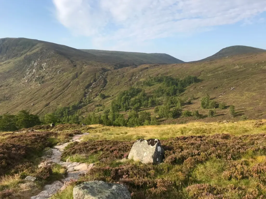
I pushed on, by now reaching the west end of Loch Muick. Taking the smaller path off to the right, the climb up to Dubh Loch began. It is never steep, but it is a mistake to think it is not much of a climb, rising eventually to over 650 metres. Even once the Stulan Burn is crossed below the waterfall, it is still a good distance to the loch on difficult rocky and narrow single-track.
Finally the Loch came into view and it only remained to complete the final section of path along the north side of the Loch. It was after 1930 when I arrived and the sun had already dipped below the high crags that surround the loch.
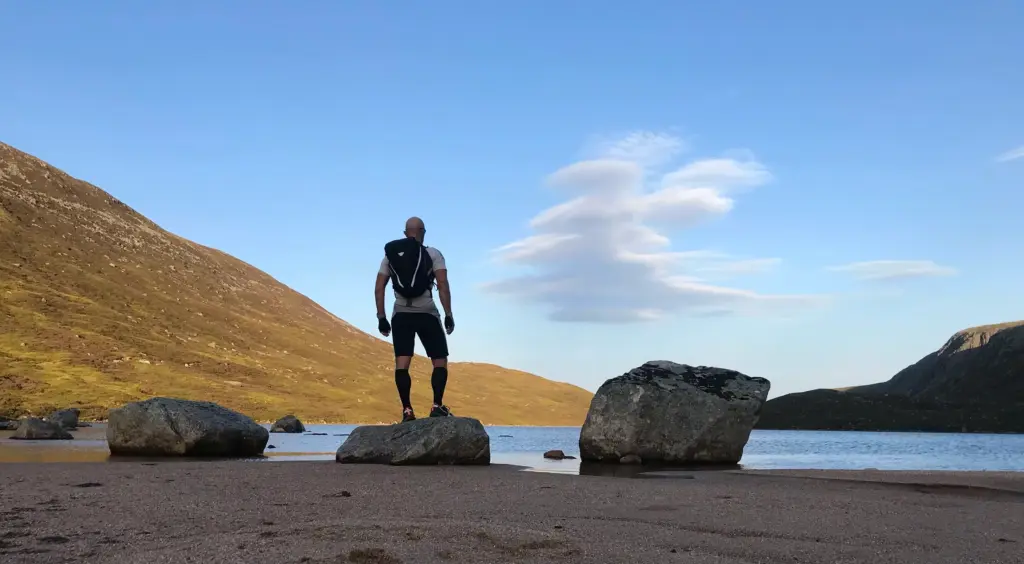
There is a nice flat grassy area adjacent to the sandy beach and this is where I sited my bivy, end on to the wind.
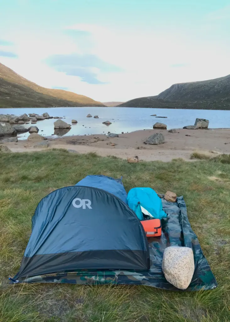
Up to the right are the imposing Creag an Dubh-Loch crags, a popular climbing location.
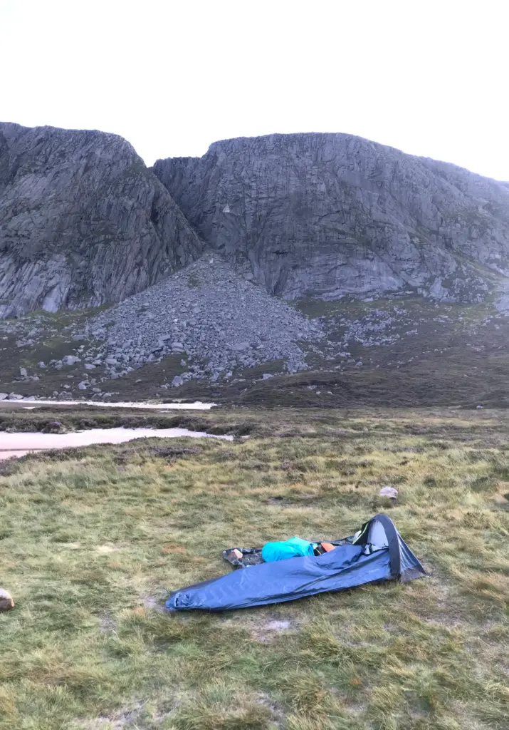
There was no-one else there, always a bonus to enhance the experience. Someone had been there fairly recently though as a bag of tent pegs had been left behind.
It was already cool in the light wind and the arrival of clouds of small flies (no midges thankfully!) necessitated a retreat behind the mesh of my bivy. I ate and watched a little downloaded TV until darkness fell. I then lay for a while, looking up to see if I could see any of the promised meteor shower. I saw one!
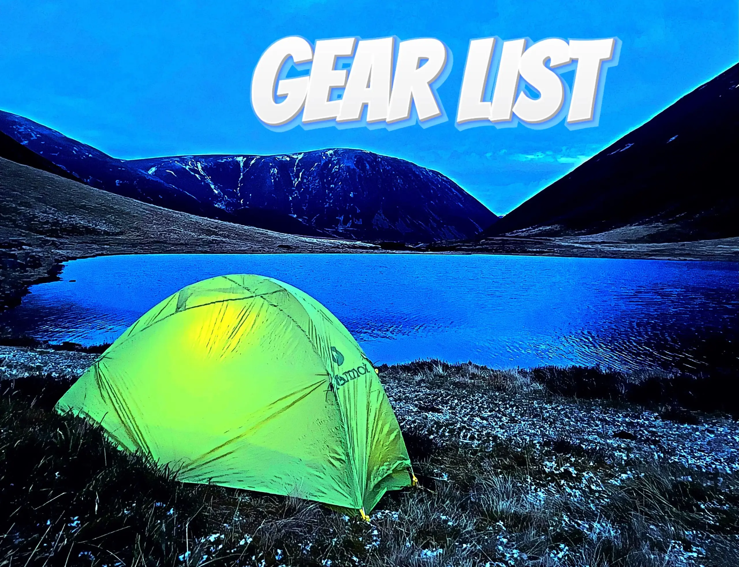
It was a restless night but I had been able to open up the mesh and enjoy the breeze and the night sky. The Nemo mat was great. Plenty of comfort for its ultralight weight and I could also feel that although it does not have a high R-value, there was some insulation.
I also make mention of the Dynafit Traverse 22 pack in the gear list post. In the end, it performed really well. I was pleasantly surprised at the comfort and lack of distracting bounce. It was easy to run with, and I would certainly use it again for a lighter-weight fastpack as well as a larger capacity day pack.
Day Two
As usual, I felt the sleepiest as dawn arrived, but I stirred myself and ate what was left of my solid calories. I had about two gels left and a complete VOOM bar for the run back. As it happened, I think I was a little light on calories on this occasion but no big deal.
The fly swarm had returned in the still conditions, and I just had to put on my head net and go for it. I packed up efficiently and I think it was about 0630 when I set off.
The first part of the return would be a retrace along the same path back down to Loch Muick. I enjoyed this section, not just for the cool morning air but also for the great views, back towards Dubh Loch and subsequently down to Loch Muick.

I made fairly good time and before long I was rounding the west end of Loch Muick.
At this point, another path splits off uphill and the climb up to the plateau begins. I think this was where I most felt the calorie deficit before I started dipping into my running calories.
I laboured up this climb but at the top, the reward was a view back down to Loch Muick in the muted morning sunshine.
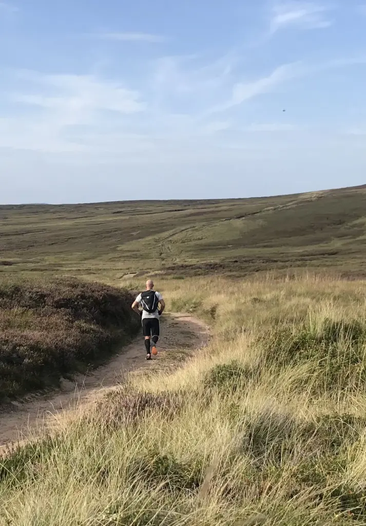
On the plateau, a good sandy path heads over relatively level ground, reaching the junction of the path up to Broad Cairn.
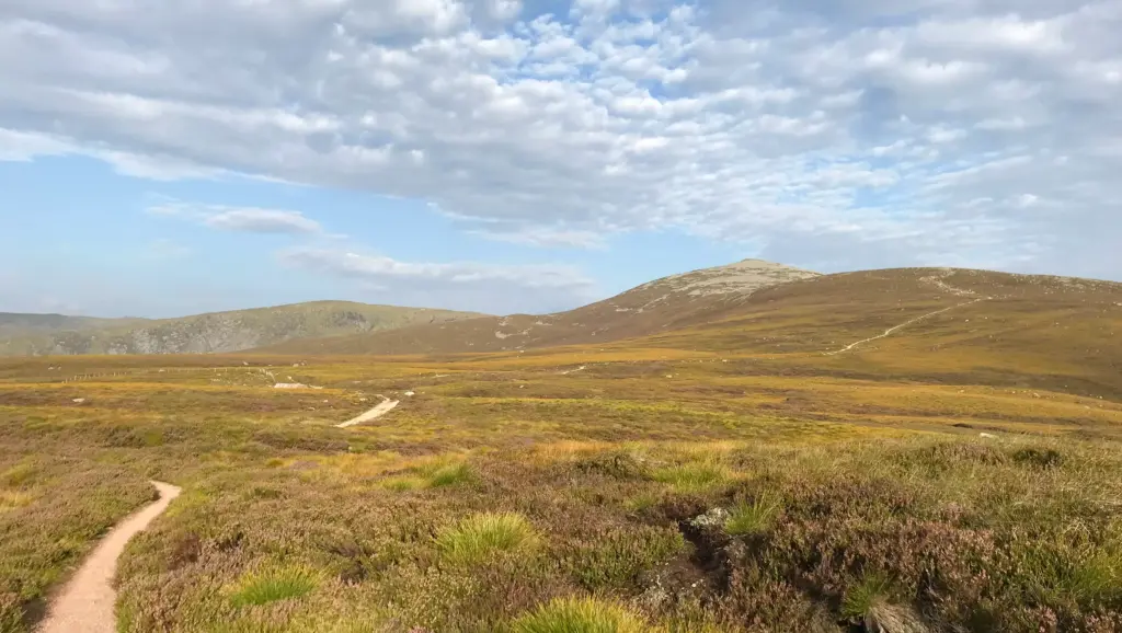
Here, I turned left and began the steady descent down to Bachnagairn. There are some very rocky and technical sections on this path, so progress was slow. I still have one swollen hand and lots of knee scabs from the previous week’s exploits, so I had no desire to add to those!
Bachnagairn is distinctive for the very pleasant larch woodland which seems out of place. However, I believe it was planted to surround a shooting lodge, now long gone. The woodland thrives though, and the path is very well maintained.
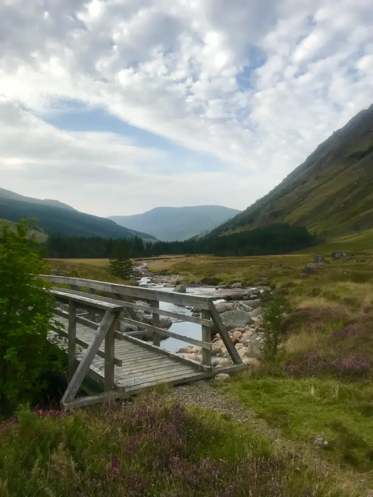
On leaving the trees, a bridge is crossed, and this is another reliable water refill spot. Then it is a steady downhill run on rocky track for about one and a half miles.
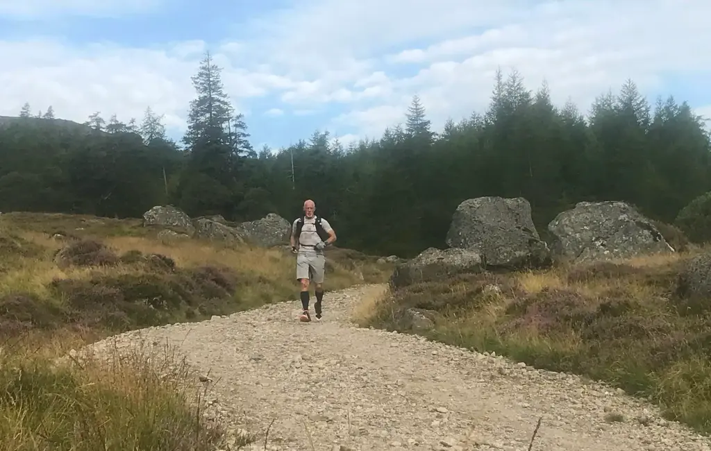
This culminates with another footbridge and the ground then levels off for the last couple of miles back to Glen Doll.
I managed an efficient run/walk on the last section and the car park was finally reached.
Overall, not the longest trip in terms of overall distance but there was more than enough elevation and technical difficulty to ensure this was a taxing outing. I can feel my fitness steadily improving and I also feel that I am making the most of the later summer to tick off some great training excursions. Another great little fastpack and I finally made it to Dubh Loch.
I often think it is a shame that some fantastic country in the east of Scotland is overlooked by visitors. Then I give myself a hard shake. Why would I want it to be any different?