If you have read the GRP report, you will know that I curtailed that part of the trip due to a serious case of feeling shit.
I spent the evening of the Wednesday and the whole of Thursday resting and eating, and I could feel myself quickly returning to an even keel. Although the highest capital city in Europe, Andorra La Vella is only at around 1,000 metres so any adverse altitude effects were also reversing.
The weather forecast for the following two days was excellent and I didn’t want to waste any days. I double-checked the mountain forecast as well and this confirmed ideal conditions on Friday for my intended route.
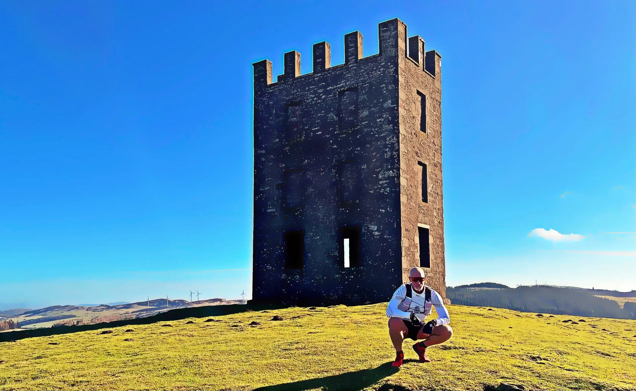
I had planned this day outing before the trip so had the GPX etc all prepared. I figured a quick return to higher altitude would probably be OK. In case the photos raise any kit confusion, I had also used my rest day to purchase a 5L running pack. The 30L would have been huge overkill and I justified the expense by consoling myself that the low taxes in Andorra meant a much cheaper price than in the UK. Besides, can you really ever have too much running kit?
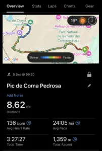
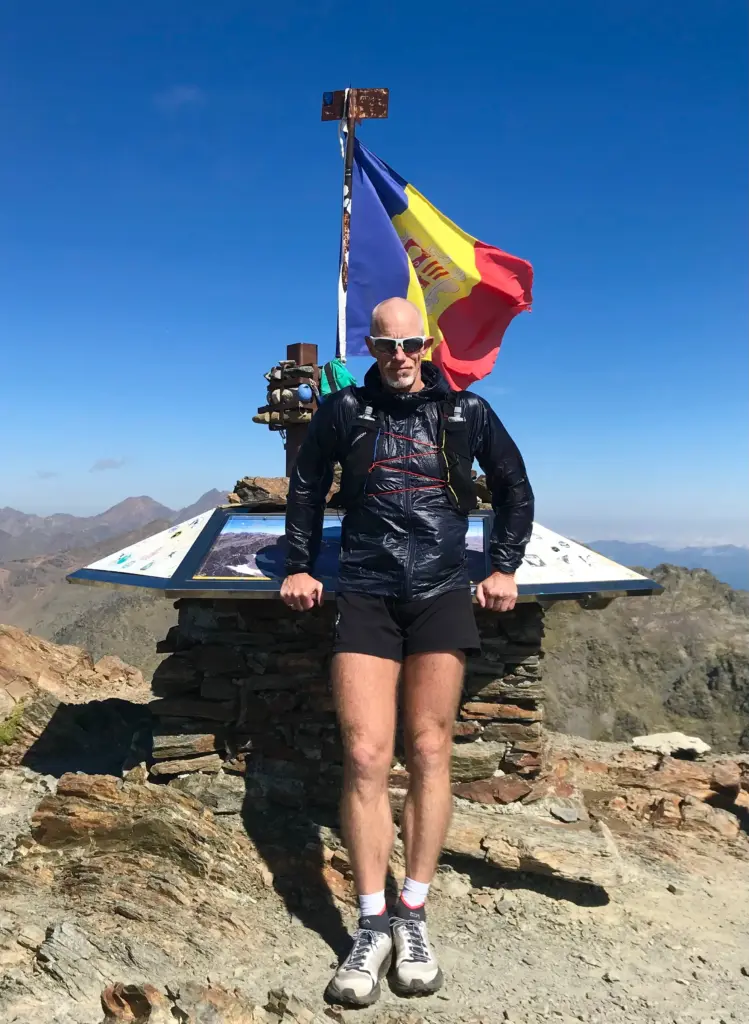
The plan for the day was an out and back route to the summit of Pic de Coma Pedrosa. At 2,942 metres, this is the highest peak in Andorra. It is also in a sector that I did not reach on the GRP so I could tick a further box by seeing some of that area. It would be a chunky climb, and I expected significant technicality on the route overall. This would increase nearer the summit where my research indicated there were portions of scrambling, although nothing much beyond Grade 1 it seemed.
Although the buses start early, there was no need for a crack of dawn start so I ensured I had a good breakfast then headed for the bus station. The bus service in Andorra is excellent, and I was soon on my way up to Arinsal which is one of the ski centres at the terminus of the public road in the north-west of the country. The road climbs significantly and before too long, I was off the bus and heading up through the short road tunnel to the road end and the start of the route.
There was already warmth in the air so I went for short sleeves although I had a long sleeve top and wind jacket with me as it would be much cooler higher up.
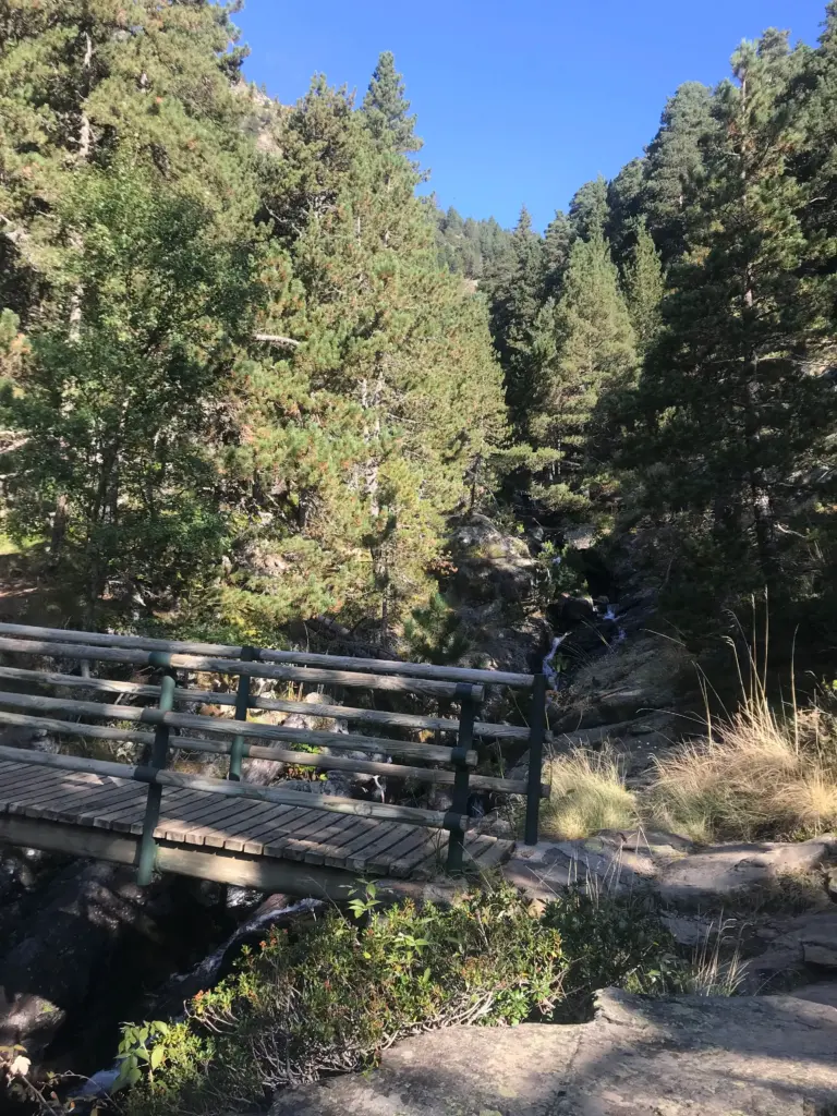
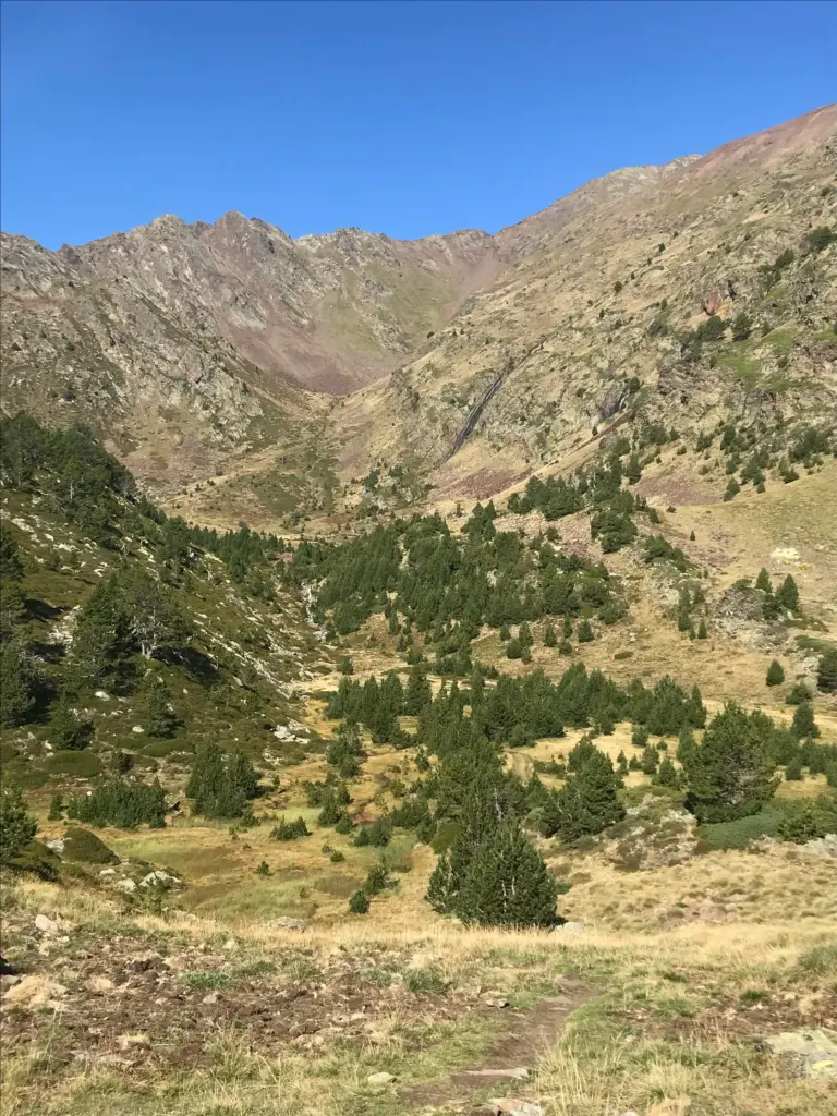
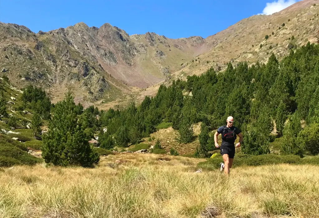
The climbing started immediately, up a gravel road into the trees. After about a half mile, I was on more technical single-track which continued to wind its way up through the trees. I could hear the river in the gorge down to my left and before long, I reached the bridge crossing. It remained cool in the trees with the benefit of bursts of greater warmth when exposed to the sun.
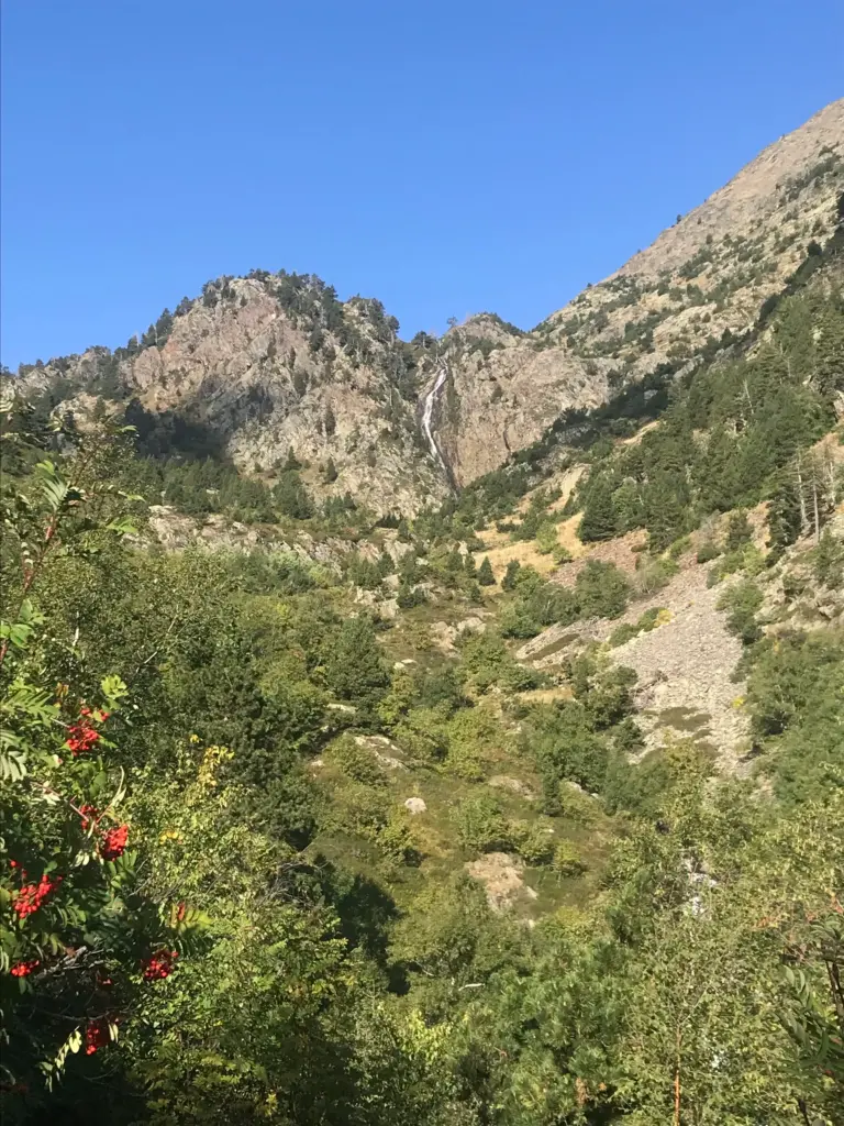
The path continued to climb and I was consistently passing hikers making their way up the same route or to the Refuge. Soon, the trees started to thin and more expansive views of the surrounding peaks and steep valleys emerged. I was full of energy, the conditions were perfect and I was moving well.
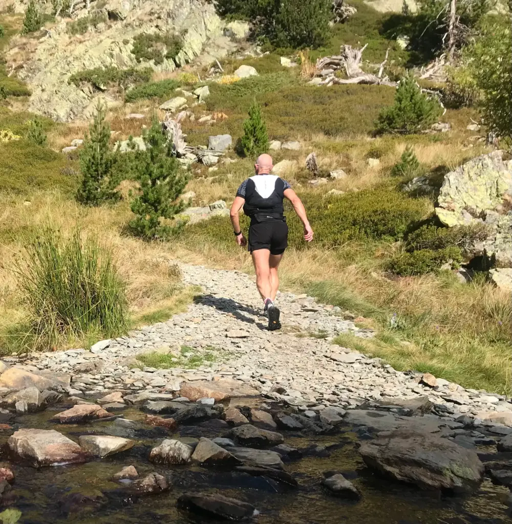
After another easy water crossing, a further steep and rocky section led to the path junction at the start of the flatter high pasture which lies below the refuge.
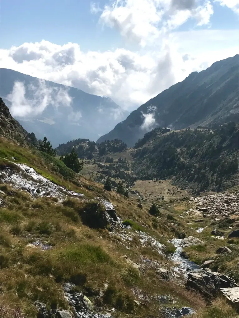
The Refugi de Coma Pedrosa sits at 2,260 metres and is the fourth of the larger, staffed refuges in Andorra. I would have passed here on the GRP had I continued further than I did.
It is a loop diversion to go up to the refuge, but I had no need to do so and wanted to press on to my ultimate goal.
There was some good running across the high pasture with a clear view of the direction of the trail leading up into the high cirque ahead of me. So, the climbing continued but I was enjoying it and the continually changing scenery. I knew the peak was somewhere up and to the right but it was not yet in view.
On climbing up into the cirque, there is a river crossing and the path then turns more steeply uphill and to the right (north).
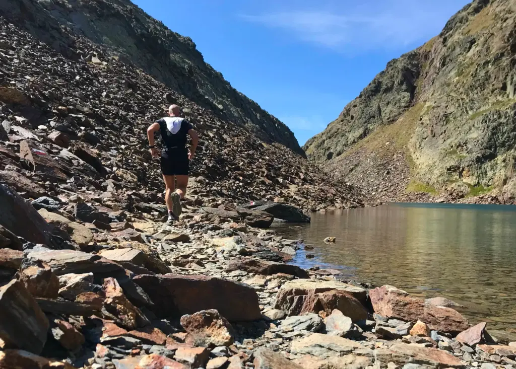
A small alpine lake is reached, following which there is a much gnarlier rock gully which then arrives at the Estany Negre, a larger alpine lake which sits to the west of and below the peak itself.
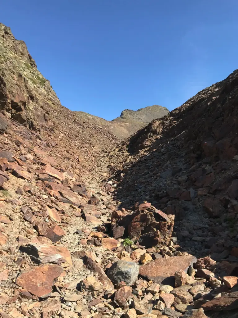
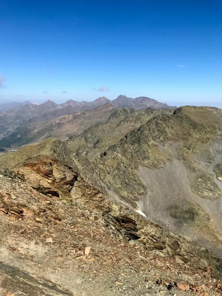
There are two route options at this point. The path continues alongside and beyond the lake before climbing to the final steep climb up the western face of the peak. The alternative is to cut sharply up to the right and then follow the ridge and subsidiary summits all the way up to the final summit itself. My research had indicated that this was the route involving some actual scrambling, so I had opted to ascend by this route but to descend by the alternative path back down to the lake.
So, the final climb commenced and I have to say that it still looked like an awfully long way up to the summit which could now be seen for the first time.
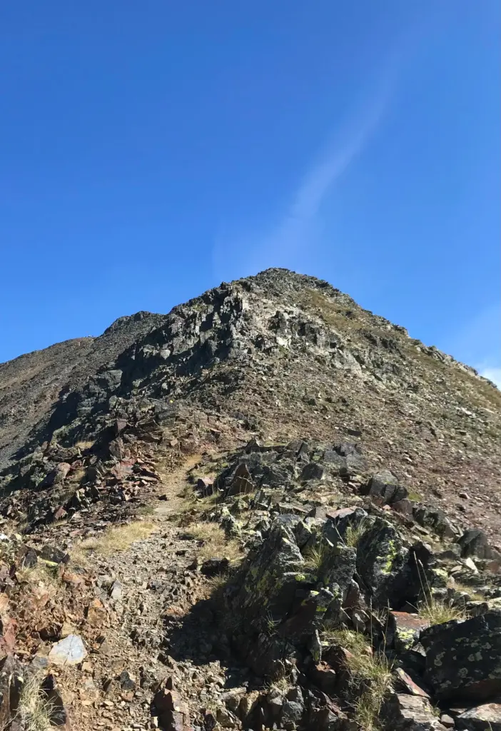
The ‘trail’ markers here are the local path yellow circles, painted randomly onto the rocks to aid navigation. There was evidence of a path at points, but it was otherwise a case of spotting and following the yellow dots. There was a fair amount of scrambling, but it never felt too precarious provided care was taken and I tried to adhere to the ‘three points of contact’ rule. That said, technical scrambling doesn’t really float my boat and I don’t get any kind of a kick out of it.
The temperature was falling quickly and I put on my wind jacket which was all that was needed to keep the chill off my skin. The remaining elevation passed more quickly than I had expected but I was climbing well and not feeling the altitude on this particular day.
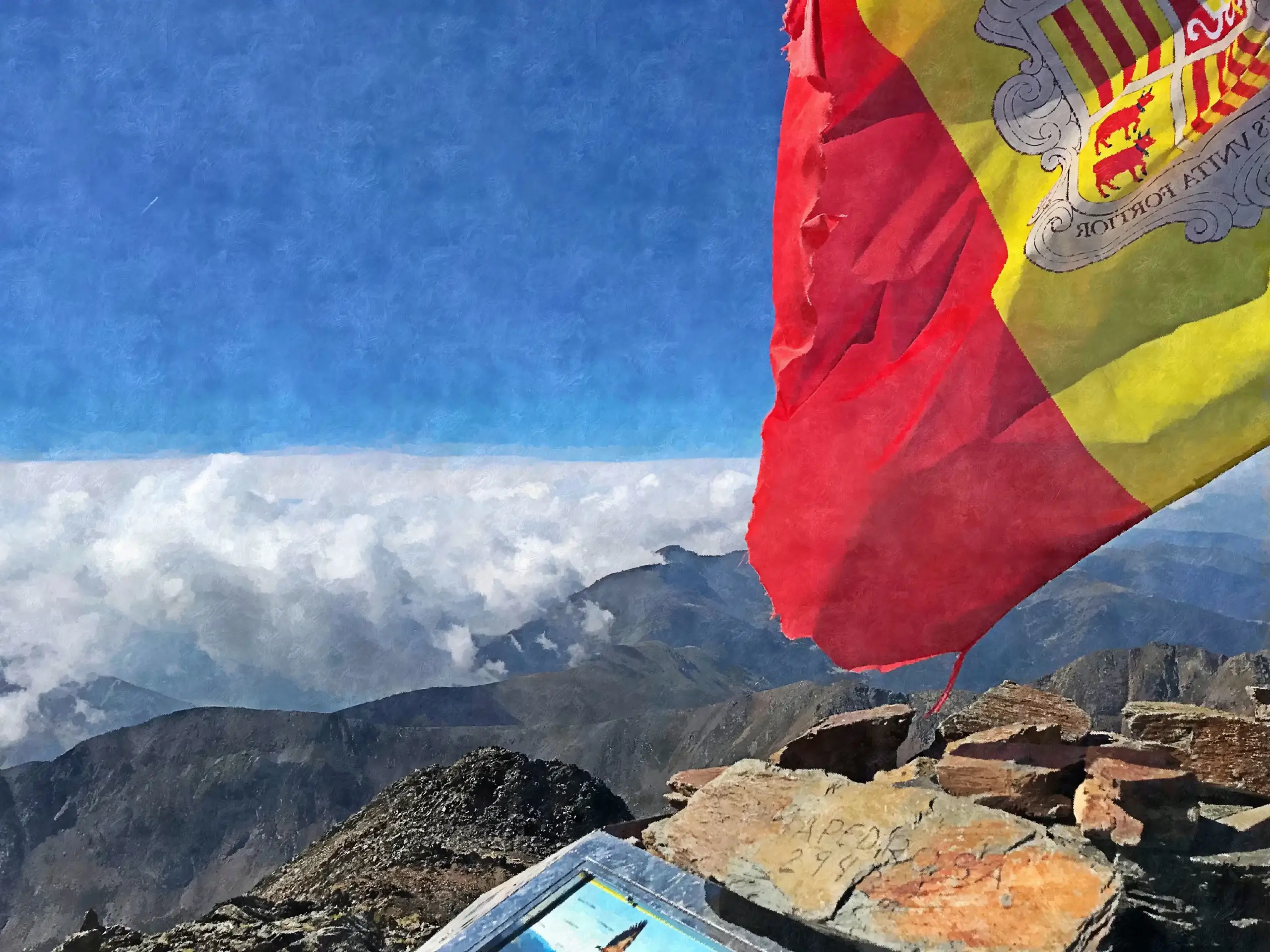
The summit arrived and I was instantly grateful for having come on a perfect weather day. The views in all directions were spectacular although the summit structure itself is a bit of an aesthetic calamity if you ask me.
There was a little group of united nations on the summit. A very friendly, banner-wielding trio from Poland, a young couple from New Zealand and a slightly surly Che Guevara-wannabe from Argentina.
I tried not to be surly and joined in the hustle and bustle of mutual photo-taking. In the end, I had to delete most of the ones taken of me. Aside from the majority where I just looked stupid, how hard can it be to frame a decent photo?! Come on, for f!*ks sake!
After about 15 minutes, the novelty of the view wore off and the wind chill won the day so it was time to get off the top. The path down the western slope started very steeply and the surface was very loose in places, so it was a slow-going affair to begin with, picking up the pace as the path improved towards the lower gradients. Quite a few people were ascending by this route although having done it the way I did, I was more than happy that I had picked the right route choices for me.
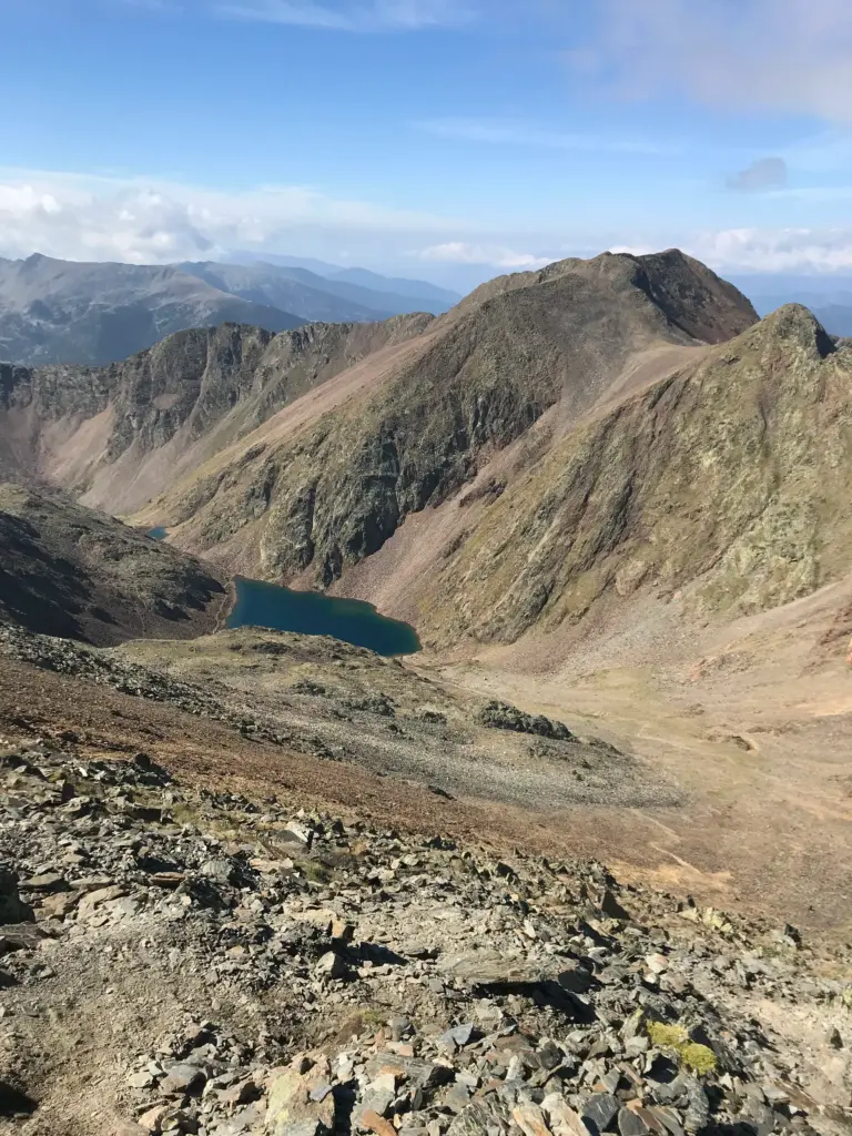
Once down the main face of the peak, there was some slow and careful running down towards Estany Negre and even the path alongside the lake was runnable. I refilled my water at the lake then pressed on, back down through the rocky gully.
I was now back on the same route by which I had ascended.
Although I had to really focus at every stage, I was efficient and pretty quick on the return journey. I was really enjoying it, glad to be feeling good and to be moving well. I ran back across the high pasture and decided not to go up to the refuge.
Soon I was back down into the trees and continuing to maintain my concentration and pick my lines as carefully and nimbly as possible.
I crossed the bridge again and then put my foot on the gas for the final non-technical section down to the road. It felt great to be running at pace and I could feel the benefits in my quads and calves from all of the climbing in the last few days.
This was a great day and although peak-bagging isn’t my main focus as I have said before, sometimes it is just what the doctor ordered. This was after all the highest peak in Andorra and on reflection, a fantastic route with ever-changing and spectacular views. I felt great and it did a lot to dispel some of my GRP disappointment.
I had moved really well. AllTrails and the trail signs themselves all indicated a projected time of around three hours 50 minutes to the summit. I completed the entire out and back in under three hours 30 minutes so that felt like a success.
Overall, a memorable outing to the very top of Andorra.