My legs were extremely stiff and sore after the suffer fest to St Andrews last Sunday, with some new aggravation around the inside of my right knee. I have never before had knee problems of any kind. However, this seemed ok after a couple of days, and I homed in on Thursday into Friday as a good weather window for a fastpack.
I wanted something that would allow me to run a large percentage of the route, not too far in distance and somewhere I would actually like to spend a night. I finalised my route choice on Wednesday night and spent the following morning bringing the necessary kit together for a mid-afternoon departure.
I decided that I wanted to overnight at the very top of Glen Isla. The route I would follow over the two days had been done before as a single day run but I have never spent a night in the dramatic setting of the head of the glen. I also decided that I would take a tent, simply as I wanted to enjoy the evening and the overnight experience to the full. I even toyed with the idea of taking a stove but decided against it as I still wanted to maximise the running and every gram counts.
Day One
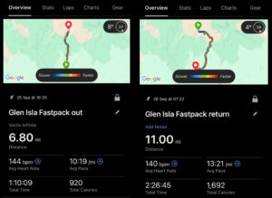
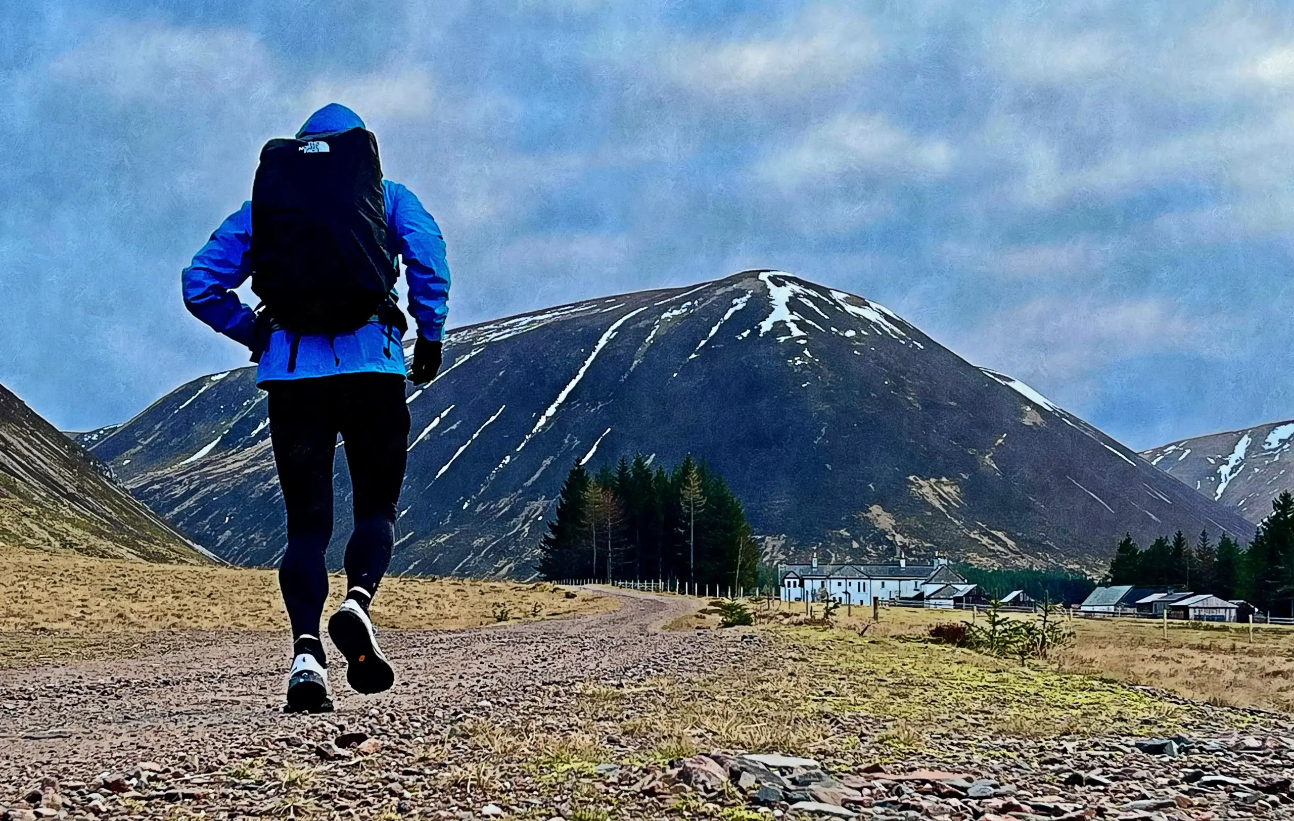
It took about an hour to drive from the centre of Dundee to my starting point which was a little lay-by in Forter and I was off and running for about 1630. The outward leg would be the easier of the two legs and after the usual stiffness in the first mile, I settled into some decent running on the gently undulating tarmac to Auchavan.
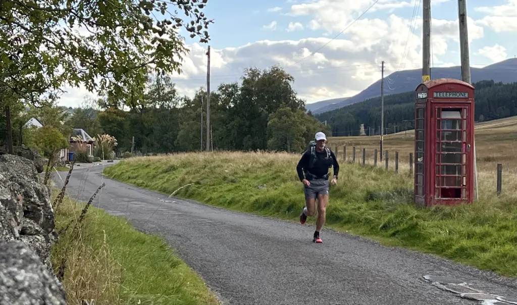
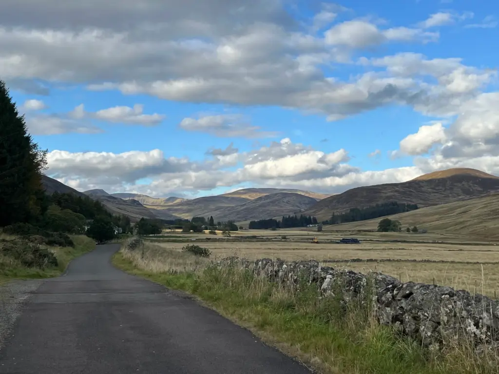
I made good time and could feel that my legs were performing well, even with the pack. I breezed through the road-end at Auchavan and onto the gravel 4×4 track which heads north into the more dramatic scenery of the upper glen.
Once over the wooden bridge and past Tulchan Lodge, the track becomes much rougher, and the hills start to rise sharply on either side of the glen. I passed the Monega Path turnoff (enough of that in recent times!) and continued up the glen. The track becomes very stony down by the river and much of this is due to track repairs after the track was washed away by floods a number of years ago.
I was looking out for two things as I neared my goal at the head of the glen.
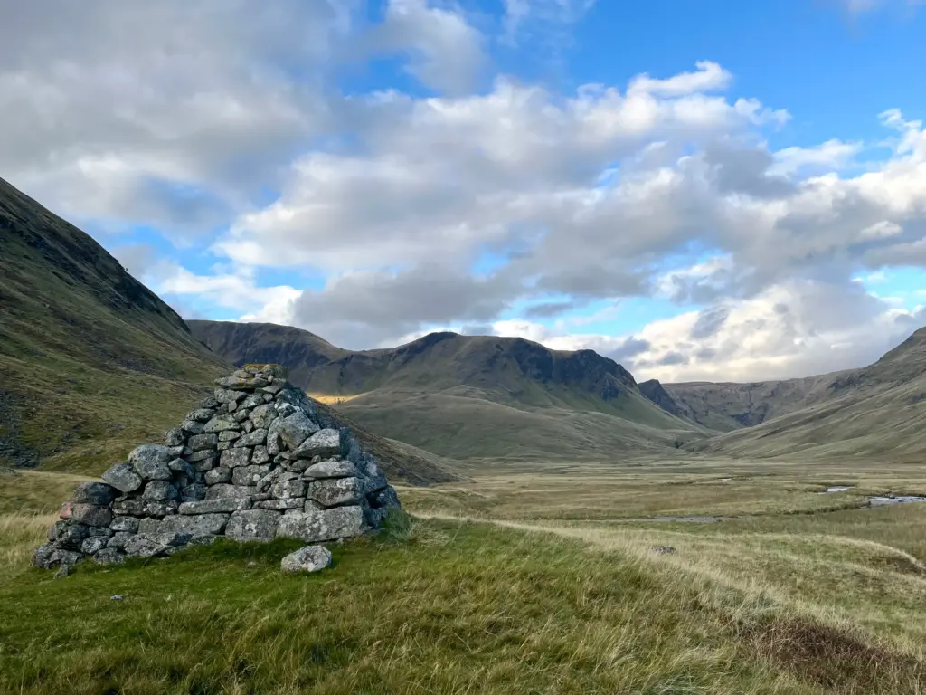
Firstly, Bessie’s Cairn. I believe Bessie was a dog belonging to Lady Elizabeth Londonderry for whom the cairn was built in 1852. Lady Londonderry was a regular visitor to Tulchan Estate. One story suggests the unfortunate Bessie was savaged to death by deerhounds on that spot, but the exact history remains unclear. In any event, the cairn commands a fantastic view of the upper glen and I feel sure Lady Londonderry enjoyed it.
Secondly, there are usually horses in these parts and true enough, the friendly beasts were grouped by the track as I passed.
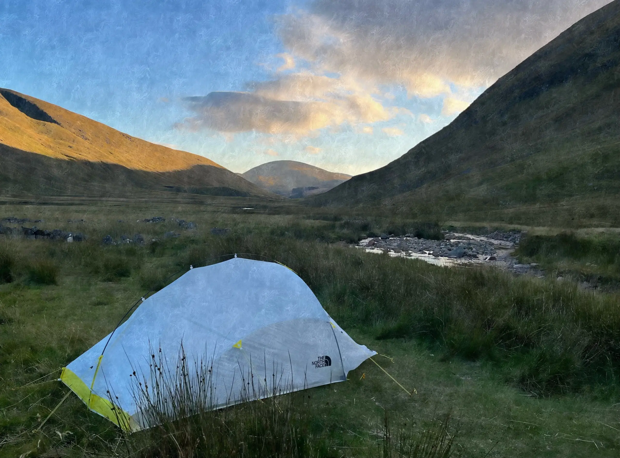
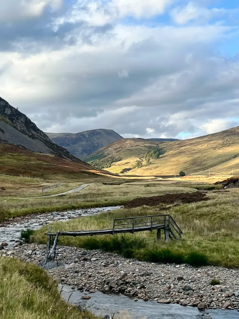
From that point, it was only about a half mile to my campsite, and I was still running strongly which I have to say was very encouraging. I intended to camp adjacent to an old, ruined shieling and stone enclosure which sits at the point where Glen Isla splits into the two smaller glens (Caenlochan and Canness) that branch out in opposite directions.
I crossed the river with dry feet and set about finding the best tent spot. My choice made, I set up the tent and sleep system then took advantage of the remaining daylight to take a short stroll a little way up Caenlochan Glen.
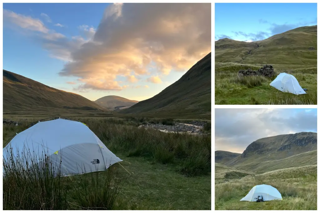
As the sun set, I retired to the tent and the warmth of my sleeping bag. I ate steadily over the next couple of hours, and I was soon pleasantly toasty. I enjoyed some downloaded TV and after a final toilet break outside, settled down to listen to some music. It was great to have the space and shelter of the tent.
I woke several times overnight, but I was sleeping solidly in between. All around the hillsides, stags bellowed continually. I am sure one was pretty close to the tent at one point as it was very loud. Aside from that, the noise of the river was a constant and welcome soundtrack.
Day Two
I roused myself about 0630, ate then set about packing up. With the space inside the tent to organise things, this was an efficient and straightforward business and once I had to get out of the sleeping bag, it really wasn’t that cold.
By about 0730 I was ready to go and there was good daylight. It was clear though that the weather forecast was spot on and there was extensive cloud cover, down to about 700 metres. I could see that I would be ascending up into the cloud and there was a good chance that I would spend most of the return run there. Day two was always meant to be a different experience anyway and a shift in the weather would just add to that.
I headed east across the floor of the glen, heading for the steep slope on the far side of Canness Glen. There is no path and it is just a case of heading straight up the grassy slope, picking a line as you go. The ground is very uneven, and it was hard going, especially the lower and uppermost sections which are about 45 degrees of incline.
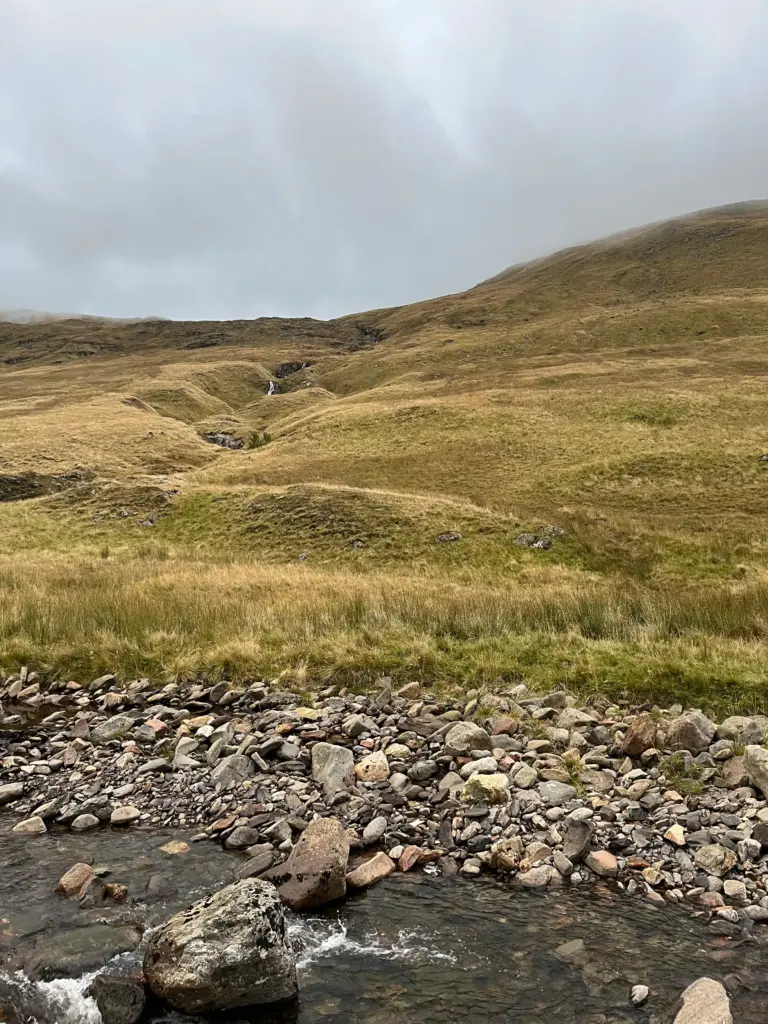
The target was to hit the plateau above just to the north of Finalty Hill. Crossing the open ground, an initially faint ATV track is reached. This track is then following uphill to a junction where I took a sharp left, heading north and downhill. I am glad I had been here before as visibility was fairly limited, but I was confident in my route-finding.
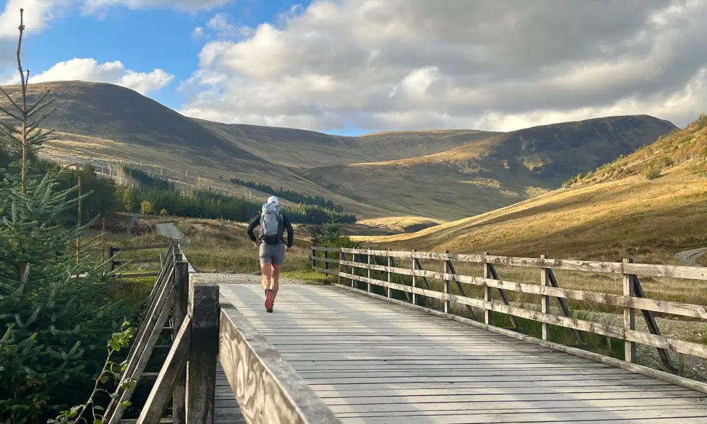
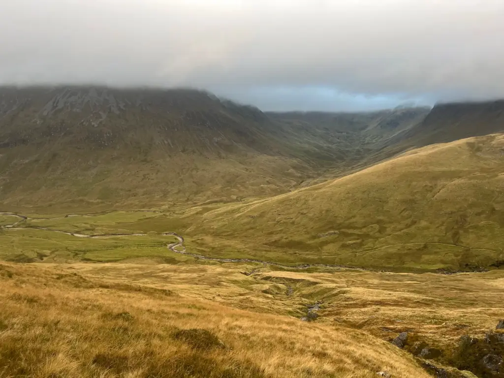
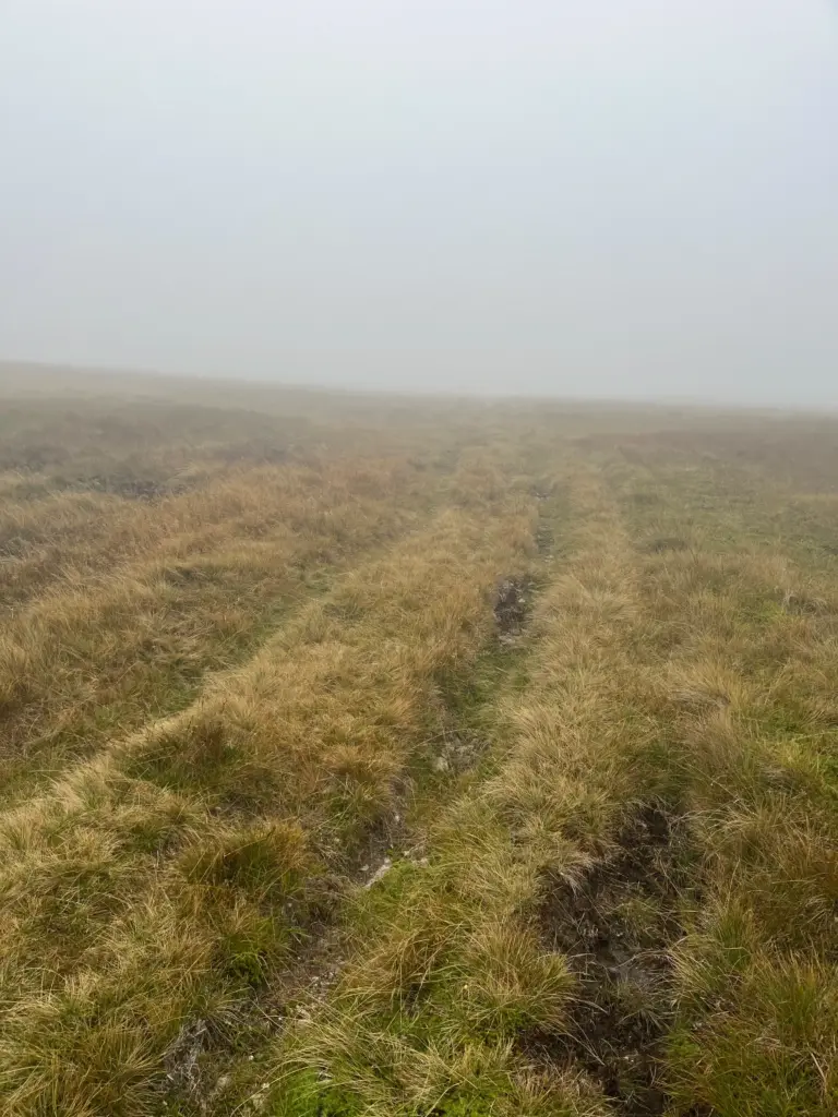
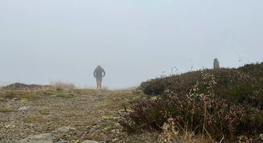
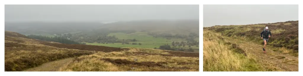
The picture below shows the track and the visibility. The latter was a shame as the views over the next few miles are fantastic in good weather. As it was, I would remain in thick cloud for about the next seven miles before I lost enough altitude for the views to open up a little more.
Again, I know the track and more importantly, which route to take at the few significant track junctions that appeared as the miles ticked by. The good news is that there are many level or slightly downhill sections and I was doing a lot of running at a decent pace. I had kept my insulated top on throughout and was glad that I did as the wind was very cold up top and it did rain a fair bit in the final hour. All that said, it was actually really enjoyable.
The downside was that my right knee was really starting to play up, having been ok the previous day and overnight. Strangely, it had little adverse effect when I was running but I could feel the pain and stiffness on the uphill walking sections.
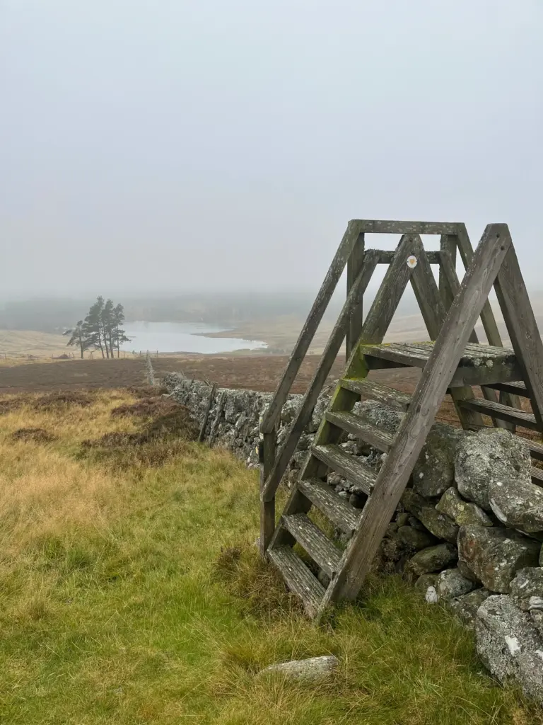
I passed the turnoff for Badandun Hill but carried on, taking the main track that circumvents the peak to the east. Finally, I reached the stile which sits above Auchintaple Loch below. This also marked my joining the Cateran Trail for the final leg down to the main road.
I was still running strongly, despite my knee and the final mile or so of downhill to the road was a great experience to end the trip.
This wasn’t a long fastpack but the routes over both days and the variable weather conditions made for two distinctly different days.
As I sit and type this, my right knee is painful, and I believe somewhat inflamed. I have never had any knee issues before so I don’t really know what this means but I will have to be very cautious, and it might be that a period of rest is the only answer.
I have too much happening in the next couple of months to have my plans derailed by impatience and frustration.