Time for a final run in the month of July, a month that has flown past but also one that has heralded a long-awaited return to full running. All things considered, it has been a very positive month, and I am extremely pleased with what I have achieved. There is still a mountain to climb, in fact probably quite a few, to get me where I would like to be in two months’ time. All my documentation for UTAT in Morocco has now been submitted and I await word from the race organisers. The sooner I know which race I am training for, the better.
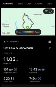
Anyway, back to today. I wanted to do around 10-12 miles with some elevation. The weather was to be favourable, so I homed in on a route that has been on my to-do list for several years. The loop route would take in the tops of two hills that lie between Backwater Reservoir and Glen Prosen in a quiet corner of Angus.
Cat Law dominates the skyline as you drive north across Strathmore. At an elevation of 671 metres it is however no giant, falling into the category of a Fiona (2000-2500 feet with at least 150m of descent on all sides). Further north across the managed grouse moors is Corwharn. At a lesser 611 metres it falls into the sub-2000s. With about 750 metres of ascent in total and some steep climbs and descents thrown in, a good test for legs that badly need some conditioning!
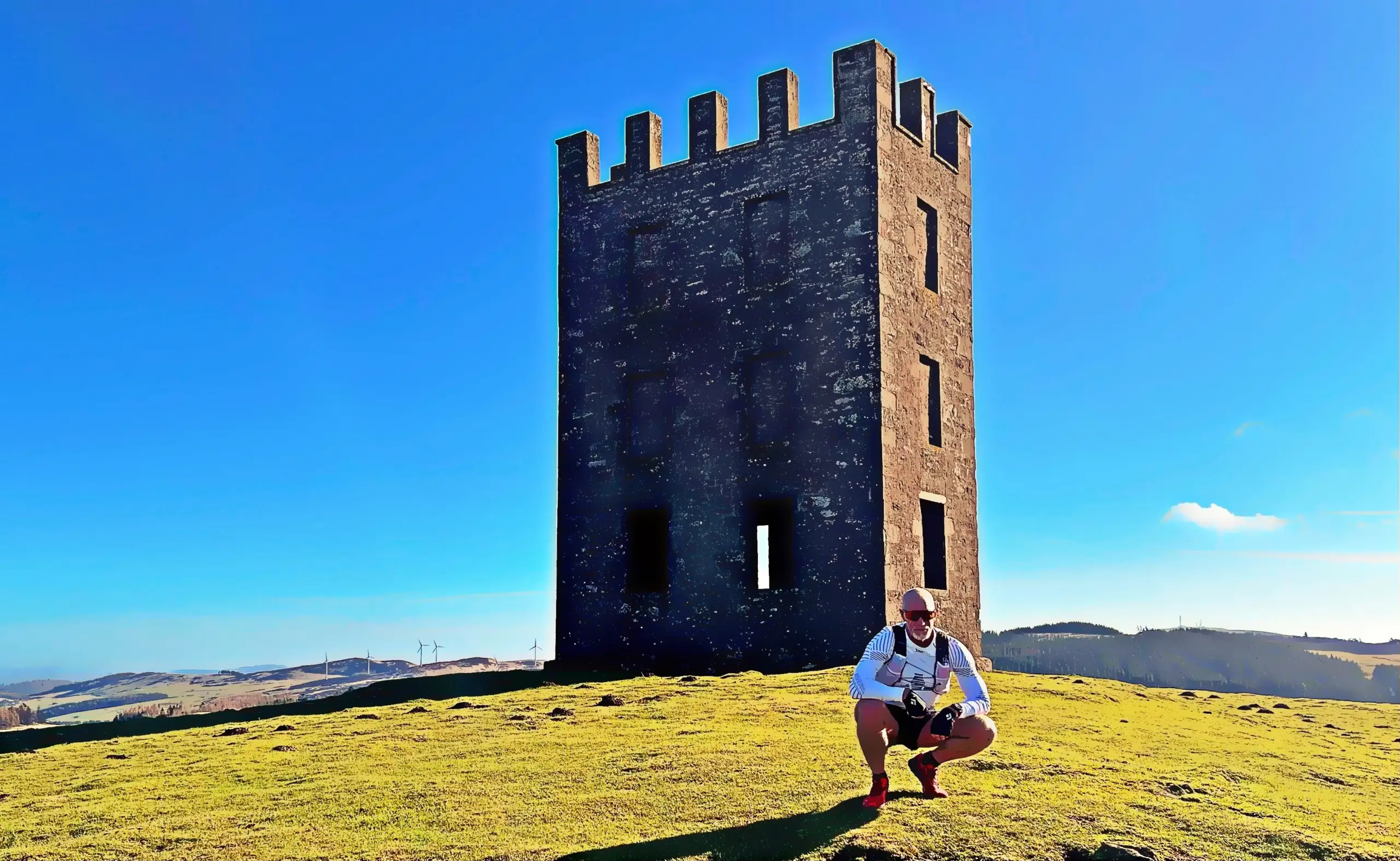
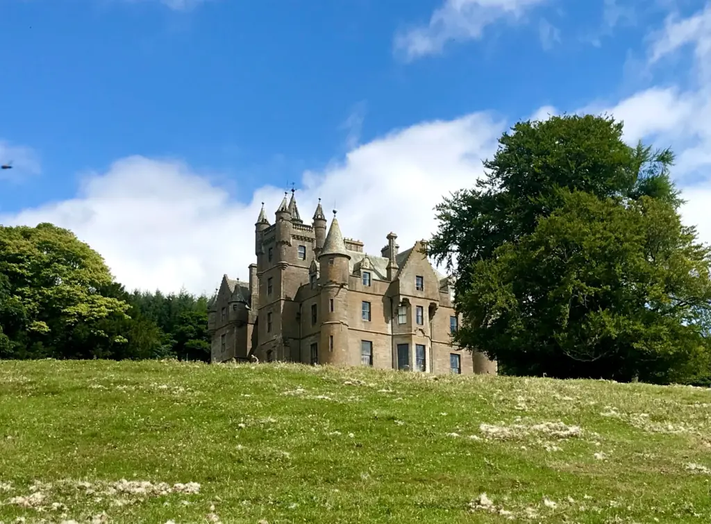
I headed up for about 0930, parking by the roadside just beyond Balintore Castle, derelict for a long time but currently undergoing a full renovation. The route begins just beyond, through a gate into the field and then the climbing starts immediately. The gradient changed frequently over the next couple of miles which eventually reach the dome-like summit of Cat Law.
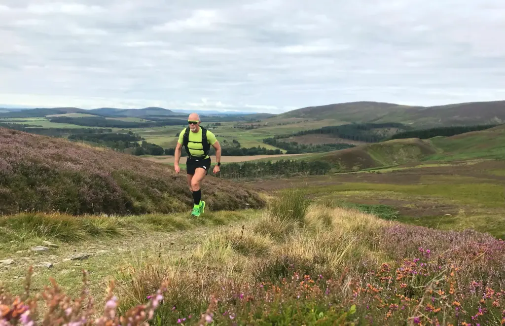
The track was good and dry but I could definitely feel my lack of fitness and my quads and calves were burning too.
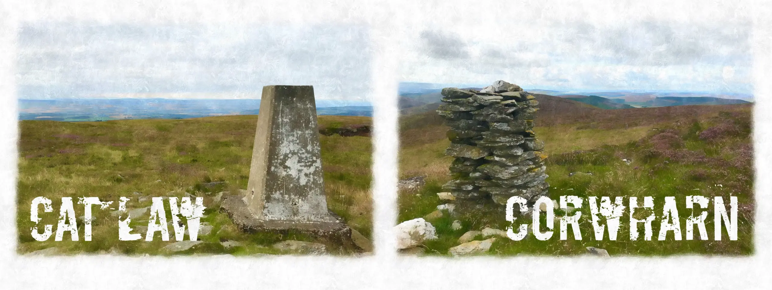
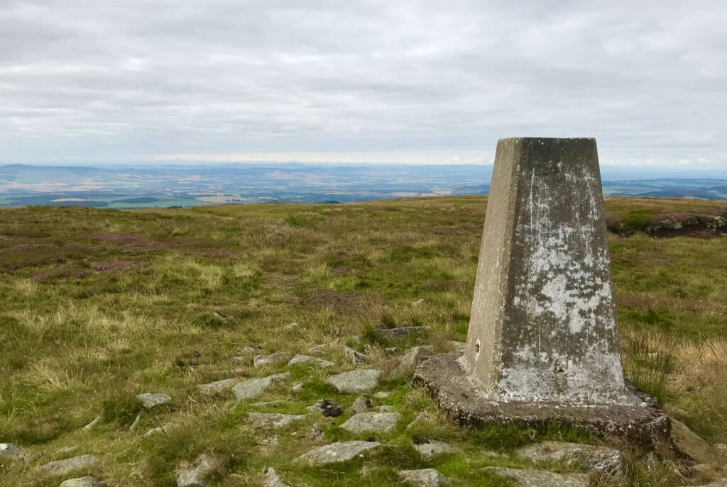
I reached the trig point on Cat Law after about 35 minutes and took a very quick break for calories and a couple of photos.
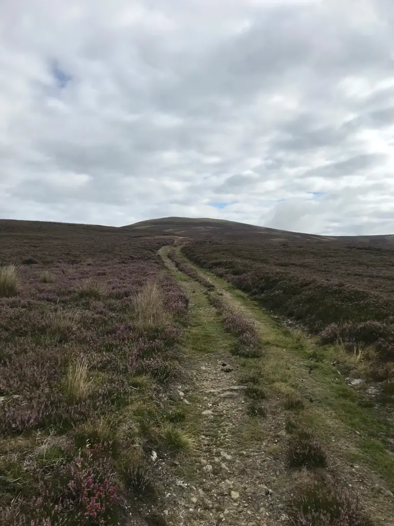
Then, onward and downhill! A nice long and varied descent on a faint, grassy quad track which soon improved to a more distinct and stonier track. Again, I could feel my quads complaining which they never should at such an early stage. Reaching a track junction, I then turned north onto a well groomed 4×4 track for a further downhill. I was really enjoying the running by this point.
Eventually, the track started to rise again and I then turned off it onto a very indistinct path up onto Hill of Dye. When I say path, more of a barely distinguishable line through the heather which then reached and ran alongside the fenceline. It was rutted and uneven, making progress slow. However, the long spell of mostly dry weather had dried the ground completely on a stretch which would otherwise be boggy as hell.
After a long drag along the fenceline the faint path then turned downhill, a short but steep descent to the main 4×4 track through Glen Quharity. Corwharn could be clearly seen on the far side of the glen, as could the very steep track required to gain the ridgeline.
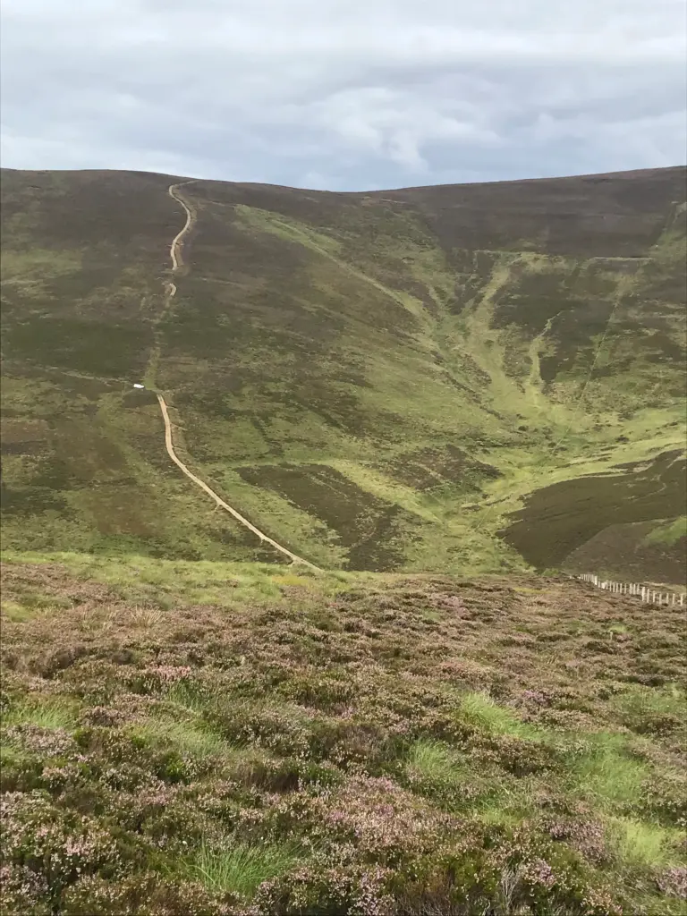
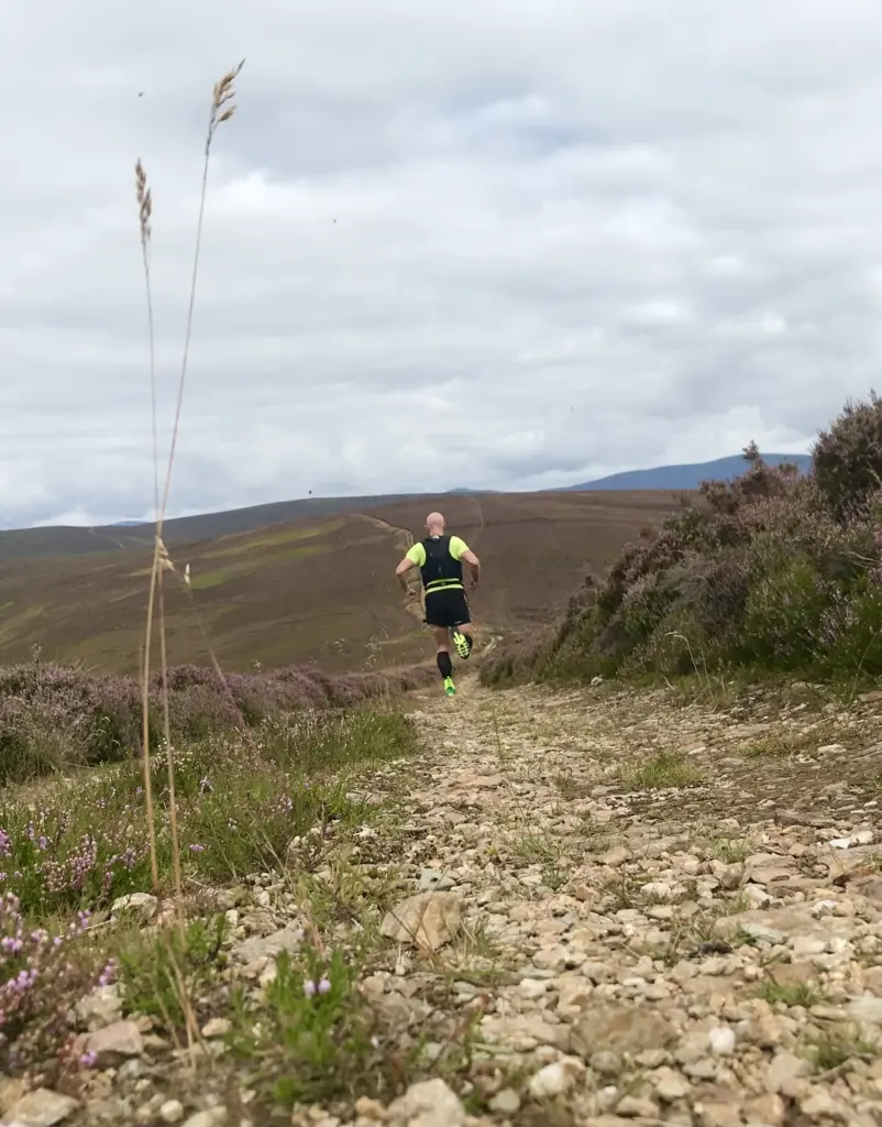
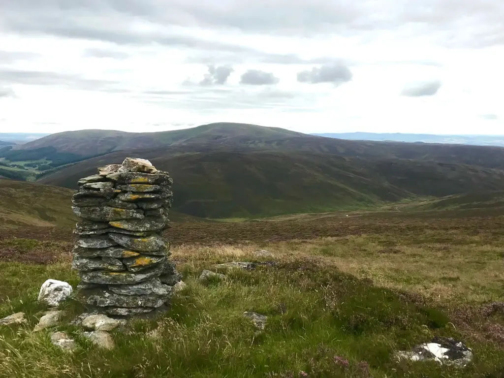
I really felt this climb. The gradient was about 45 degrees at its steepest parts and my calves were duly on fire. I caught up with a guy near the top. He was the only other person I encountered on the route, out doing bird surveys. After the customary round of bullshit about the weather, steepness of the track and birdlife in the area I pushed on to the top. I then took a right turn and ran most of the way along the single-track path and up to the cairn on Corwharn. Although a fairly inconsequential hill, the views are not to be sniffed at, particularly to the north and the Southern Cairngorms as well as back the way I had come from Cat Law.
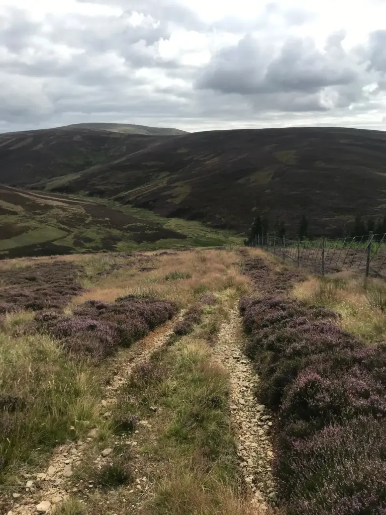
I then backtracked, continuing for about two miles along the ridge. This was a gently undulating track and great running. The track eventually turned downhill, coming down steeply off Long Drum back down to the track in Glen Quharity.
The track was to be the final leg of the run with about 2.5 miles back to the car. The sun was out by this time, and it was distinctly warm.
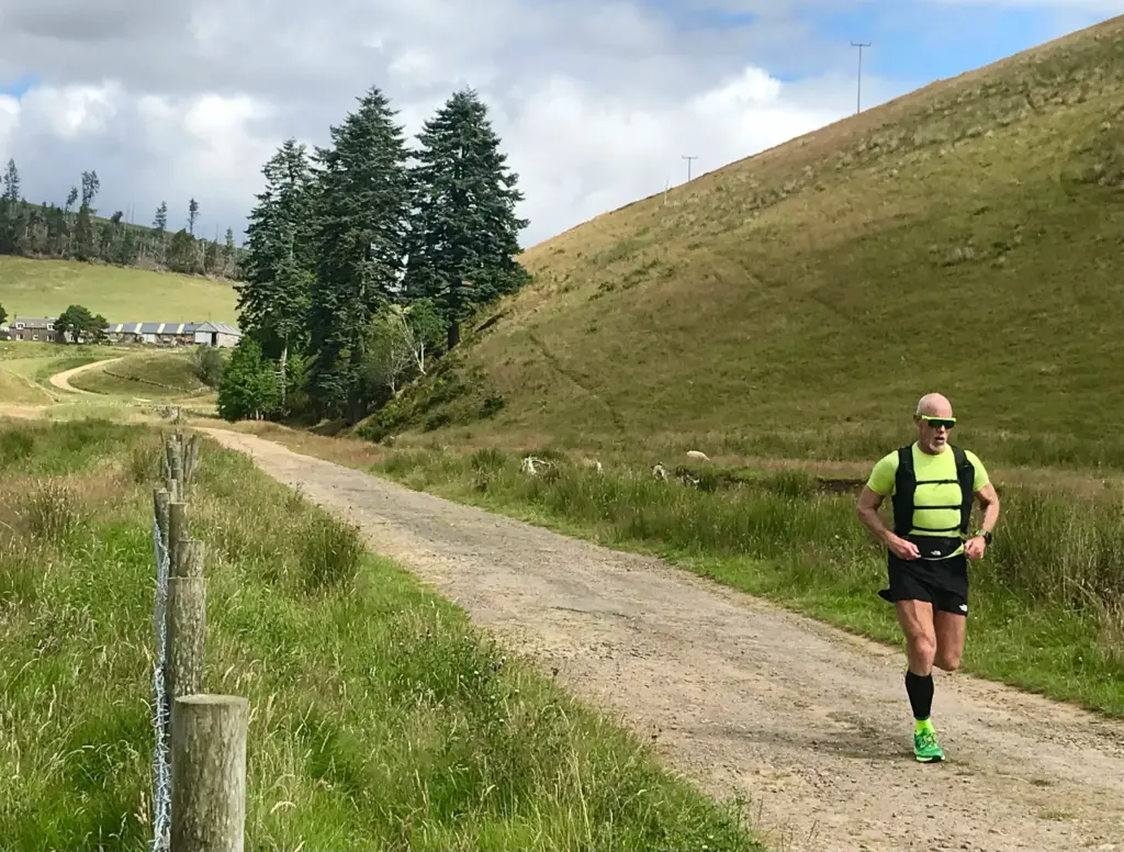
I don’t mind admitting that my unfit legs were really toiling by this time and I wasn’t shy about reining it back to a walk on the uphill sections, particularly the sharp road climb back up to the entrance to Balintore Castle and the car about half a mile beyond.
Overall, a route that both exposed my lack of fitness but will also have been of huge benefit in rectifying same.
The weather was superb, underfoot conditions bone dry and barring that one brief encounter, a people-free experience in a very attractive but less-well trodden part of Angus. Delighted to have finally ticked this one off!