Yesterday was the last day of my training trip and as I hinted in my previous posts, it was destined to be a mountain day.
Now, whilst trail and ultra running are my general interests, I do also like to train and test myself in more mountainous environments. Some of my previous races will also attest to this.
Some trail runners also indulge an interest in hillwalking and the mountains in general but I do not regard myself as a hillwalker. I’ll clarify before that resonates as snobbish, elitist or whatever else you might think.
When I do long distance events or when I train in hilly environments, I walk as part of the experience and because I am not an elite runner! However, I do not particularly enjoy the walking parts and other than walking the dog, I do not walk or climb hills for pleasure.
Despite living and training in Scotland, I am not a Munro-bagger! I have no idea how many Munros I have summited, nor do I give a shit. In fact, summiting hills and mountains as a pastime in itself is not my thing, but I do like to be in the mountains, moving as fast and as safely as I can, running wherever possible. Sometimes that involves summits, sometimes not.
I hope I am making some sense here without seeming to contradict myself.
Sorry for all the preamble, but the outing I am about to recount encapsulated all that I like about the mountains. I also need as much elevation training as I can get in the run up to the Grand Canyon.
I knew the weather would be as close to 100% reliable as it is possible to get in Scotland. Clear skies all day, temperature rising from sub-zero early in the morning to low double figures in the afternoon. As a bonus, a light breeze at worst.
I had my route prepared before I even left Dundee, but it was all going to be weather dependent and my patience in waiting for the last day had been rewarded.
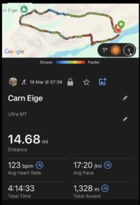
I was going to summit Carn Eige and Mam Sodhail, the two highest peaks north of the Great Glen. The route would take in two impressive ridges on the outward and return legs with a final descent back down to Loch Affric.
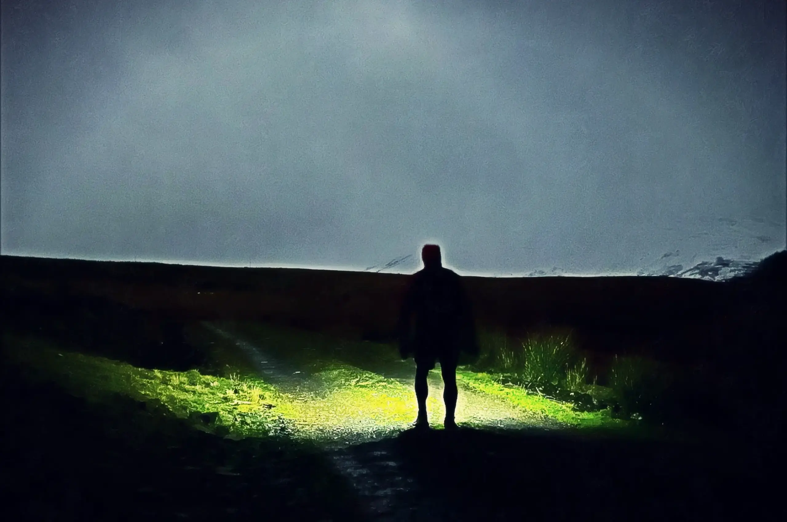
I prepared all my kit and nutrition etc the night before as it was my intention to be moving on the ground before 0800. Firstly, I just didn’t want to waste an hour of the day and secondly, I wanted to hit any snow as early in the day as possible while it was still firm and crisp.
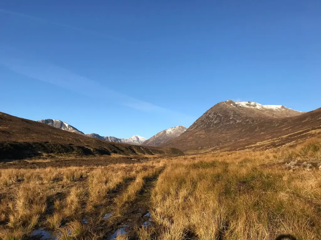
I had to scrape ice off the windscreen, but I was moving not long after 0700, heading down Glen Affric to the quarry carpark which is about a mile before the main Loch Affric carpark. From there, it is a short backtrack along the road before the track starts up and away from the road.
The track climbs steadily and I ran and walked according to the gradient. The sun was coming up behind me and I could already feel its warmth on my back as I made good progress, at least until the end of the gravel track. By this point I could see up the glen and got a first view of Mam Sodhail at the top of the glen.
Then the bog began in earnest.
The next couple of miles were a battle with the sodden ground and the indistinct nature of the path in many places. It was slow and frustrating progress, but I reminded myself constantly not to overdo it with the biggest climb of the day coming up.
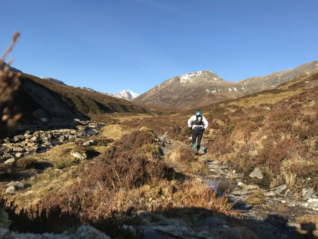
I managed to run very short sections but not much and eventually my Garmin signalled the turn up the hill to the right. To be honest, there was almost nothing by way of a path to be seen so I was grateful for the Gpx track.
After a few hundred metres uphill, the path became more distinct and this took me up into the coire where the gradient levelled briefly past the lochan before the final grassy ascent to the ridge above. As I approached the bealach, the rugged climb up Sron Garbh to my left seemed fairly imposing and I could see that I would encounter snow at that point already.
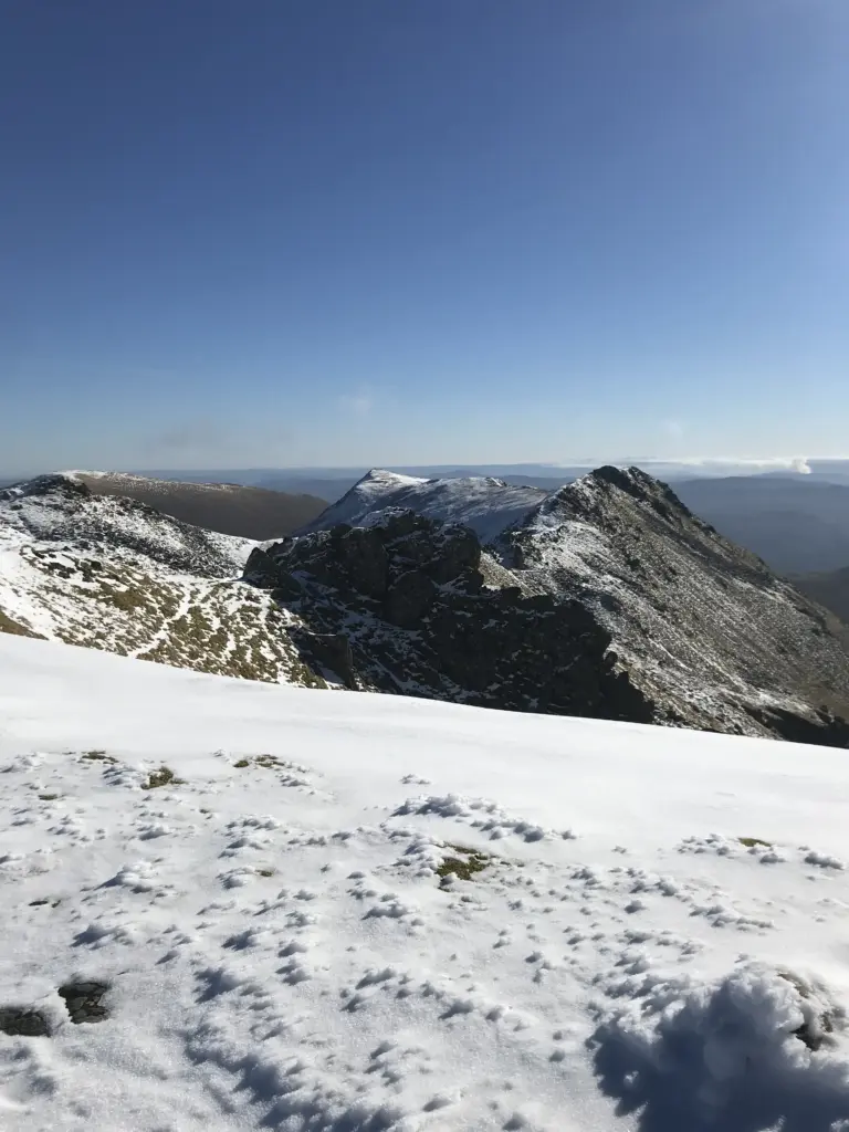
I regrouped at the bealach, admiring the emerging view to the north over Loch Mullardoch and its own ring of surrounding peaks. Then I started the climb.
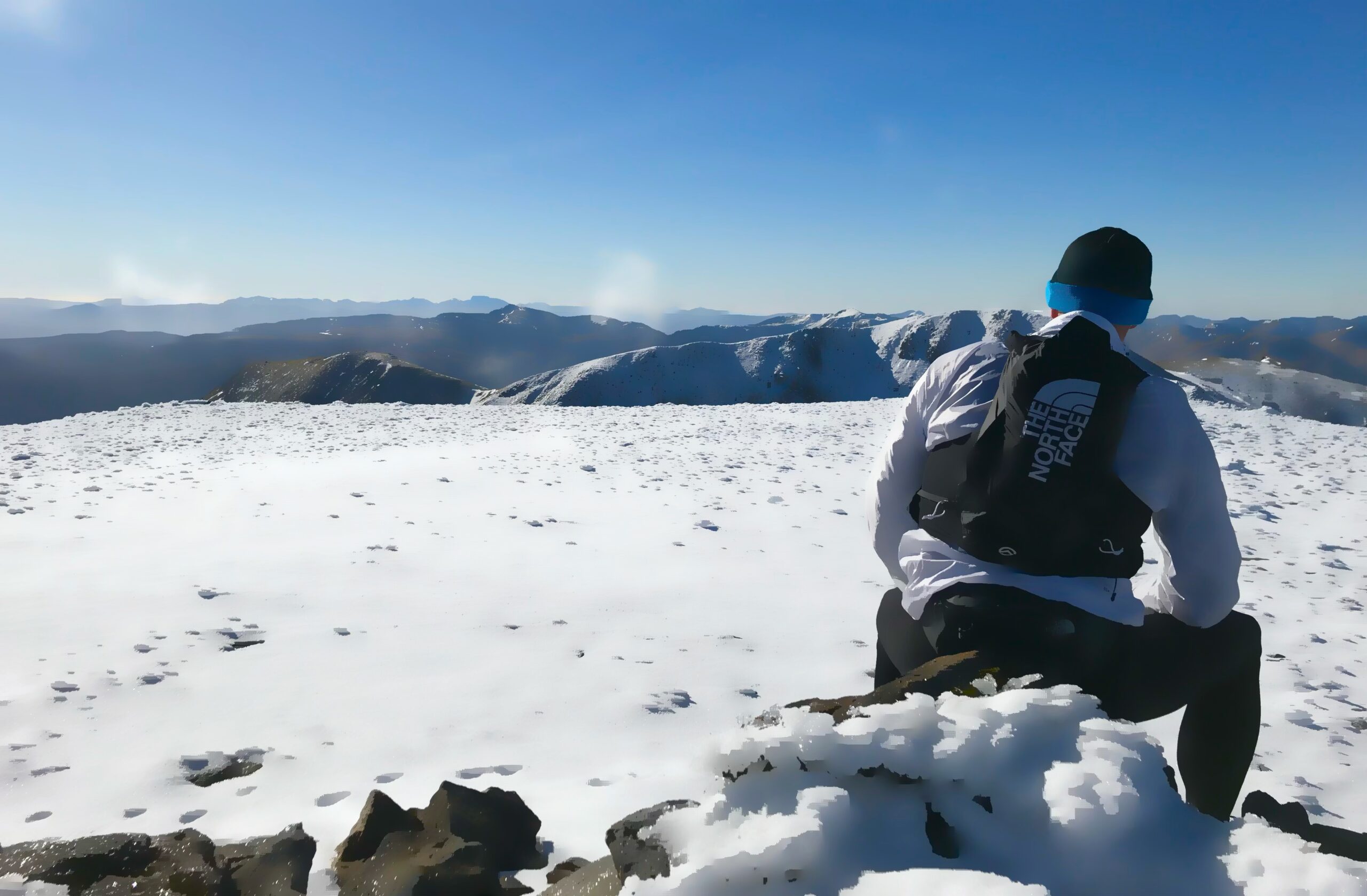
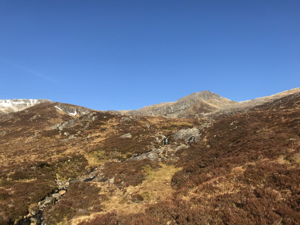
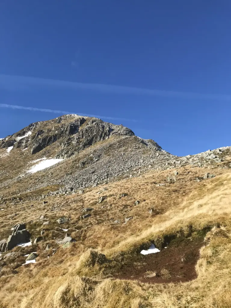
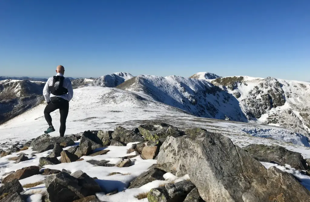
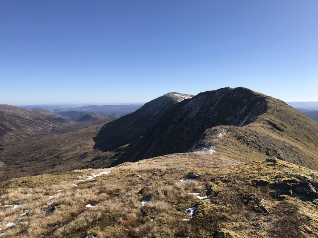
It started ok but became very steep and sketchy about halfway up where the rocks form a natural gully. There was enough snow between the jumble of boulders to conceal any semblance of a path and it quickly became a scramble using all four limbs. Fortunately, things improved nearer the summit and it became more snow-covered as I approached the summit cairn of Sron Garbh. This also afforded the first view of the spectacular ridge ahead, culminating in Carn Eige which I could now clearly see for the first time.
The change in the landscape above the snowline was quite remarkable.
The ridge ahead was really welcome as there were good runnable sections. The snow was still firm and crunchy and the larger rocks were all visible so it was fairly safe to up the pace a little. I negotiated some of the rockier sections along the ridge, managing to pick a safe line to the right or left of the craggy minor summits. Before long I was charging down the gentle gradient before the final push up Carn Eige.
The top was obvious of course with the trig point inside the cairn. There was a light breeze but the sun was warm and I remained there for about ten minutes, eating and taking in the incredible 360 degree views. Ben Nevis was clear on the horizon and to the north I am sure I could see almost as far as Assynt, such was the clarity of the air.
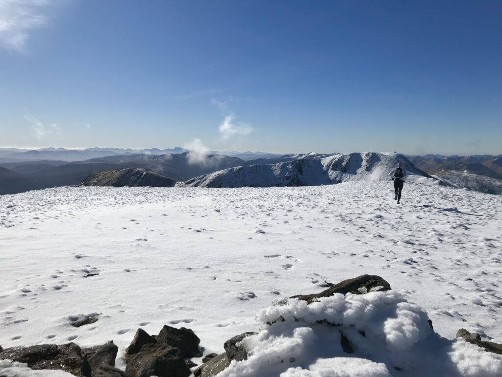
Anyway, Mam Sodhail was taunting me all this while so I set off downhill. I met the only other person of the day at the bottom of the bealach, a walker from England who was doing a fairly similar route to me in reverse. I then set off up the snowy side of Mam Sodhail. The fellow I had just met had left a distinct track in the snow and I was able to follow his footsteps as they zig-zagged up through the rocks and boulders to the summit.
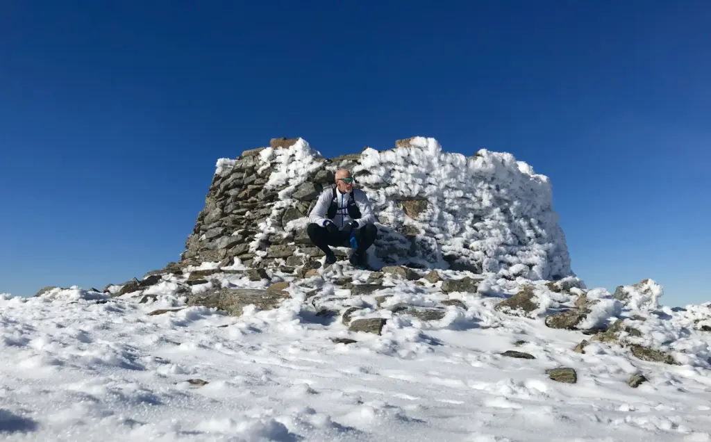
Now it has to be said that the cairn on Mam Sodhail is a fairly ostentatious affair. It is also ‘hollow’ and would provide good shelter in the worst of conditions. Again, I paused for a while, took some photos and enjoyed the views and the quiet.
Then, it was time for the off, mostly downhill aside from the slight rise up Mullach Cadha Rainich, then the final climb to the last summit of the day, Sgurr na Lapaich.
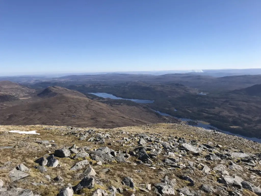
I was soon below the snow line and although the ground was very wet, there was a half decent path to be followed and a lot was runnable which was great after all the snow and boulders. I made excellent time along the ridge, views of Loch Affric appearing below and to the right.
The haul up Sgurr na Lapaich was longer than anticipated but almost all on ground and at a gradient that could be taken at a power-hiking pace. There is a decent cairn at the top but this was not out of place as this is actually a de-commissioned Munro, so not an insignificant peak. This was also reinforced by the time it took me to descend. Although there was a broken path to follow down the shoulder of the mountain, it was steep and technical and I had no intention of having an accident this late in the day.
Once the main descent has passed, there is no real path as such and it is a case of making a beeline for a hairpin bend on the 4×4 track about a mile or so away across the boggy peatland. The track was visible so it was just a case of perseverance through the uneven and sodden ground until the track was reached. From there it was about a mile of great downhill running to the main Loch Affric track.
If only that was the end! I ground out the last couple of miles along the track and then the road until the quarry carpark once more hove into view.
In total, about 14.5 miles and about 1,350 metres of elevation in just over 4 hours which I think is a pretty good winter conditions time.
The boggy sections were hard as always but the spectacle of the snowy peaks and dramatic ridges more than made up. It is a challenging route, more so in those underfoot conditions, but the weather is rarely so kind and I have to say it was a memorable outing.
It was also a great end to what was a hugely beneficial, varied and enjoyable training block up in Cannich. I would certainly go back to this area again in the future as there are a wealth of other routes I would like to do.