I am now back in Dundee so there has been a good period of time to reflect and to gather my thoughts and observations. In this instance, I think that is a beneficial thing as I need to kick things off with a spoiler alert! Things did not go according to plan!
That said, I’ll describe things as they happened and then lay out my own conclusions at the end. One other thing. There are several days to cover, and I am spoilt for choice for photos so the post may run on a bit. I hope you’ll bear with me.
This isn’t a travel blog so I’ll condense all the planes, trains and automobiles stuff as quickly as I can. It is relevant though….trust me.
Monday 1 September 2025 arrived and I took the 1000 airport bus from Dundee to Edinburgh Airport and a flight about 1320 to Toulouse. At Toulouse, I took the 1815 direct bus from the airport which arrived at the central bus station in Andorra about 2115 in the evening.
On arrival, it was raining so I donned my waterproof and marched the few hundred metres back up the road to McDonalds where I ate. Fuelled up with the food of champions I returned to the bus station and acquired a taxi to take me the few miles down towards the Spanish border where the GRP trail intersects with the main road.
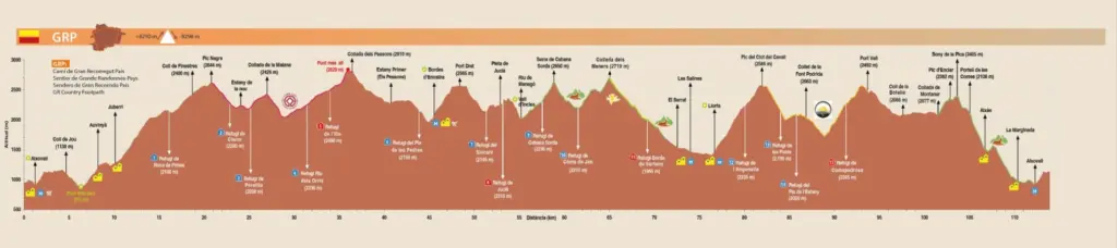
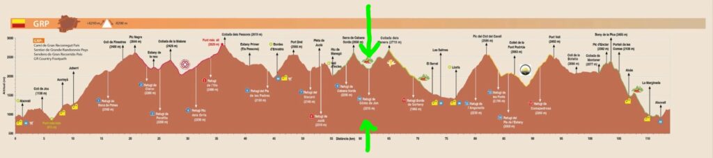
It was about 2200 by this time and the good news was that the rain was easing off. However, it was chilly and I was going upwards so I kept my jacket on. And thus, my fastpack on the GRP began. For anyone that missed it on previous posts, I’ll post the route profile again below. My starting point was nearly the same as that on the profile which is quite handy for reference.
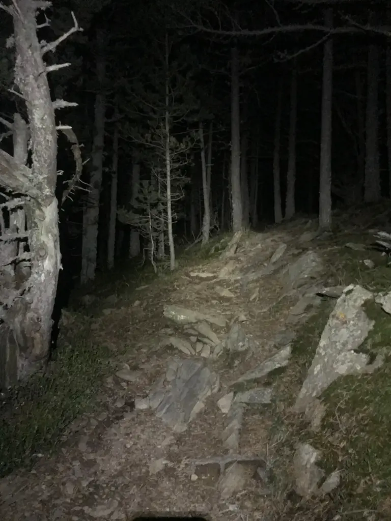
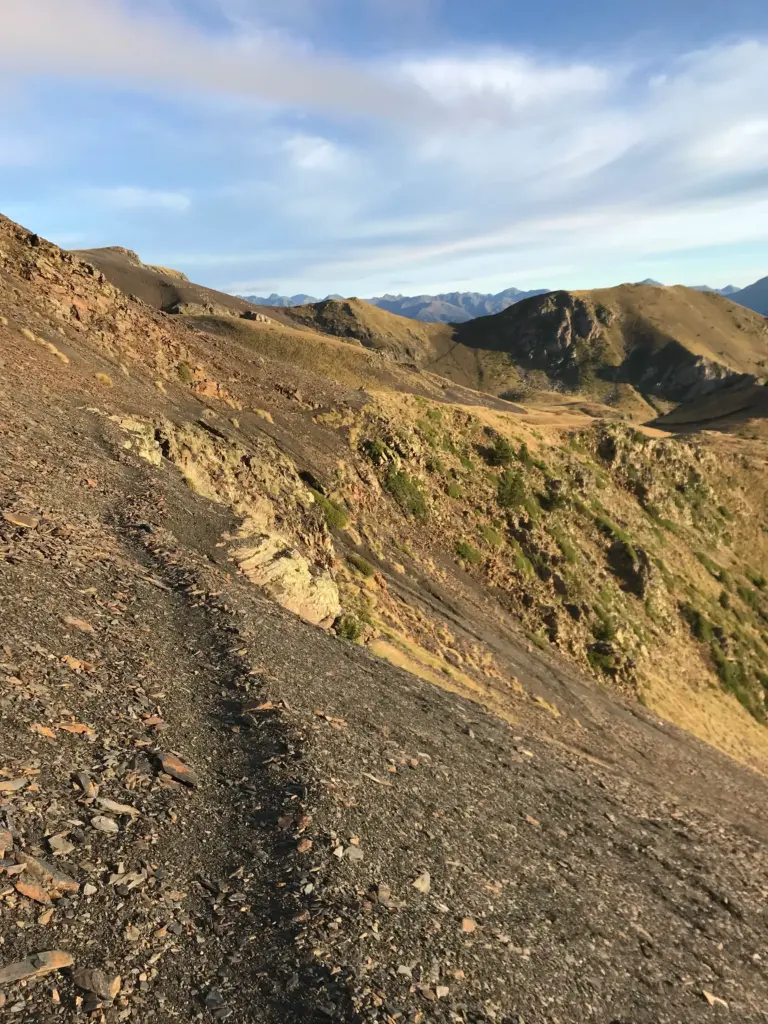
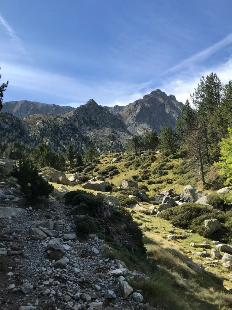
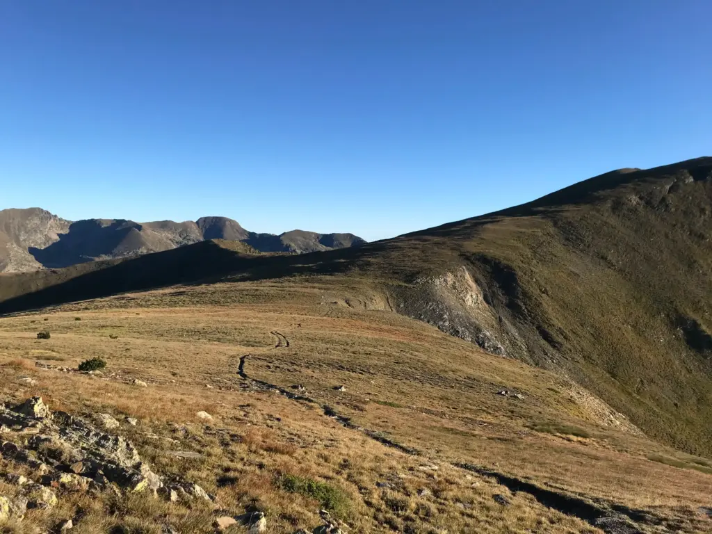
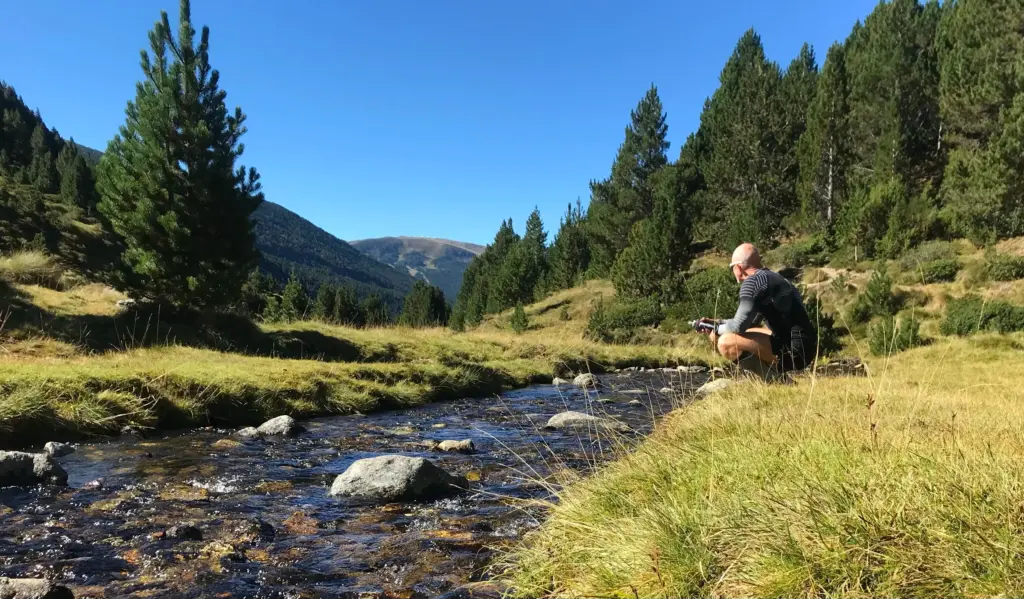
The climb started immediately with some short and steep switchbacks, transitioning to rocky trail after only a short distance. I kept my pace low as I knew I had miles of climbing to come and before long I was passing through the quiet little hamlet of Aubinya. The rain eased off as I continued on steep rocky paths until I hit a road section which continued to take me up through the village of Juberri.
Here, the first of many small navigational dilemmas arose. I was following the GPX track on my watch but as I left Juberri, the path indicated on my watch simply didn’t exist in reality. After lost time toing and froing, I identified a slightly longer loop that would get me back on track further up but the detour and messing about cost me a chunk of time.
By now, I was on a relentlessly long and sometimes steep climb up through the forest on some very rocky and gnarly path, much of which had been washed away by water erosion.
This was really hard going, and I was starting to feel some fatigue as I approached the 2,000-metre contour. Shortly thereafter, I finally popped out of the forest and into the Naturelandia leisure complex which is a big, sprawling outdoor/MTB area during the day.
I continued to climb, back into the forest, heading for the Refugi de Roca de Pimes about a mile further on. I intended to bivy there and make the final remaining climb a few hours later at first light.
On arrival at the refuge (more akin to a UK bothy), I found a group outside partying around a campfire. No room at the inn!
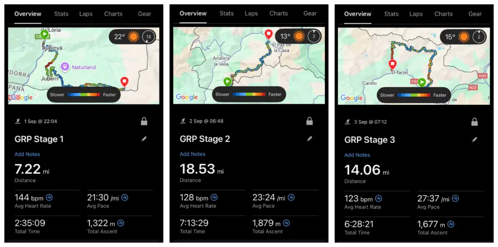
There was nothing for it then but to carry on and look for a suitable bivy spot before the climb started again in earnest. The track had levelled off at this point and about ten minutes later, I found a level grassy spot adjacent to the track at the Collada de Pimes (2,140 metres). It had been a hard seven miles to that point with over 1,300 metres of ascent.
I was very tired, cold and starting to pant a bit in the thinner air. I quickly threw my bivy system together and made my first mistake (OK, maybe not the first but we’ll come back to that later!). I did not put on my thermal tights, thinking my bag would be warm enough. I also pulled my PrimaLoft jacket on over my waterproof jacket which wasn’t the best idea either.
I was fine initially although I was too wired to sleep and I did find myself occasionally gasping briefly for air, which must have been down to the elevation. However, things changed quickly as the sky had cleared completely, and the temperature dropped considerably over the next couple of hours. By about 0300, it was much colder and I was feeling it. At that stage though, I was focussed on maintaining what warmth I had inside my bivy, so I just tried to find a warm spot and move as little as possible. The result of course is that I wasn’t really sleeping much at all, maybe ten or 15 minutes here and there.
About 0400, I started biting chunks off a RealMeal bar until I had finished it about an hour later. It allowed me to warm up somewhat and I would need the calories soon enough once I was moving.
My plan was to pack up and start moving about a half hour before sunrise so I could get the best of that at the summit, about three miles uphill from my bivy location. My bivy, drybag and groundsheet were iced a little and my sleeping bag had got damp where it had been exposed outside the top of the bivy bag. No drama, I could dry it later.
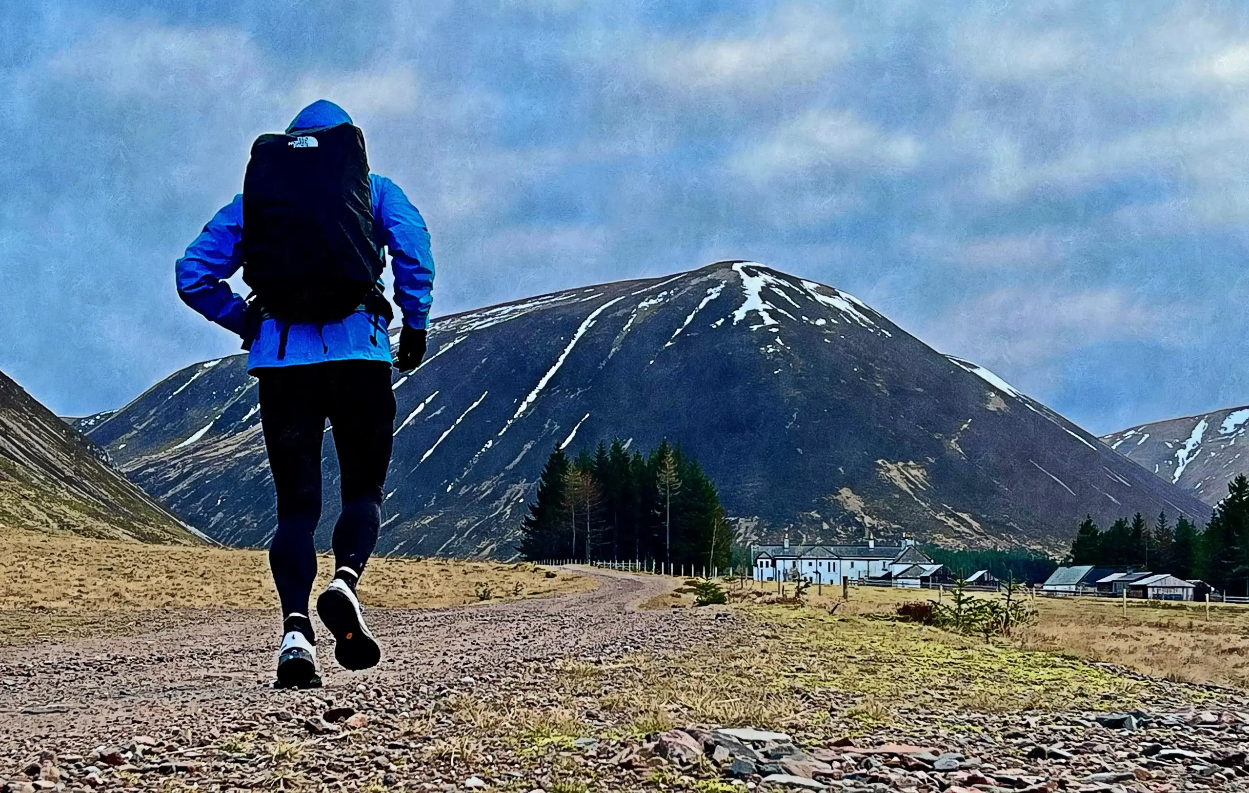
I was already dressed so I was more than happy to set off on the climb and to generate some body heat in the process.
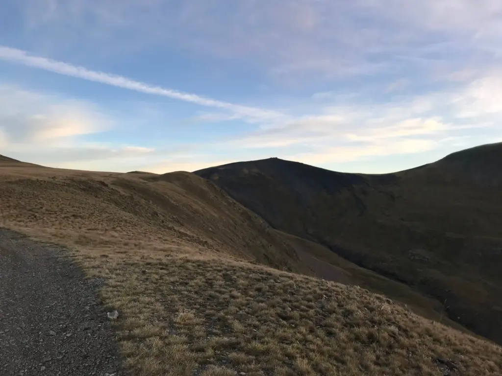
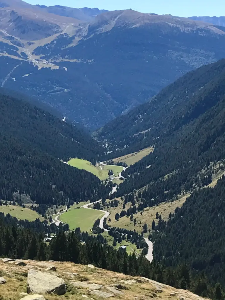
The climb to the top of Pic Negre is not too steep but it is several miles. It is exposed terrain and the views started to open up once I could switch off the headlamp and enjoy the first morning light as the sun breached the tops of the mountains to the east.
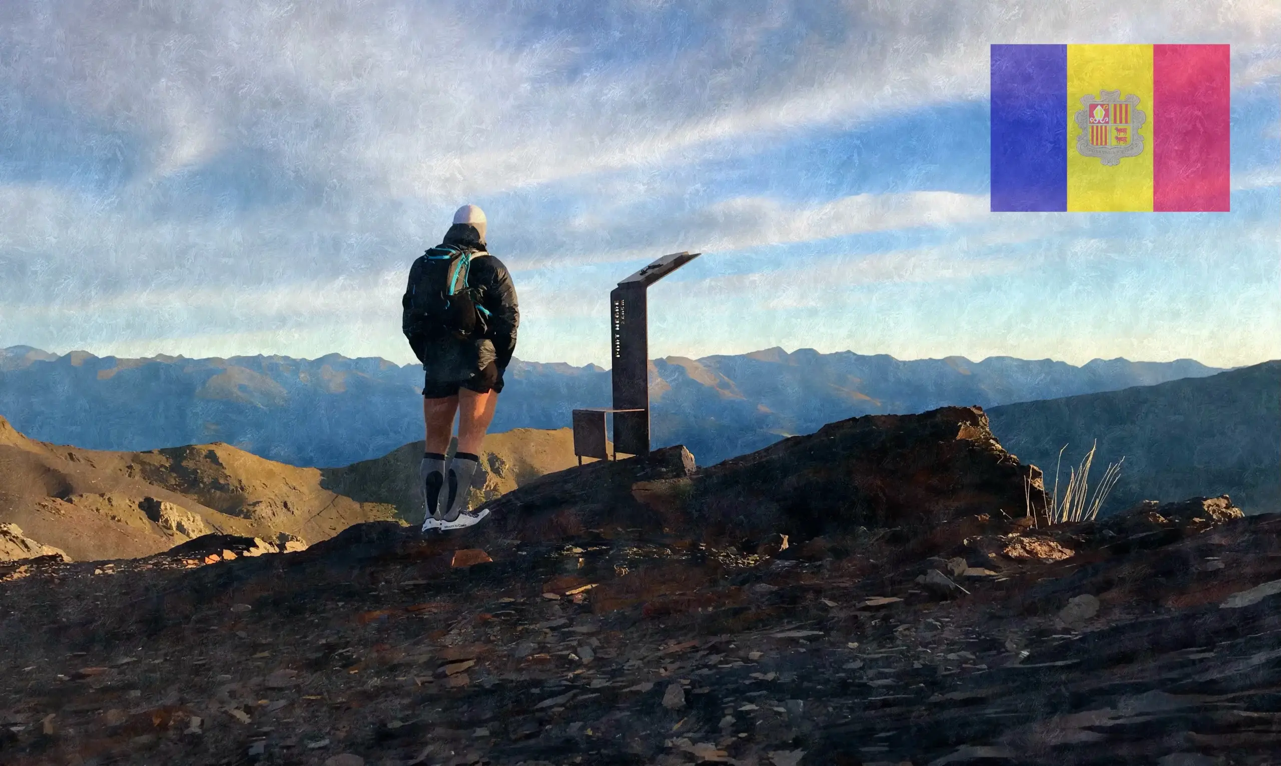
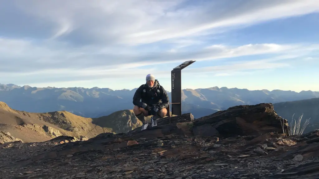
Pic Negre is named for the dark grey rock and gravel which make up its summit, causing it to look black against the surrounding landscape. I timed it well and hit the top just as the sun had climbed high enough to illuminate the huge vista before me. At 2,642 metres, I believe Pic Negre is the second highest point on the GRP.
I soaked up the views but it was bitterly cold so I moved on fairly quickly, making my way carefully down the initially steep descent onto the faint gravel path that cuts across the scree slopes below the summit.
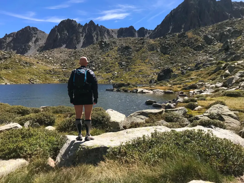
This descent took me into the start of the Vall de Madriu-Perafita-Claror, both a national park and a UNESCO World Heritage Site.
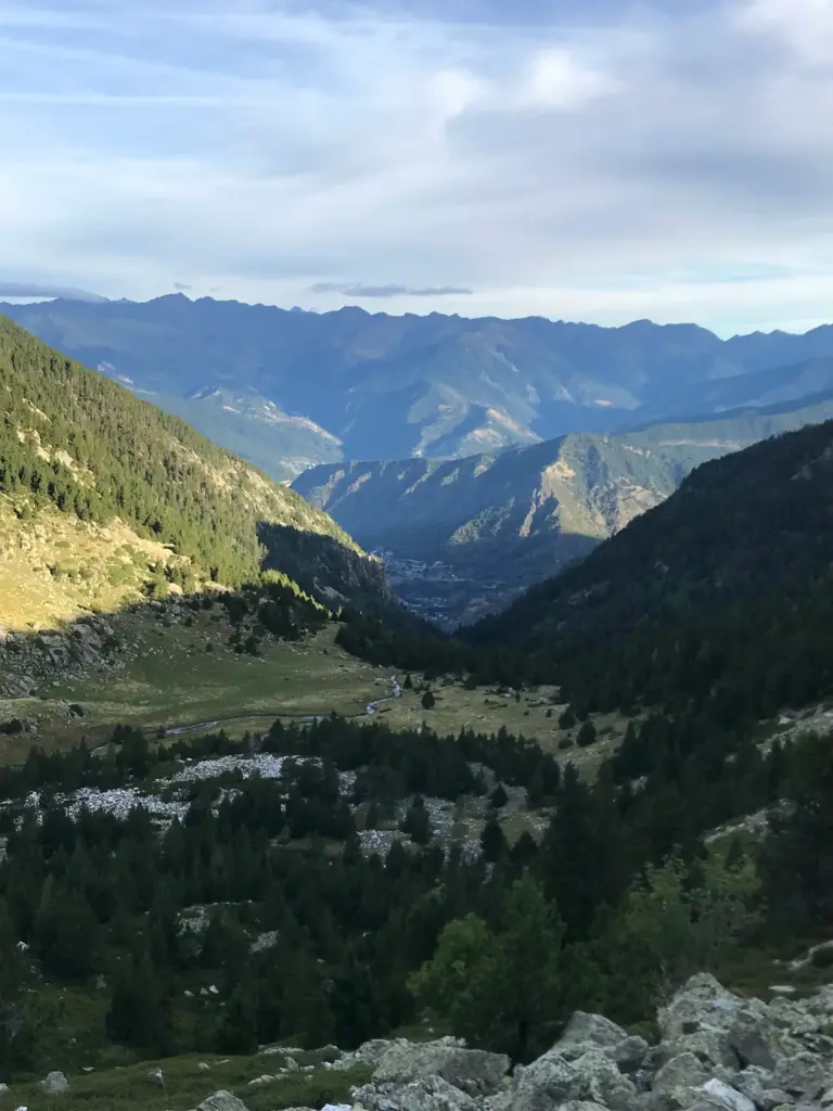
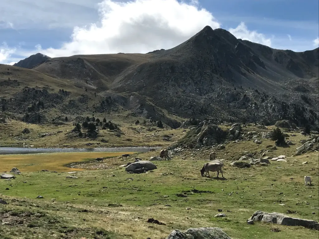
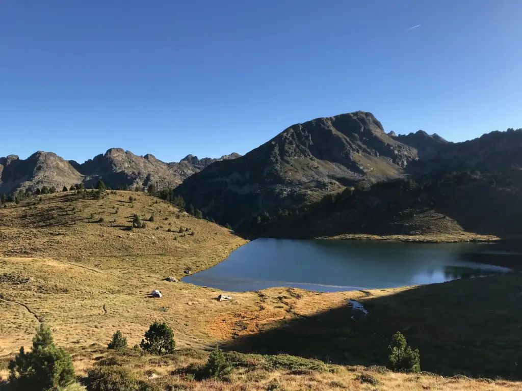
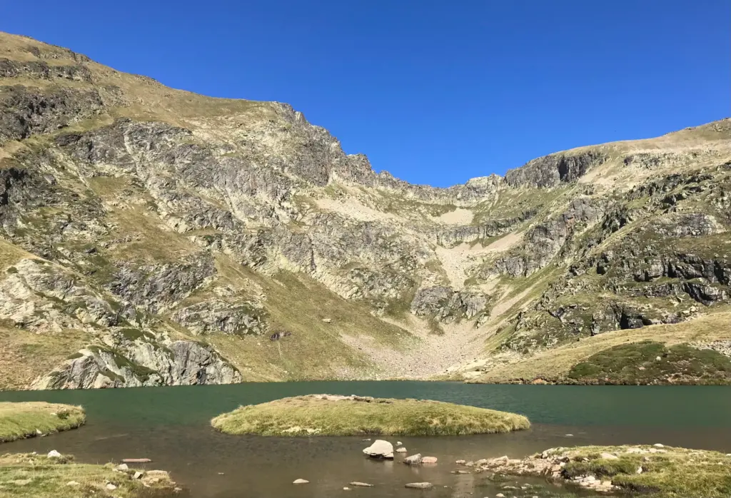
Descending sharply into the upper Claror valley, I passed the Refugi de Claror before continuing along the undulating and rocky path to the Estany de la Nou (Estany translates as lake).
This tranquil oasis was a nice change of scenery before the path plunged sharply downhill into the Perafita valley. I took a short break and some calories outside the Perafita refuge. I also took off my waterproof jacket but kept the PrimaLoft on over my long-sleeved top underneath. I just couldn’t warm up and never really did for the remainder of the day, despite passing numerous hikers wearing only short-sleeve t-shirts.
There was then a further climb, up to the Collada de la Maiana at over 2,400 metres. This opened up a fantastic view to the east, down into and up the Madriu river valley. However, I had reflected by this point that I was not making nearly as much progress as I had anticipated at the planning stage. This erroneous planning assumption was at least my second mistake as I had not appreciated how technical and slow most of the trail and paths are on the GRP. To be perfectly honest, much to that point was not any easier than a lot of the path on the GR20 which is renowned for its technical difficulty.
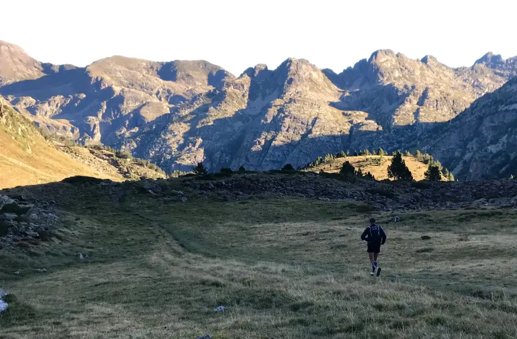
After a long and tricky descent through the trees, I crossed the Madriu river pasture and the little foot bridge that leads to the north side of the river. The path then starts upwards again, up through the trees and hugging the bank of the river. On this section, I started to notice some tape route markers in the trees and as I progressed, pairs of runners wearing race numbers started coming from the opposite direction. From the writing on the tape and the time of year, I realised that my route had coincided with a stage of the Pyrenees Stage Run. This is a multi-day stage race, run in pairs and organised by BiFree who also run the Costa Brava Stage Race which I did back in 2023.
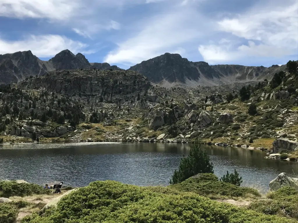
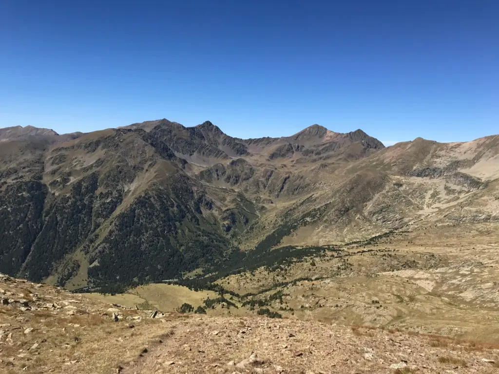
The route continued to climb gradually, coming out of the denser forest into more open mountain pasture. The views of the surrounding peaks and the landscape in general were outstanding in this area. It is easy to see how the area has achieved its UNESCO status.
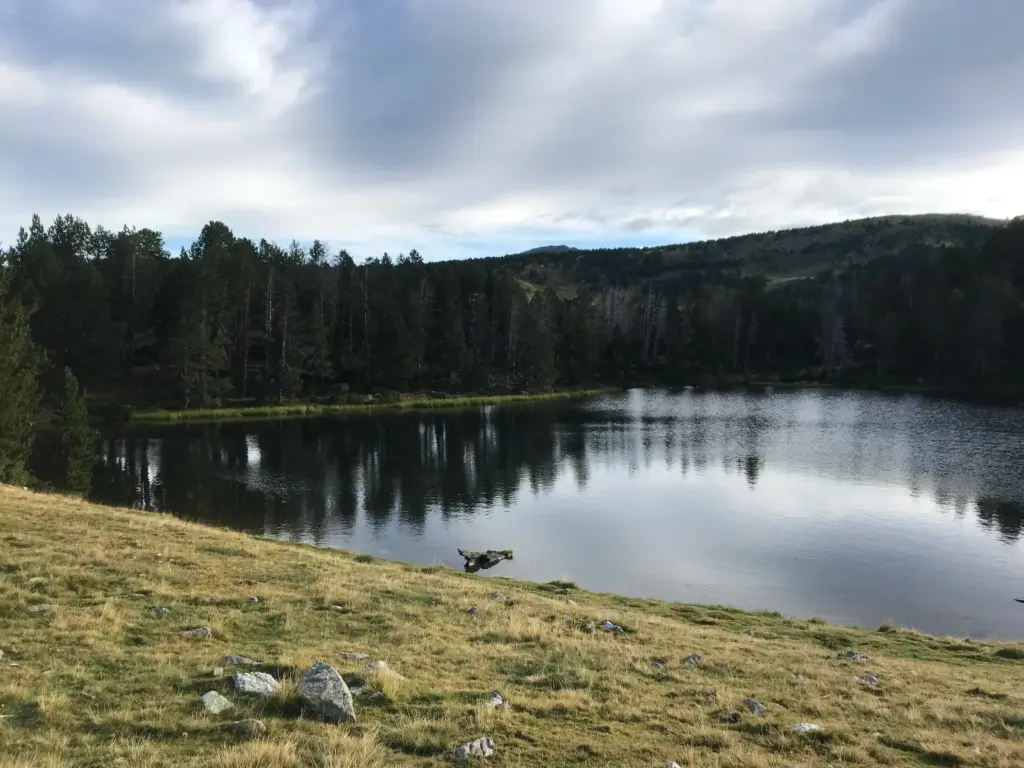
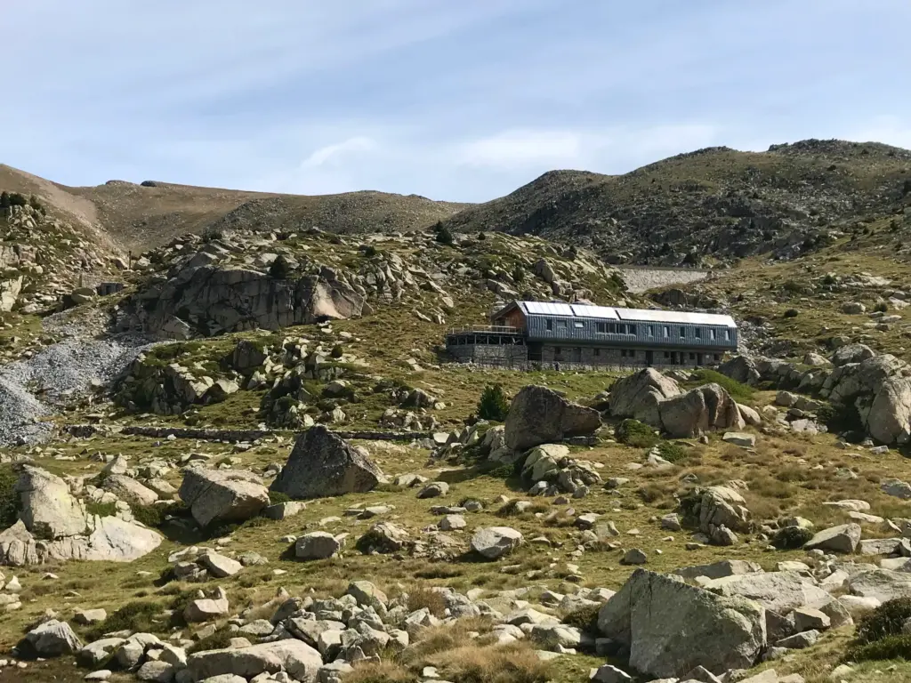
Eventually, the Refugi de L’Illa came into view, nestled below the dammed lake that shares its name. This refuge is one of the four larger, staffed refuges on the GRP, offering accommodation and evening meals. There was no-one else there at the time I arrived which was about 1200 as I recollect. One of the wardens was able to sell me a can of Coke, some crisps and a piece of chocolate cake. I struggled to get these down, taking the time whilst eating to lay out the sleeping bag and bivy bag on the terrace to dry fully in the sunshine.
By this time, there was a fairly steady stream of runners passing the refuge on the Pyrenees Stage Run.
It is important to highlight that by this point, I was feeling distinctly shit. I had now spent nearly twelve hours above 2,000 metres and a good proportion of that time near to or above 2,500. Whilst I didn’t develop a headache, my appetite was minimal, and I felt consistently nauseous which did nothing whatsoever to improve my chances of maintaining appropriate calorie intake. The latter was now starting to move quickly into a deficit that would continue to take its toll as the afternoon wore on.
I was also conscious of my slow progress and the distance I still had to cover to reach the road and my next and only food re-supply at a filling station shop where the trail crossed the main road. I pressed on, in the knowledge that I was about to climb sharply to the highest point on the whole GRP.
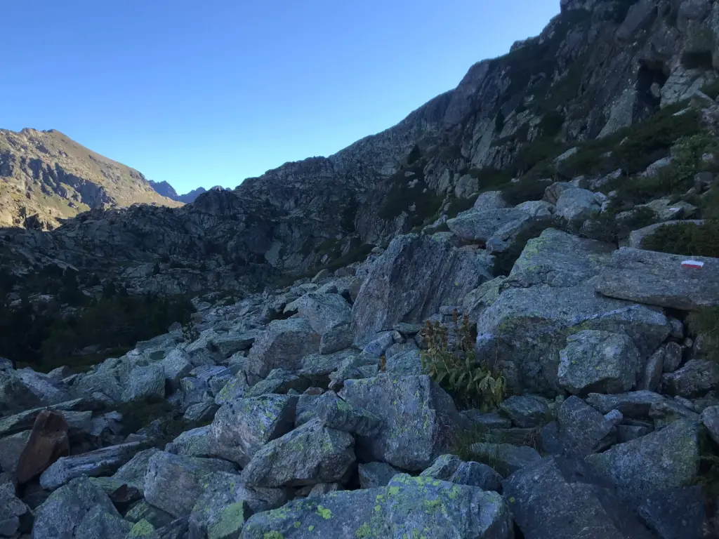
I rounded the lake, the path very indistinct amongst the boulders and this was one of a number of sections where I was heavily reliant on the yellow/red or white/red trail blazes to keep myself going in the right direction. I could look up and know roughly where on the high ridge I had to climb to but there was a path of sorts all the way up provided you paid attention. The climb wasn’t so much long as very steep and as I climbed towards 2,800 metres, I was really feeling the vicious combination of thin air and lack of energy. Towards the top, I was stopping every ten metres or so of elevation, something I almost never have to do. Eventually I reached the top and the path turned sharp left along the ridge before reaching the highest point, the Pic dels Pessons at 2,840 metres.
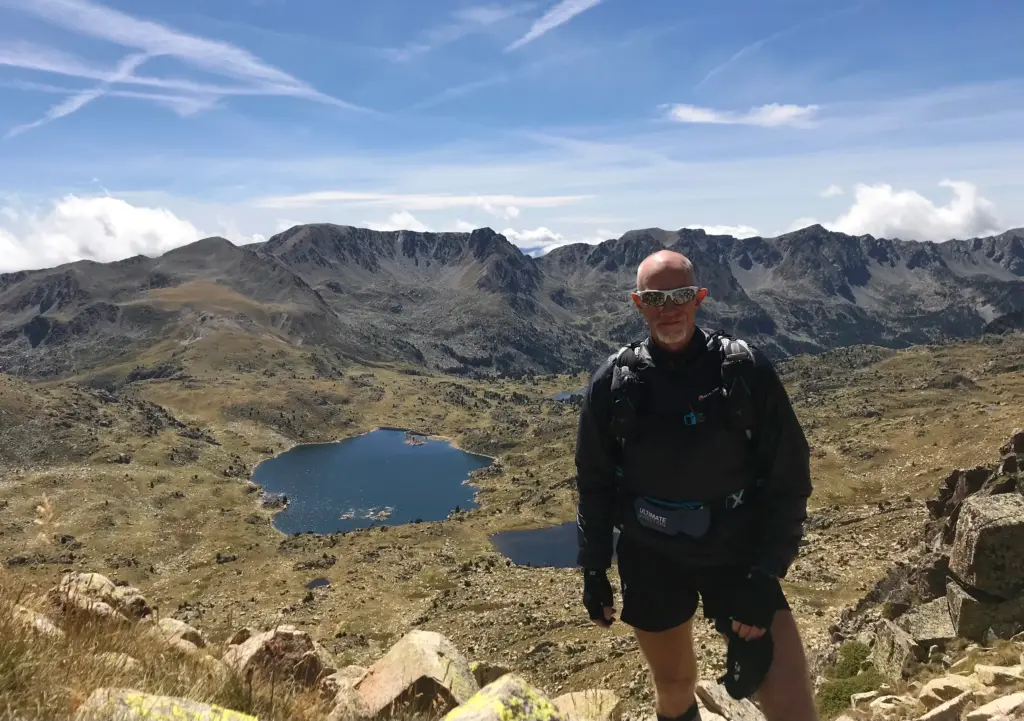
Although I was fairly f*!cked, the sky was a bright blue and the views in all directions were fantastic. Behind, Estany de L’Illa looked like a puddle down below and in front of me, the Circ dels Pessons with its patchwork of lakes was laid out as the way ahead.
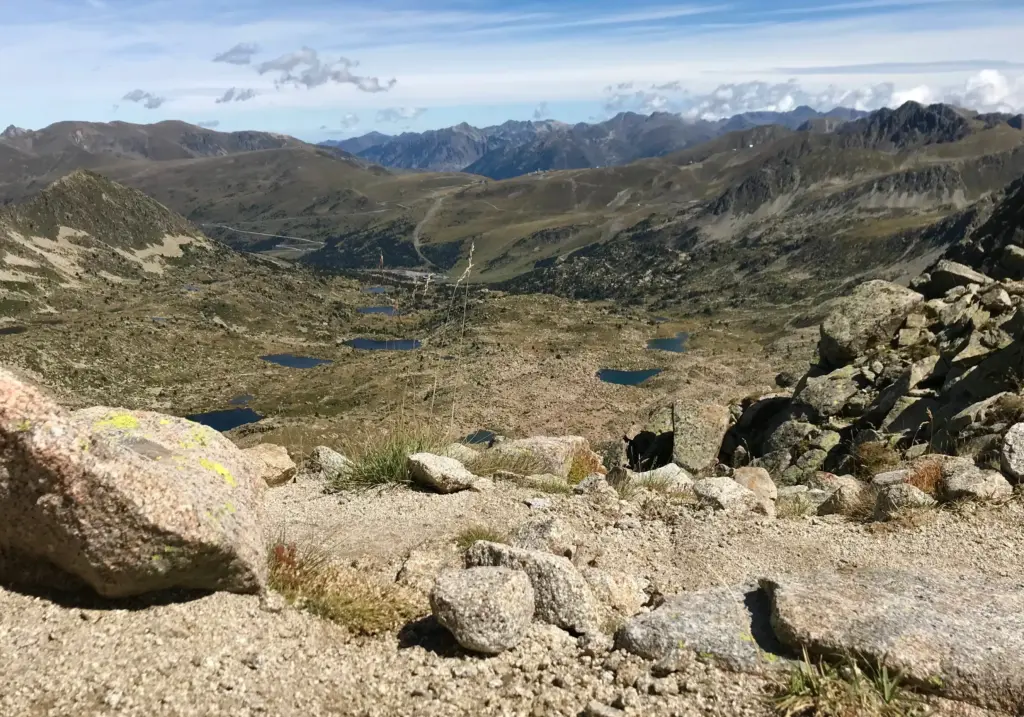
I forced down some more calories then started the very slow, steep and technical descent down into the Circ. Finally, the track levelled off a little and the journey through the lakes commenced. This had been very deceiving from above as the terrain around the lakes looked fairly level and the distance across not too great. However, each lake was on its own level, almost like terraces and the path winding its way between them was very technical and slow, the trail blazes once more essential to keep on track.
I was slow on this whole section, but I resigned myself to plod forward and more importantly to stop and enjoy the spectacular views wherever possible. Hopefully some of the photos will do it justice.
I finally reached the last lake, Estany Primer and this is where some civilisation returns as everything ahead is the winter ski area with all of its vehicle access tracks and bare pistes. It was here that I made my most significant navigational error. I had been following a trail, which seemed logical, but missed a turn which saw me a couple of hundred metres down the hill. The only way to recover this was to come back uphill, a steep and soul-destroying climb in the circumstances.
Once back on track, there were only a couple of miles to the road intersection, and these were either level on path across the mountain pasture or eventually downhill through the trees between the ski pistes.
I reached the main road at Envalira and had a big decision to make. My original plan had been to overnight somewhere at or near the Refugi de Juclar, a staffed refuge a further five miles distant. This would have involved another significant climb, a tough descent then an unknown technical section and it was about 1700 by this time. I had only managed 18 miles since first thing that morning, way less than I had anticipated and at that point of the day, I was wasted. I had no energy, I felt sick and I decided it was imprudent to continue.
I jumped on a bus and went a number of miles down the road to Encamp where I found a hotel room and retired to my room to lick my wounds. I forced myself to wash kit and to go to the only supermarket to buy food which I struggled to eat in my room.
In the morning, some food and a night of rest had made some difference but I never felt that I had made up the calorie/energy deficit I had built up the day before. I had calories though and I decided to press on. I was out for the first bus and soon after 0700 I was back standing on the road where I had ended the evening before.
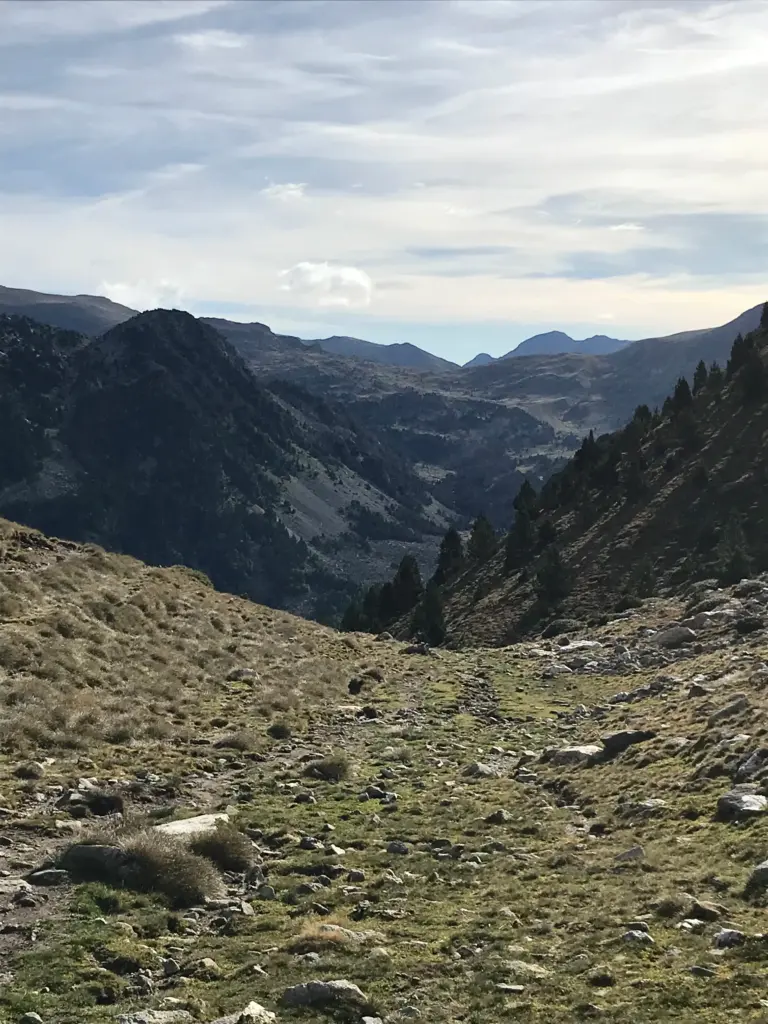
The day, Wednesday by now, began with a sharp climb from the road. The path weaved up through the trees, eventually levelling off above the treeline which allowed a breather before the final climb up to the ridge. I lost the path more than once and needed to rely on a combination of the GPX and sight of the infrequent and faded blazes to get back on track. After skirting along the top of the ridge I reached the pass at Port Dret, sitting at 2,568 metres.
This was the start of a level section with a smooth path, heading north. This was a real highlight as it was one of the rare running sections and as shit as I felt, it also felt good to break into a run and cover some ground with relative ease. This was initially short-lived as I soon hit the top of a very steep and technical descent down into the next cirque.
This was covered quickly and before long, I was running again across the pasture above and around the Estany del Siscaro, a phenomenally scenic area of country.
My GPX showed an average descent and a short distance from the lake across to the Refugi de Juclar. What the GPX could not show was that this was the most technical, slow section of trail one might imagine. It went from impenetrable boulder field to tricky rocky scrambles using chains and it just seemed to go on for ever.
However, it did end of course, and I rewarded myself with a seat by the river where I ate some food and replenished my water. Any second wind I might have experienced that morning was wearing off fast though and I was starting to get that sluggish, hollow nauseous feeling again.
I moved on again, climbing through irregular, rocky terrain, contouring up and around the hillside before coming down through the trees to cross the Riu Del Manegor where I had another rest and drink. Like the day before, I was experiencing an unusually strong thirst in that I was drinking very regularly but still remaining thirsty all the time. Altitude again perhaps.
At this point, there was nothing to be done but carry on so I covered the climb up from the valley and to the Refugi de Cabana Sorda which sits adjacent to the lake which shares its name. This was a busy area as there is a different path which comes up directly from the valley below and is thus popular with day walkers.
I knew the next climb to the higher pass was going to be a hard one, so I didn’t delay and set off.
This whole section was just like the climb the day before to the Pic del Pessons. Even the switchbacks on the upper section of the path couldn’t speed my progress and I was breathing like a retired coal miner with asbestosis. My balance was gone too, and I had to stop in my tracks a few times to steady myself on my feet.
The pass, at nearly 2,700 metres, was finally attained and despite my physical disintegration, I was able to stop and appreciate the stunning view. Much of that view was of course across the expansive cirque below to the equally high ridge on the other side where I knew the next pass to be.
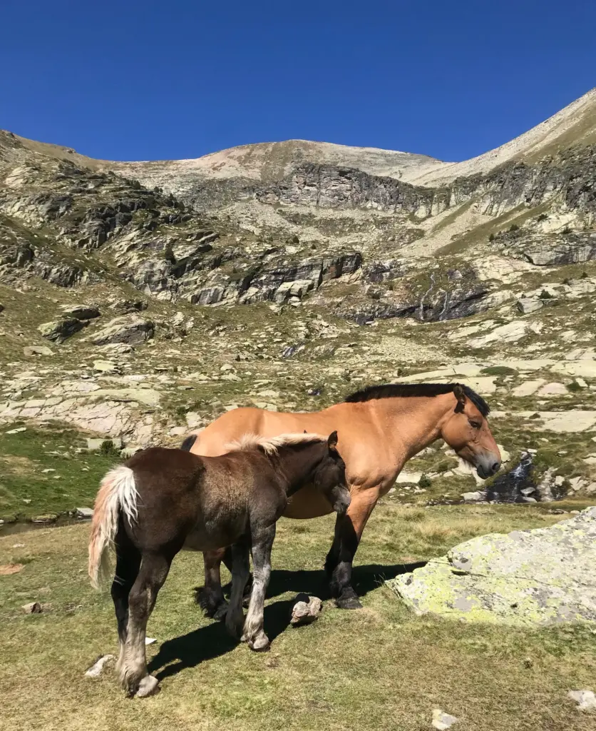
I set off downhill, taking my time to avoid any accident. The track wound its way around the rocky outcrops and eventually I could see the Refugi dels Com de Jan come into view, surrounded by a group of horses in the pasture.
Here is where I had resolved to make a crucial decision. Below me in the Vall De Ransol was a dead-end road which I could descend to and then reach the main road in about three miles. This was my last ‘escape’ route for quite a long distance. I knew I could labour slowly over the next pass then make it down the long downhill section to Sorteny and eventually the road at El Serrat. However, I had no idea where I would overnight, or more importantly where I would obtain sufficient food to replenish that night and set me up for the following day which would hopefully see me to the end of the trail.
The deciding factor was that I was physically in fairly bad shape. Nothing too dramatic. Although I was still moving faster than all of the hikers I was encountering, I knew I was incredibly slow by my own standards and getting less capable by the hour. I felt empty, devoid of energy and I was battling nausea which was causing me to eat less and less. It was turning out to be a vicious cycle and I decided that I needed to abort further progress for the sake of my overall health. I felt very strongly that I was only going to deteriorate, and I wasn’t there to do myself harm. It was also becoming less and less enjoyable as the hours passed.
So, I found the path downhill and made my way down to the road end. After two and a half miles of tarmac downhill, some of which I forced myself to run, I reached the main road.
I waited minutes only before the bus arrived. It took about a half hour to descend all the way to Andorra La Vella but my challenge for the entire journey was to stop myself from hurling my guts all over the bus. I had identified a hotel in advance so only had to book it once I had a signal on the bus. On arrival at the central bus station, I made a beeline there where I collapsed on the bed in the air conditioning.
I will add that rest, food and a recovery day the next day did get me firmly back on track. However, even with hindsight, it was absolutely the right thing to do to pull the plug when I did. As disappointing as that is overall, I do not regret my decision at all.
I’ll include the profile again below to show how far I got. Overall, about 40 miles on some very challenging trail, the technicality of which surprised me I have to say.
So, what did I take from all of this?
I have hinted strongly at it throughout, but I have no doubt that I fell victim to altitude sickness. Although I was only periodically over 2,500 metres, I was consistently over 2,000 and I went to that elevation very quickly whilst applying considerable exertion throughout. I did not expect this to happen, having been at nearly 4,000 metres in Kyrgyzstan without meaningful issue.
However, I had no acclimatisation and went from an aircraft flight to a bus journey then a taxing climb to over 2,000 metres in a very short time. I was most certainly short of breath, and the persistent nausea was I am sure, a further symptom of altitude. The knock-on effect of that nausea was to deprive me of appetite which had the further knock-on effect of robbing me of energy. The continual thirst and dizziness on the higher sections would also tend to point towards the effects of altitude.
Thus, it went inevitably downhill. It all seems a bit obvious now, but I just need to look at it as valuable experience. On one hand it seems a bit lame but as is well known, anyone can be susceptible, particularly if you go about things the wrong way. I assumed I would be fine and I wasn’t.
The trail was also way more technical than I had anticipated. Nothing I had researched had indicated this so I had assumed, wrongly of course, that the level of technicality might be more akin to the TMB for example. In the end, it was more like the GR20. That was a little frustrating as I know I would have enjoyed more running and faster progress overall.
On the plus side, my kit was all good.
It was my own errors that called my sleep system into question, and it would have held up fine had I done everything else right.
The scenery was spectacular, and I know that I saw most of the best parts of the trail. ( I would see more in due course anyway as will become apparent). I have some great photos and I will most certainly reflect with positive memories of my attempt at the GRP.
Failing to complete will always be a disappointment but much has been learned and gained from the experience.