January has passed in a flash and slowly but surely the days are getting brighter. Storm Eowyn was certainly an unwelcome visitor, particularly for those of you in the west of the country. Here in sunny Dundee, we were not unscathed, but it could have been much worse. So, I sat last night to come up with a running plan for today, the 29th of January.
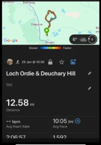
In the end, the weather forecast looked good, and I decided to return to a familiar stomping ground, the rolling Perthshire hills to the north of Dunkeld. I have been up there in all weathers over several years, in hot sunshine and up to my knees in water in the middle of winter. There are many route variations, but I settled on a new one for me, amounting to about 12 miles. This time I had my sights set on the top of Deuchary Hill which I have always bypassed on previous occasions despite the knowledge that the 360-degree view from the top is fairly spectacular. Today promised clear skies so it was decided.
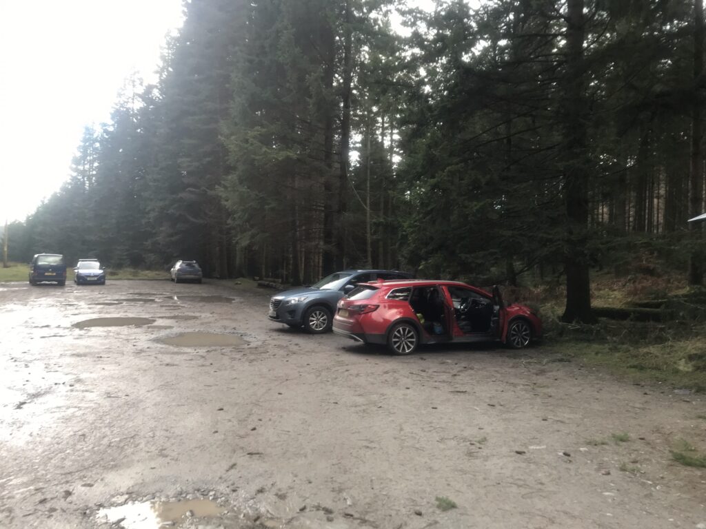
No sense enduring the rush hour traffic in Dundee or at Broxden, so I left about 0900. It’s dual carriageway all the way to Dunkeld, then through the centre of Dunkeld to the Cally carpark just off the Butterstone road. The track and carpark are all well maintained, courtesy of Atholl Estates.
The first few miles are a gradual uphill on solid vehicle track until Mill Dam is reached then it is a right turn onto broad single track and up onto the hillside. Storm Eowyn had left its mark here, but the few downed trees were small in size and easily negotiated.
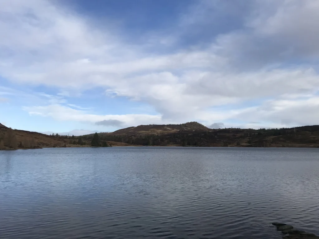
From the top, the view opens to the north and the path undulates around the hillside before turning east, eventually arriving after about 5 miles at the shore of Loch Ordie.
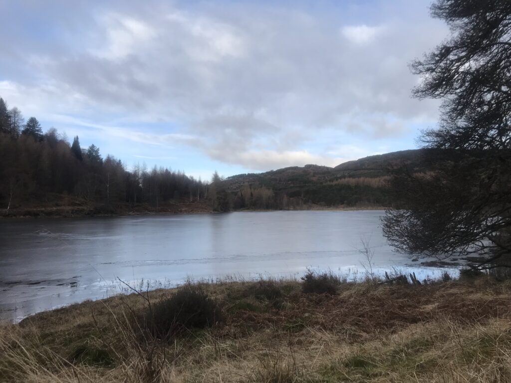
This is always a really wet and muddy section and today was no exception so there was no choice but to fully surrender the shoes to the mud and water. I took a short refuelling break at the little bridge on the north side of the Loch and by now the sun had emerged which was most welcome.
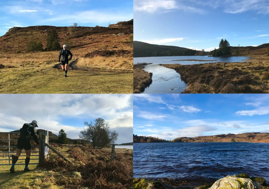
The path meanders along the north of the loch and then there is a mile or so on vehicle track to the start of the path that heads back west below the bulk of Deuchary Hill. This was a very muddy and steady incline, so I was kind to myself and power hiked a good part of the way.
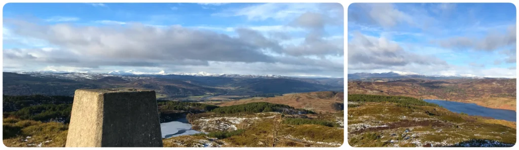
The turnoff for the summit is not obvious and I went past it before a check of the Garmin showed I was off course. I found the path and headed upward. It is a steep initial ascent through some very wet and muddy ground which warned of a tricky descent to follow. The trig point was soon reached and despite a fairly bitter wind, the view was indeed remarkable. The snow-capped peaks of Ben Vrachie, Beinn a’ Ghlo and the Cairngorm massif beyond were all clearly visible against the blue sky, with equally impressive views to the northeast over Loch Ordie below towards the higher peaks around Glenshee and the Southern Cairngorms in the distance.
I would have liked to have stayed longer but it was absolutely baltic, so I slithered back downhill, only once on my arse I am happy to report. Back on the main path, the outward route is soon rejoined and the last three miles or so are the first few in reverse. It is a really popular area with walkers and mountain bikers and there were quite a few people out by this time, despite it being mid-week.
Overall, I didn’t feel that great. One of those heavy-legged off days when it seems harder than it should be but that said, not bad enough to detract from a great route on a great weather day.